Click to visit the main New York Public Library Homepage
The New York Public Library
Digital Collections
About Digital Collections
Browse
Search only public domain materials
Items
Collections
Divisions
Home
Search
Browse
About
Search only public domain materials
Items
Collections
Divisions
Digital Collections
Using Images
Using Data
Search
Filtered search
Show filters
Hide filters
Show Only Public Domain
topic
Real property
135
Landowners
13
Railroads
10
Local transit
8
Railroads, Elevated
8
More
Less
name
G.W. Bromley & Co
50
Ullitz, Hugo
48
E.B. Hyde & Co
45
E. Belcher Hyde Map Company
34
Bromley, George Washington
21
More
Less
collection
Atlases of New York City
119
Maps of New York City and State
57
Collection of broadside real estate maps announcing auctions of lots in early 19th century New York City
6
Lawrence H. Slaughter Collection of English maps, charts, globes, books and atlases
1
Maps of North America
1
More
Less
place
x
New York
New York (State)
185
Brooklyn (New York, N.Y.)
84
Manhattan (New York, N.Y.)
70
New York (N.Y.)
42
More
Less
genre
Maps
182
Cadastral maps
10
Manuscript maps
10
Pamphlets
5
Title pages
5
More
Less
publisher
G.W. Bromley & Co
46
E. Belcher Hyde
36
E.B. Hyde & Co
12
E. Robinson Co
9
G.M. Hopkins & Co
8
More
Less
division
Map Division
184
General Research Division
1
Manuscripts and Archives Division
1
type
x
cartographic
text
10
Date Range
to
186 results found
Filtering on:
x
Note
: "Miniature from the 'Historia romana excerpta ex libris Pauli Orosii' ; Italian M.S. executed in the XVIth century and attributed to Giulio Clovio ; no 71 H.L. Arsenal Library, Paris."--lettered on border.
x
Place
: New York
x
Type
: cartographic
Sort by:
Title
Date created
Date digitized
Sequence
m
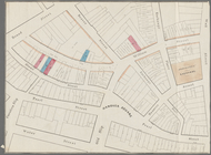
Map of property belonging to …
m
Rand, McNally & Co.'s complet…
Brooklyn, from Rand McNally m…
Rand, McNally & Co.'s new han…
Rand McNally & Co.'s new hand…
Map showing the present dista…
Map of the Harlem River and S…
m
Rand McNally & Co.'s road map…
Map of portion of greater New…
The northwesterly part of the…
Southern part of the borough …
H4. Map (Scheme B) illustrati…
m
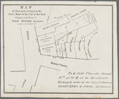
Map of lots to be sold at auc…
Map of lots to be sold at auc…
m
Map of 45 lots of ground leas…
m
Map & plan of the contemplate…
Map & plan of the contemplate…
Map of three lots of land in …
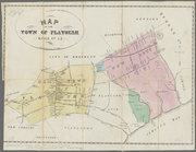
Map of the town of Flatbush, …
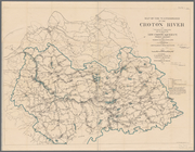
Plate I. Map of the watershed…
L.A.W. road maps of New York …
La Pensilvania, la Nuova York…
m
1906 Library map of Manhattan…
Map of Garret Nostrand's farm…
Map showing the old farms : f…
Plan[s] of Majr. Douglas's re…
Plan of the city of New-York …
Map of wharves and piers on N…
m
Map of the city of Brooklyn, …
Map of 285 sections of ground…
Plan of the city of New-York …
m
Plan of the city of Brooklyn,…
m
Plan of the city of Brooklyn,…
m
Map of the original grants of…
Rand, McNally & Co.'s map of …
Proposed Harlem River Drive f…
m
Plan of the Harlem River Driv…
Rand McNally & Co.'s guide ma…
m
1907 Library map of Manhattan…
m
Map of New York City from Bat…
m
Map showing the high and low …
Map showing the original high…
m
Beers' new map of Staten Isla…
Blackwell's, Ward's and Randa…
m
1905 Library map of Manhattan…
m
New map of that part of the c…
m
Citizens & traverlers guide m…
m
1907 Library map of Manhattan…
Rand, McNally & Co.'s new han…
m
Profile of Riverside Drive fr…