Click to visit the main New York Public Library Homepage
The New York Public Library
Digital Collections
About Digital Collections
Browse
Search only public domain materials
Items
Collections
Divisions
Home
Search
Browse
About
Search only public domain materials
Items
Collections
Divisions
Digital Collections
Using Images
Using Data
Search
Filtered search
Show filters
Hide filters
Show Only Public Domain
topic
City planning
6
Social conditions
6
Real property
5
name
M.I.T. Press
6
New York (N.Y.). City Planning Commission
6
E. Robinson Co
5
Pidgeon, R. H. (Roger H.)
5
Robinson, E. (Elisha)
5
More
Less
collection
x
Atlases of New York City
place
x
New York (N.Y.)
New York
9
New York (State)
9
Queens (New York, N.Y.)
2
genre
Maps
13
Cadastral maps
2
publisher
MIT Press
6
E. Robinson Co
5
G. W. Bromley & Co
2
division
Map Division
13
type
still image
6
cartographic
5
text
2
Date Range
to
13 results found
Filtering on:
x
Note
: [2 written sides] from Chapter 3. "...only as far as easy reading.... each has answered them according to his ability in his..." Corresponds to pp. 116-117 of the first edition.
x
Place
: New York (N.Y.)
x
Collection
: Atlases of New York City
For more collection details, visit the
Atlases of New York City collection page
.
Sort by:
Title
Date created
Date digitized
Sequence
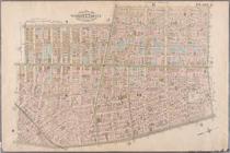
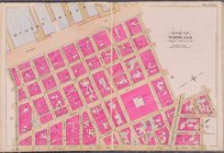
Plate 2: Bounded by West Stre…
Plate 3: Bounded by West Stre…
Plate 4: West Broadway, Canal…
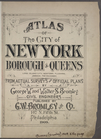
Atlas of the City of New York…
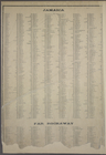
STREET INDEX: Jamaica -- Far …
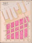
Plate 6 [Map bounded by Hudso…
Plate 7 [Map bounded by Hudso…
Queens community planning Dis…
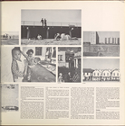
The Rockaways, Rockaway Point…
"The Rockaways, Rockaway Poin…
"The Rockaways, Rockaway Poin…
"The Rockaways, Rockaway Poin…
The Rockaways, Rockaway Point…
End of results
|
Top