Click to visit the main New York Public Library Homepage
The New York Public Library
Digital Collections
About Digital Collections
Browse
Search only public domain materials
Items
Collections
Divisions
Home
Search
Browse
About
Search only public domain materials
Items
Collections
Divisions
Digital Collections
Using Images
Using Data
Search
Filtered search
Show filters
Hide filters
Show Only Public Domain
topic
Real property
4090
Fire insurance
2644
Cities & towns
2563
City planning
115
Social conditions
115
More
Less
name
Sanborn Map Company
2575
G.W. Bromley & Co
1015
Bromley, George Washington
508
Bromley, Walter Scott
507
Ullitz, Hugo
388
More
Less
collection
x
Atlases of New York City
place
New York (State)
4360
New York
1778
Manhattan (New York, N.Y.)
931
New York (N.Y.)
594
Brooklyn (New York, N.Y.)
440
More
Less
genre
Maps
4811
Title pages
84
Index maps
58
Topographic maps
50
Indexes
15
More
Less
publisher
Sanborn Map Company
2591
G.W. Bromley & Co
944
E. Belcher Hyde
315
E. Robinson Co
223
MIT Press
115
More
Less
division
Map Division
4809
type
cartographic
4710
still image
117
text
115
Date Range
to
4,903 results found
Filtering on:
x
Note
: Inscribed in pencil on front free endpaper: "George of Russia, presented by Mr. Perlstein, March 19th, 1937, New York."
x
Collection
: Atlases of New York City
For more collection details, visit the
Atlases of New York City collection page
.
Sort by:
Title
Date created
Date digitized
Sequence
m
Map 19 - Queens
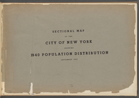
Sectional map of the City of …
Bounded by Avenue K., Ralph A…
Bounded by E. 103rd Street, A…
Bounded by Avenue D., Ralph A…
Bounded by Rockaway Avenue, R…
Bounded by Ralph Avenue, E. 9…
Bounded by Avenue J., E. 56th…
Bounded by Avenue P., E. 31st…
Bounded by Avenue V., Knapp S…
Coney Island. Bounded by Cana…
Bounded by Bay View Avenue, W…
Bounded by Ocean Parkway, Ave…
Bounded by Ditmas Avenue, Con…
Bounded by Regent Place, Tild…
Bounded by Winthrop Street, (…
Bounded by Terrace Place, 11t…
Bounded by 86th Street, W. 9t…
Bounded by 86th Street, W. 11…
Bounded by 72nd Street, 22nd …
Bounded by 58th Street, West …
Bounded by 86th Street, 20th …
Bounded by 85th Street, 1st A…
Bounded by 72nd Street, 21st …
Bounded by 58th Street, 21st …
Bounded by 43rd Street, West …
Bounded by 72nd Street, Fourt…
Bounded by 58th Street, Fourt…
Bounded by 43rd Street, 14th …
Bounded by (Greenwood Cemeter…
Bounded by Mackay Pl., 1st Av…
Bounded by 60th St., Seventh …
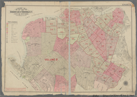
Outline Map of the Borough of…
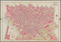
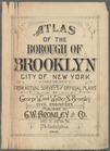
Atlas of the Borough of Brook…
Bounded by Stanley Ave., Mill…
Bounded by Park Place, East N…
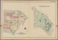
Prospect Park Bounded by (Ins…
Bounded by 9th Avenue, Twenty…
Bounded by Fourth Avenue, 38t…
Bounded by First Avenue (New …
Bounded by (New York Bay) Sec…
Bounded by (New York Bay Pier…
Bounded by Rochester Avenue, …
Bounded by Saratoga Avenue, E…
Bounded by Conway Street, Nor…
Bounded by Metropolitan Ave.,…
Bounded by S. 11th Street, Be…
Outline map of the Borough of…
Atlas of the Borough of Brook…
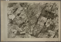
19A - N.Y. City (Aerial Set).
1
2
3
4
5
6
7
8
9
10
…
19
20
Previous
Next
1
2
3
4
5
6
7
8
9
10
…
19
20
Previous
Next