Click to visit the main New York Public Library Homepage
The New York Public Library
Digital Collections
About Digital Collections
Browse
Search only public domain materials
Items
Collections
Divisions
Home
Search
Browse
About
Search only public domain materials
Items
Collections
Divisions
Digital Collections
Using Images
Using Data
Search
Filtered search
Show filters
Hide filters
Show Only Public Domain
topic
Real property
124
Maps
13
Local transit
5
Railroads
4
Railroads, Elevated
4
More
Less
name
E.B. Hyde & Co
95
Ullitz, Hugo
95
E. Belcher Hyde Map Company
86
G.W. Bromley & Co
19
Bromley, George Washington
12
More
Less
collection
Atlases of New York City
140
Maps of New York City and State
14
place
x
Brooklyn (New York, N.Y.)
New York (State)
135
New York
133
Maps
67
Brooklyn
3
More
Less
genre
Maps
153
Indexes
2
Cadastral maps
1
Index maps
1
Manuscript maps
1
More
Less
publisher
E. Belcher Hyde
86
G.W. Bromley & Co
12
E. Robinson Co
11
E.B. Hyde & Co
9
G.M. Hopkins & Co
9
More
Less
division
Map Division
154
type
x
cartographic
text
2
Date Range
to
154 results found
Filtering on:
x
Note
: Manuscript notation "U.S. Light House Rept. 1898" in lead and printed numeral "15" on verso.
x
Place
: Brooklyn (New York, N.Y.)
x
Type
: cartographic
Sort by:
Title
Date created
Date digitized
Sequence
m
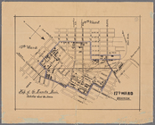
Map of property belonging to …
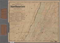
Rand, McNally & Co.'s new han…
Rand McNally & Co.'s new hand…
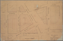
Bounded by Avenue K., Ralph A…
Bounded by Avenue P., E. 31st…
Bounded by Ocean Avenue, Emmo…
Bounded by Ocean Parkway, Ave…
Bounded by Avenue Q., Ocean A…
Bounded by 72nd Street, 22nd …
Bounded by 58th Street, West …
Bounded by 86th Street, 20th …
Bounded by Metropolitan Ave.,…
Bounded by S. 11th Street, Be…
Bounded by Fifth Avenue, Atla…
Bounded by Clermont Avenue, G…
m
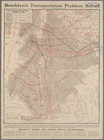
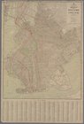
Transportation map of Brookly…
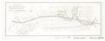
Plan[s] of Majr. Douglas's re…
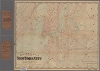
Rand, McNally & Co.'s map of …
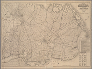
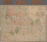
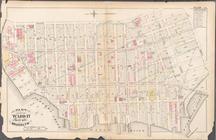
Map of the borough of Brookly…
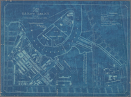
Map of the Eureka Basin, incl…
Rand McNally & Co.'s new hand…
Map of property belonging to …
Plan of the U. S. Navy Yard, …
m
Rand, McNally & Co.'s map of …
m
Rand, McNally & Co.'s map of …
m
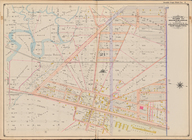
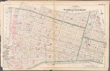
Map of Brooklyn, House Number…
Bounded by Stillwell Ave., Av…
Bounded by Avenue Q, E. 36th …
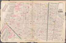
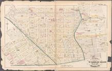
Plate 15: Map bounded by Pine…
Plate 9: Bounded by Fulton St…
Plate 13: Bounded by 11th Str…
Plate 15: Bounded by Congress…
Plate 20: Bounded by S. 11th …
Plate 21: Bounded by Grand St…
Plate 23: Bounded by Oakland …
Plate 28: Bounded by S. Schol…
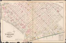
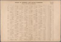
Index to Streets and House Nu…
Plate 5: [Bounded by Clermont…
Plate 9: [Bounded by S. 11th …
Plate 10: [Bounded by N. Seco…
Plate 15: [Bounded by Ten Eyc…
Bounded by West Street, Ditma…
Bounded by (U.S. Government R…
Plate 15: [Bounded by 58th St…
Plate 19: [Bounded by 72nd St…
Plate 22: [Bounded by Avenue …
Plate23: [Bounded by Avenue P…
Plate 26: [Bounded by Avenue …
Plate 27: [Bounded by Avenue …
Map bound by U.S. Navy Yard, …