Click to visit the main New York Public Library Homepage
The New York Public Library
Digital Collections
About Digital Collections
Browse
Search only public domain materials
Items
Collections
Divisions
Home
Search
Browse
About
Search only public domain materials
Items
Collections
Divisions
Digital Collections
Using Images
Using Data
Search
Filtered search
Show filters
Hide filters
Show Only Public Domain
topic
Canyons
306
Mountains
288
Waterfalls
143
Hotels
140
Rocks
99
More
Less
name
Kilburn Brothers
241
Pease, N. W. (Nathan W.), 1836-1918
201
Bierstadt Brothers
116
Soule, John P
101
Littleton View Co
84
More
Less
collection
Robert N. Dennis collection of stereoscopic views
1293
Detroit Publishing Company postcards
201
Maps of North America
27
Photographic views of the United States
5
"The Pageant of America" Collection
4
More
Less
place
x
New Hampshire
White Mountains (N.H. and Me.)
375
North Conway (N.H.)
158
Washington, Mount (N.H.)
120
Coos County (N.H.)
94
More
Less
genre
Photographs
1302
Stereographs
1293
Postcards
201
Maps
27
Cadastral maps
3
More
Less
publisher
Detroit Publishing Company
189
Kilburn Brothers
122
John P. Soule
100
D.A. Clifford
7
H.S. Fifield
7
More
Less
division
Wallach Division: Photography Collection
1498
Map Division
27
Milstein Division
5
Wallach Division: Picture Collection
2
Wallach Division: Print Collection
2
More
Less
type
still image
1508
cartographic
27
Date Range
to
1,535 results found
Filtering on:
x
Note
: NYPL Map Div. copy has accession no. stamped in lower left corner: 22254. Label pasted on verso : "Land Office, map of Minnesota.The property of U.H. Painter."
x
Place
: New Hampshire
Sort by:
Title
Date created
Date digitized
Sequence
Map of the boundary lines bet…
Map of New England, with adja…
m
Map of Rockingham Co., New Ha…
Railroad and post office map …
Map of the city of Concord, N…
m
Colton's railroad & township …
An Accurate map of New Hampsh…
m
A map of the most inhabited p…
m
A map of the most inhabited p…
Map of New England with adjac…
A topographical map of the st…
Topographical map of Monadnoc…
Map of southern New Hampshire
Map of Webster Lake, Franklin…
Map of Swanzey, 1890: [New Ha…
Railroad map of New Hampshire…
Webster Park, Franklin, N.H.
Historical maps of Sanbornton
Historical map of Sanbornton
Map of New Hampshire, 1816
Map of Massabesic Lake and su…
m
A map of the most inhabited p…
m
A map of Cabotia: comprehendi…
NE sheet of map of North Amer…
Extract from a map of the Bri…
A new and accurate map of the…
m
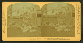
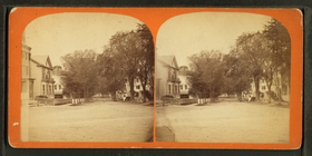
A New Hampshire farm yard, U.…
m
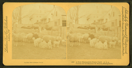
A New Hampshire farm yard. U.…
m
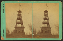
Garrison Hill and the Observa…
m
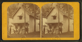
D.C. Chapman's Cottage, Camp …
m
Grandpa Will's House at Exete…
m
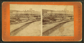
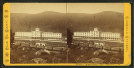
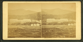
Fabyan House, White Mountains…
m
Fabyan House, White Mountains…
m
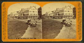
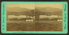
Glen House, White Mts., N.H.
m
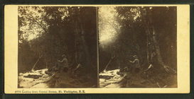
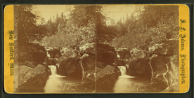
Looking down, Crystal Stream,…
m
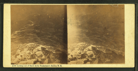
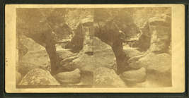
Looking out of Snow Arch, Tuc…
m
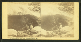
Looking into Snow Arch, Tucke…
m
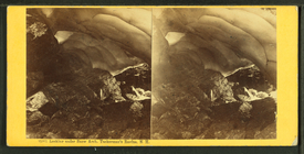
Looking under Snow Arch, Tuck…
m
Glen House, from Mt. Wash'n C…
m
Garnet Pool, Glen, White Mts.…
m
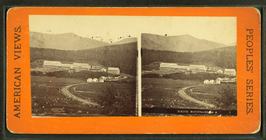
White Mountains, N.H.
m
Garnet Pool, White Mts. N.H.
m
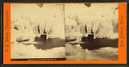
Winter view at Glen Ellis Fal…
m
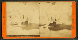
Winter view at Glen Ellis Fal…
m
Glen House, White Mts. N.H.
m
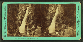
Glen Ellis Falls, White Mount…
m
Garnet Pool, Glen, White Mts.…
m
Mt. Washington, from the Glen…
m
Emerald Pool, Glen, White Mou…
m
Glen Falls in winter, White M…
1
2
3
4
5
6
7
Previous
Next
1
2
3
4
5
6
7
Previous
Next