Click to visit the main New York Public Library Homepage
The New York Public Library
Digital Collections
About Digital Collections
Browse
Search only public domain materials
Items
Collections
Divisions
Home
Search
Browse
About
Search only public domain materials
Items
Collections
Divisions
Digital Collections
Using Images
Using Data
Search
Filtered search
Show filters
Hide filters
Show Only Public Domain
topic
History
15
Landowners
9
Real property
2
Administrative and political divisions
1
Architecture, Domestic
1
More
Less
name
United States. Army. Corps of Topographical Engineers
11
Merrill, W. E. (William Emery), 1837-1891
4
United States. Army. Dept. of the Cumberland. Topographical Engineers
4
Margedant, Wm. C. (William C.)
3
Finegan, N
2
More
Less
collection
Maps of North America
31
Maps of New York City and State
9
place
United States
14
Georgia
9
New York (State)
8
Virginia
8
Cobb County (Ga.)
7
More
Less
genre
Maps
40
Manuscript maps
11
Cadastral maps
9
Pictorial works
1
Topographic maps
1
More
Less
publisher
Corps of Topographical Engineers
8
producer not identified
6
Topographical Engineer's Office
3
publisher not identified
3
Am. Photo-Lithographic Co. (Osborne's Process)
1
More
Less
division
Map Division
40
type
cartographic
40
still image
1
Date Range
to
40 results found
Filtering on:
x
Note
: Relief shown by hachures
Sort by:
Title
Date created
Date digitized
Sequence
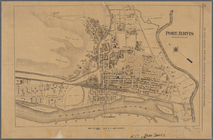
Port Jervis
Town & village of Ovid, Senec…
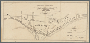
Enlargement of the Erie Canal…
m
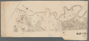
Map of Clasons Point: in the …
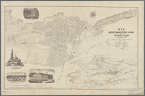
Map of Westminster Park of th…
1863, West Point: [New York]
Map of field of occupation, A…
Frederick County Maryland: pr…
Yorktown, armament of batteri…
Information map, Hd. Qrs. 20 …
Map of a portion of Virginia:…
Part of Cobb County, Georgia
Map of first district, Campbe…
Part of northern Georgia
Part of northern Georgia: no.…
Part of northern Georgia: no.…
Plan of the town of Newton in…
m
New York
A map of the district of Main…
m
Dec. 13th Positions of Humphr…
Map of field of occupation of…
Yorktown, armament of batteri…
m
Position Army Cumbld., June 2…
Information map only, H. Qrs.…
Manuscript map of Civil War t…
Information map: [northwester…
Manuscript map of a military …
Manuscript map of an approxim…
Battle of Rappahannock Statio…
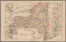
Map of the State of New York …
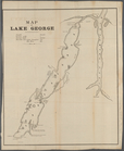
Map of Lake George
Map of Loudon [sic], Jefferso…
Part of Cobb Co., Ga
Henrico County, Virginia: pre…
Map of the battle field of Ge…
Map of the Butterfield Overla…
Map of Dauphin & Lebanon coun…
A map of the state of New Jer…
Western vicinity of Frederick…
Fredericksburg, Virginia and …
End of results
|
Top