Click to visit the main New York Public Library Homepage
The New York Public Library
Digital Collections
About Digital Collections
Browse
Search only public domain materials
Items
Collections
Divisions
Home
Search
Browse
About
Search only public domain materials
Items
Collections
Divisions
Digital Collections
Using Images
Using Data
Search
Filtered search
Show filters
Hide filters
Show Only Public Domain
topic
x
Real property
Landowners
59
Railroads
6
Administrative and political divisions
5
Land grants
4
More
Less
name
Walling, Henry Francis, 1825-1888
4
Davis, Thomas W. (Surveyor)
3
Heliotype Printing Co
3
N. Currier (Firm)
3
Pease, Richard H., 1813-1869
3
More
Less
collection
Maps of North America
79
Maps of New York City and State
36
place
New York (State)
36
Massachusetts
23
Boston
12
Michigan
10
New York
7
More
Less
genre
Maps
115
Cadastral maps
93
Illustrations
2
Wall maps
2
Advertisements
1
More
Less
publisher
x
publisher not identified
Heffron & Phelps litho
1
Lith of R.H. Pease
1
Lith. by Berggoetz & Co
1
Lith. of Jones & Newman
1
More
Less
division
Map Division
115
type
cartographic
115
still image
2
Date Range
to
115 results found
Filtering on:
x
Location
: Map Division
x
Publisher
: publisher not identified
x
Rights
: Public Domain
x
Topic
: Real property
For more division details, visit the
Lionel Pincus and Princess Firyal Map Division division page
.
Sort by:
Title
Date created
Date digitized
Sequence
Map of Bar Harbor, Maine, 1895
Property nos. 43, 45, and 47 …
Webster Park, Franklin, N.H.
Plan of McLean Hospital lands…
Springfield, Ill. 1892
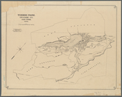
Tuxedo Park, Orange Co., New …
Map of New England City, Dade…
m
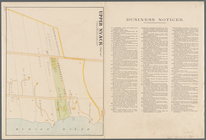
Upper Nyack
Nyack
South Nyack
Map of lots situated in the c…
Map of Winter Park, Orange Co…
Springfield, Greene County, M…
Plan of the Village of Marque…
m
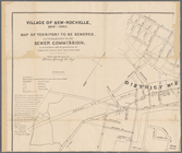
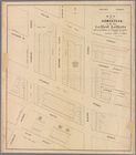
Village of New-Rochelle, New-…
Map of La Presa : San Diego C…
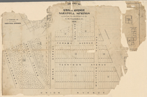
Historical sketch map of King…
The city of Boca Grande, Lee …
La Mesa Colony : San Diego Co…
Plan of cottage sites at Magn…
Map of property belonging to …
Map of Clay County, Florida
Map of Chattanooga, Tenn.
Plan of the village of Marque…
Plan of the town Ebenezer and…
m
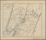
Map of the highlands of the H…
Map of a portion of Point Ke…
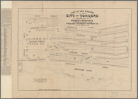
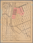
Part of the 5th Ward of the C…
Map of property owned by Fran…
Plan of real estate at Harris…
Map of the homestead of the l…
Plan of land on West Chester …
Plan of burnt district (by fi…
Map of pr[op]erty of Union Av…
A plan of the town of Pittsfo…
Map of Black Point property n…
Map of the city of Erie : sho…
Hartford in 1640
Map of Dobbs Ferry and Hastin…
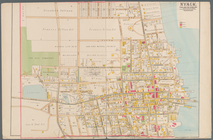
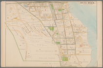
Hyde Park : [Chicago, Illinoi…
m
Brooklyn City Hall
m
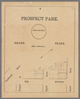
Prospect Park, plaza lots
Mineral company lands : shade…
Map of Highbridgeville in the…
Plan of Suffolk Street Distri…
Plan of Church St. district: …
Railroad map of the City of S…
Town of Bethel, Fairfield Co.…
Map of building lots, on the …
Map of the oil region, Venang…