Click to visit the main New York Public Library Homepage
The New York Public Library
Digital Collections
About Digital Collections
Browse
Search only public domain materials
Items
Collections
Divisions
Home
Search
Browse
About
Search only public domain materials
Items
Collections
Divisions
Digital Collections
Using Images
Using Data
Search
Filtered search
Show filters
Hide filters
Show Only Public Domain
topic
Real property
115
Landowners
74
Railroads
58
Administrative and political divisions
51
History
48
More
Less
name
Heliotype Printing Co
7
Gavit, John E., 1817-1874
6
Hayward, George, approximately 1800-
6
Pease, Richard H., 1813-1869
6
Ackerman Lithr
5
More
Less
collection
Maps of North America
332
Maps of New York City and State
118
Maps of Europe
1
Maps of North and South America
1
place
New York (State)
98
Massachusetts
64
New York
30
United States
28
Boston
25
More
Less
genre
Maps
452
Cadastral maps
98
Geological maps
16
Facsimiles
10
Early maps
9
More
Less
publisher
x
publisher not identified
Lith of R.H. Pease
2
AM. Photo-Lith. Co. N.Y. (Osborne's Pro.)
1
D. McLellan, lithographer
1
Engraved & Printed by J. E.Gavit
1
More
Less
division
Map Division
452
type
cartographic
452
text
8
still image
7
Date Range
to
452 results found
Filtering on:
x
Location
: Map Division
x
Publisher
: publisher not identified
x
Rights
: Public Domain
For more division details, visit the
Lionel Pincus and Princess Firyal Map Division division page
.
Sort by:
Title
Date created
Date digitized
Sequence
Plan of the former township o…
Map of the town of Roxbury
m
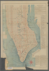
Bird's eye view of New York C…
Public parks boroughs of Manh…
Mapa de la provincia de Pinar…
Map of part of Washington and…
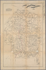
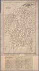
A map of the county of Worces…
Territory covered by the prin…
m
Map of a part of northern New…
Map of Connecticut showing co…
Map of Alaska & surroundings,…
A map of the countrey of the …
m
New York City elevated railro…
m
The Green-Wood cemetery 1897
m
Map of Cambridge in the vicin…
Map of the 23rd and 24th ward…
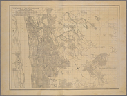
Map of the city of Boston and…
Butler County, Iowa
The heart of greater New York…
Map of Bar Harbor, Maine, 1895
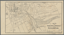
Map of Saratoga Springs and E…
Plan of Boston proper, showin…
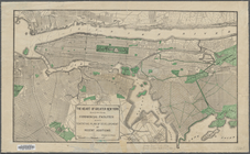
Map of part of Jersey City, …
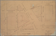
Property nos. 43, 45, and 47 …
Map of Seneca Co., New York: …
Map of the buildings and grou…
Map of Jackson Park : showing…
City of Washington
Webster Park, Franklin, N.H.
Plan of McLean Hospital lands…
Labor commissioner's official…
Springfield, Ill. 1892
Map showing the proposed Tenn…
Green-Wood Cemetery
Map of property belonging to …
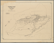
Tuxedo Park, Orange Co., New …
Map of the city of New Haven
Lines of proposed bridge to C…
Map of the city of Washington…
Map of the city of Washington…
m
Map of the Grand Rapids and I…
Guide map of the city of Los …
Map of the city of Worcester …
Map of the city of Washington…
Map of New England City, Dade…
Map of Cambridge in the vicin…
Map of the Dead River, Kenneb…
m
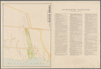
Upper Nyack
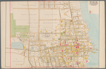
Nyack
Map of the Town of Milford an…
1
2
Previous
Next
1
2
Previous
Next