Click to visit the main New York Public Library Homepage
The New York Public Library
Digital Collections
About Digital Collections
Browse
Search only public domain materials
Items
Collections
Divisions
Home
Search
Browse
About
Search only public domain materials
Items
Collections
Divisions
Digital Collections
Using Images
Using Data
Search
Filtered search
Show filters
Hide filters
Show Only Public Domain
topic
Real property
10889
Fire insurance
5305
Cities & towns
5007
City planning
1087
Social conditions
942
More
Less
name
Sanborn Map Company
5108
G.W. Bromley & Co
2551
New York (N.Y.). City Planning Commission
980
M.I.T. Press
942
Bromley, George Washington
857
More
Less
collection
Atlases of New York City
11592
Atlases of the United States
3839
Maps of North America
3345
Maps of New York City and State
2057
Lawrence H. Slaughter Collection of English maps, charts, globes, books and atlases
1248
More
Less
place
New York (State)
13151
New York
4862
New York (N.Y.)
3351
Manhattan (New York, N.Y.)
2239
Brooklyn (New York, N.Y.)
1212
More
Less
genre
Maps
23265
Atlases
3762
Topographic maps
1050
Cadastral maps
594
Nautical charts
394
More
Less
publisher
Sanborn Map Company
5145
G.W. Bromley & Co
2371
MIT Press
942
E. Belcher Hyde
807
K.u.K. Militargeographisches Institut
774
More
Less
division
Map Division
23798
type
cartographic
22270
still image
1222
text
755
Date Range
to
23,798 results found
Filtering on:
x
Location
: Map Division
For more division details, visit the
Lionel Pincus and Princess Firyal Map Division division page
.
Sort by:
Title
Date created
Date digitized
Sequence
Results 2251 - 2300
m
Map of the Yellowstone Nation…
Map of the "Hunter Fly Farm" …
m
Map of the city of Williamsbu…
m
Eastern part of Long Island S…
Kniga glagolema︠i︡a kosmograf…
m
Bird's eye view of Chicago, 1…
Chicago : with the school sec…
Map showing the boulevards an…
Metropolitan district of Chic…
m
Colton's map of the state of …
State of Indiana
Map of Parke County, Indiana
m
Map of Vigo County, Indiana
m
Map of n. eastern Virginia an…
m
A map of the most inhabited p…
A map of the country between …
m
Map of part of Virginia, Mary…
m
Nova Virginiae tabula
m
Hotchkiss' geological map of …
m
Central Virginia
Map of eastern Virginia : com…
A sketch of the Cherakee boun…
A map of the Virginia Central…
m
Map of Calhoun County, Iowa :…
m
Map of Buena Vista County, Io…
m
Map of Plymouth County, Iowa …
m
Map of Monona County, Iowa : …
Map of Woodbury County, Iowa …
m
Map of Bedford County, Pa.
m
Hardee's geographical, histor…
m
Map of Fulton Co., Pennsylvan…
Plan of Amelia Island in East…
Northern Alabama and Georgia
Geological map of the environ…
Middle Georgia & South Caroli…
Putnam County Florida
Plan of the French and Americ…
Georgia, parish of St. John :…
m
Official map of Georgia
1892 Tallapoosa, Ga., Haralso…
Plat of the city of Tallapoos…
Plan of the town Ebenezer and…
A map of Maryland and Virgini…
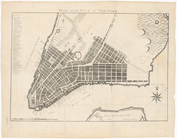
Plan of the city of New York
Map of the business and centr…
Chicago Tribune's Columbian S…
Plan of the village of Lima o…
Duncan's addition to Michigan…
Map showing territorial growt…
Survey of the mouth of Trail …
1
2
…
7
8
9
10
11
12
13
14
…
95
96
Previous
Next
1
2
…
7
8
9
10
11
12
13
14
…
95
96
Previous
Next