Click to visit the main New York Public Library Homepage
The New York Public Library
Digital Collections
About Digital Collections
Browse
Search only public domain materials
Items
Collections
Divisions
Home
Search
Browse
About
Search only public domain materials
Items
Collections
Divisions
Digital Collections
Using Images
Using Data
Search
Filtered keyword search
Show filters
Hide filters
Show Only Public Domain
topic
Real property
29
Indians of North America
20
History
19
Administrative and political divisions
13
Landowners
13
More
Less
name
Burr, David H., 1803-1875
27
De Witt, Simeon, 1756-1834
26
Rawdon, Clark & Co
25
Rawdon, Wright & Co
25
A.R. Ohman Map Co
12
More
Less
collection
Maps of North America
45
Maps of New York City and State
44
Atlases of the United States
27
Lawrence H. Slaughter Collection of English maps, charts, globes, books and atlases
12
New York City directories
9
More
Less
place
x
New York (State)
New York (N.Y.)
63
New Jersey
26
New York
25
New England
17
More
Less
genre
Maps
142
Atlases
27
Books
9
Directories
9
Registers (Lists)
9
More
Less
publisher
D. H. Burr
26
Museum of the American Indian, Heye Foundation
12
publisher not identified
10
G.W. Bromley & Co
4
New Jersey Boundary Commission?
3
More
Less
division
Map Division
132
Rare Book Division
9
Dorot Jewish Division
1
type
x
cartographic
text
9
still image
1
Date Range
to
142 results found for:
x
America
Filtering on:
x
Place
: New York (State)
x
Type
: cartographic
Sort by:
Relevance
Title
Date created
Date digitized
Sequence
Part of North
America
, containing Canada
A map of the countrey of the …
abstract:
…
America
, from the eastern
… of
America
: viz Virginia
note:
Covers North
America
from the Gulf
… in
America
note:
Phillips. Maps of
America
, p. 586
Map of the frontiers of the n…
topic:
Indians of North
America
Map of the River Niagara and …
topic:
Indians of North
America
… in
America
note:
LC Maps of North
America
, 1750-1789, 712
m
Official map covering territo…
note:
Automobile Club of
America
.
…
America
, from a late
note:
Jolly D.C. Maps of
America
, in periodicals
…, in
America
note:
LC Maps of North
America
, 1750-1789, 714
Copy of a map attached to Gov…
topic:
Indians of North
America
m
Map of the progress of His Ma…
note:
…
America
.
La Pensilvania, la Nuova York…
note:
…'s Storia dell'
America
Various plans and draughts of…
collection:
Maps of North
America
A map of the provinces of New…
note:
LC Maps of North
America
, 1750-1789, 1048
m
To his excellency William Try…
topic:
Indians of North
America
New England, New York, New Je…
note:
From John Oldmixon's The British Empire in
America
.
… in North
America
A map of New England and New …
note:
Phillips. Maps of
America
, 4
[A chart of New York Island &…
note:
…
America
, 1750-1789. …
A new and accurate map of the…
note:
Jolly, D.C. Maps of
America
in periodicals
m
The engagement on the White P…
note:
Phillips. Maps of
America
, p. 1071
A chart of New York Island & …
note:
…
America
, 1750-1789.
A map of New England and New …
note:
Phillips. Maps of
America
, 467
A map of the eastern part of …
note:
Jolly, D.C. Maps of
America
in periodicals
A map of the country in which…
note:
LC Maps of North
America
, 1750-1789, 1183
A map of the eastern part of …
note:
Jolly, D.C. Maps of
America
in periodicals
The United States of
America
The provinces of New York, an…
note:
… topography of North
America
A map of the provinces of New…
note:
LC Maps of North
America
, 1750-1789, 1048
m
The provinces of New York, an…
note:
LC Maps of North
America
, 1750-1789, 1045
A sketch of the operations of…
note:
LC Maps of North
America
, 1750-1789, 1057
Yorkville and East Harlem in …
topic:
Indians of North
America
A plan of Fort Montgomery & F…
note:
…
America
, 1750-1789, 1191.
The provinces of New York, an…
note:
LC Maps of North
America
, 1750-1789, 1046
m
Post route map of the states …
collection:
Maps of North
America
Upper Manhattan, comprising t…
topic:
Indians of North
America
The southeastern part of the …
topic:
Indians of North
America
m
The southern part of the Prov…
note:
Phillips. Maps of North
America
, p. 505
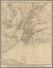
Greater New York and contigou…
topic:
Indians of North
America
Werpoes, a village of the Man…
topic:
Indians of North
America
Southern part of the borough …
topic:
Indians of North
America
The southwestern part of the …
topic:
Indians of North
America
Map showing the New York and …
collection:
Maps of North
America
The state of Connecticut: inc…
collection:
Maps of North
America
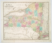
The state of New York from th…
note:
Phillips. Maps of
America
, p. 511
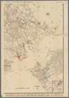
Map of Long Island Sound show…
collection:
Maps of North
America
Map of Niagara Falls, suspens…
Southeastern part of the boro…
topic:
Indians of North
America
Southern New England and New …
collection:
Maps of North
America