Click to visit the main New York Public Library Homepage
The New York Public Library
Digital Collections
About Digital Collections
Browse
Search only public domain materials
Items
Collections
Divisions
Home
Search
Browse
About
Search only public domain materials
Items
Collections
Divisions
Digital Collections
Using Images
Using Data
Search
Filtered search
Show filters
Hide filters
Show Only Public Domain
topic
Railroads
58
Roads
27
Administrative and political divisions
17
Local transit
17
Landowners
10
More
Less
name
Rand McNally and Company
16
Colton, G. Woolworth (George Woolworth), 1827-1901
10
Atwood, John M., approximately 1818-
8
Dripps, M. (Matthew)
8
G.W. & C.B. Colton & Co
7
More
Less
collection
x
Maps of New York City and State
place
x
New York Metropolitan Area
New York (State)
91
New York (N.Y.)
63
New York
58
New Jersey
36
More
Less
genre
Maps
146
Road maps
10
Aerial views
5
Topographic maps
5
Manuscript maps
2
More
Less
publisher
The Company
11
G.W. & C.B. Colton & Co
10
Rand, McNally & Co
6
M. Dripps
5
J.H. Colton
4
More
Less
division
Map Division
146
type
cartographic
146
still image
2
Date Range
to
146 results found
Filtering on:
x
Place
: New York Metropolitan Area
x
Collection
: a1a9d830-c5a6-012f-00ec-58d385a7bc34
Sort by:
Title
Date created
Date digitized
Sequence
m
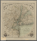
Freight map of the metropolit…
Map of New York City and vici…
Map of the comprehensive plan…
Rand, McNally & Co.'s new aut…
m
Metropolitan district local a…
m
The John Wanamaker automobile…
New York and vicinity roads a…
m
Official map covering territo…
m
Rand, McNally & Co.'s complet…
Railroads in Manhattan, Jerse…
Map of the suburban territory…
Road map of the New York dist…
m
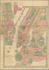
New York City and vicinity
Birdseye view of greater New …
m
Map showing 100 miles around …
Rand McNally official 1921 au…
Map showing suggested connect…
Erie Railroad suburban lines
Rand McNally standard map of …
Wall St. New York City, U.S.A…
Greater New York and Long Isl…
m
Map showing 50 miles around N…
Map of Hudson & Manhattan Rai…
Map of the country thirty mil…
Rapid transit map of Kings, Q…
Map of the New York City metr…
Port of New York Authority : …
Hagstrom's map of 50 mile rad…
Map of Hudson & Manhattan Rai…
American Automobile Associati…
Greater New York City
m
New York und Umgegend
Rand Mcnally official detaile…
Map of New York City region a…
Relief map of New York and vi…
m
Map of New York City : showin…
Greater New York and its harb…
Map of the City of New York :…
m
Rand McNally official motor g…
Transportation lines connecti…
Map of the country thirty thr…
Freight terminal map of New Y…
New-York City, County, and vi…
The strangers mercantile guid…
Map of the country thirty thr…
Map of the Hackensack & New Y…
Map of New York, Brooklyn, an…
m
The surroundings of New York …
Map showing the present dista…
Map of the country thirty thr…