Click to visit the main New York Public Library Homepage
The New York Public Library
Digital Collections
About Digital Collections
Browse
Search only public domain materials
Items
Collections
Divisions
Home
Search
Browse
About
Search only public domain materials
Items
Collections
Divisions
Digital Collections
Using Images
Using Data
Search
Filtered keyword search
Show filters
Hide filters
Show Only Public Domain
name
Bell, A. (Andrew), 1728-1779
1
Thornton, Samuel
1
collection
Atlases, gazetteers, guidebooks and other books
1
Map of the Old Continent exhibiting its greatest diametrical length from the point of East Tartary to the Cape of Good Hope
1
place
x
Africa
Asia
1
Europe
1
Indian Ocean
1
genre
Maps
2
Nautical charts
1
publisher
s.n
1
division
Map Division
1
Schomburg Jean Blackwell Hutson Research and Reference Division
1
type
cartographic
2
Date Range
to
2 results found for:
x
East Africa Maps
Filtering on:
x
Place
: Africa
Sort by:
Relevance
Title
Date created
Date digitized
Sequence
… from the point of
East
note:
Covers Europe, Asia and
Africa
.
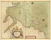
A chart of the WESTERN part of the
EAST
collection:
… of the
EAST
-INDIES with all