Click to visit the main New York Public Library Homepage
The New York Public Library
Digital Collections
About Digital Collections
Browse
Search only public domain materials
Items
Collections
Divisions
Home
Search
Browse
About
Search only public domain materials
Items
Collections
Divisions
Digital Collections
Using Images
Using Data
Search
Filtered keyword search
Show filters
Hide filters
Show Only Public Domain
topic
History
120
Colonies
31
Discovery and exploration
7
Geography
4
Mathematics
3
More
Less
name
Montanus, Arnoldus, 1625?-1683
116
Ogilby, John, 1600-1676
116
Moll, Herman, -1732
10
Childe, Timothy
5
Sayer, Robert, 1725-1794
5
More
Less
collection
Lawrence H. Slaughter Collection of English maps, charts, globes, books and atlases
157
Maps of North America
29
Maps of North and South America
5
America: being the latest, and most accurate description of the Nevv vvorld
4
I. N. Phelps Stokes Collection of American Historical Prints
2
More
Less
place
x
America
West Indies, British
116
Great Britain
42
North America
42
Colonies
15
More
Less
genre
Maps
195
Prints
9
Illustrations
3
Title pages
3
Correspondence
1
More
Less
publisher
Printed by the author, and are to be had at his house
120
Published by Mathew Carey
4
s.n
4
J. Bowles
2
Printed for R. and J. Dodsley..
2
More
Less
division
Map Division
193
Rare Book Division
8
Wallach Division: Print Collection
2
Schomburg Manuscripts, Archives and Rare Books Division
1
Wallach Division: Picture Collection
1
type
still image
103
cartographic
99
text
6
Date Range
to
206 results found for:
x
London
Filtering on:
x
Place
: America
Sort by:
Relevance
Title
Date created
Date digitized
Sequence
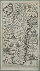
Louisiana, as formerly claime…
abstract:
…:
London
and Ferro. "For the
London
magazine" -- top
m
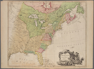
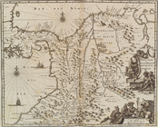
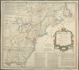
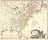
The British colonies in North…
note:
Prime meridian:
London
.
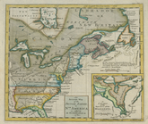
A new map of the English plan…
note:
Print also published in
London
An Accurate map of the presen…
note:
Prime meridian:
London
.
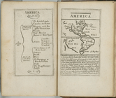
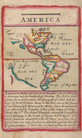
America
note:
Prime meridian:
London
.
An accurate map of the Britis…
note:
…"Longitude west from
London
A New and correct map of the …
note:
Prime meridian:
London
.
m
Mauritiopolis
A map of the British and Fren…
note:
…"Longitude west from
London
."…
A new and accurate map of the…
note:
… west from
London
."…
The isle of California, New M…
m
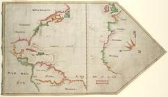
The Virginia Company chart
note:
… in the great fire of
London
A new map of the most conside…
note:
… and present geography.
London
An accurate map of the Britis…
note:
Prime meridian:
London
.
A Map of the British and Fren…
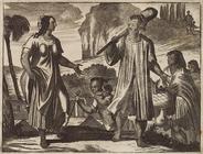
Image depiciting Indians inte…
The English empire in America
Gviana siue Amazona Regia. [d…
Terra firma et novum regnum G…
A Map of the British and Fren…
abstract:
…:
London
. Relief shown
A general map of the northern…
note:
Prime meridian:
London
.
A map of the British dominion…
note:
Prime meridian:
London
.
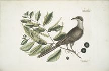
Cuculus Caroliniensis, The Co…
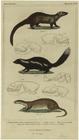
Canadian marten or pelcan ; A…
note:
… organization. (
London
A Map of the British and Fren…
abstract:
… meridian:
London
. Relief
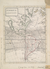
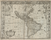
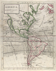
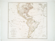
America.
America with those known part…
note:
…,
London
, 1627.
North America from the French…
abstract:
… and
London
. Relief shown
A new and correct map of Nort…
note:
Prime meridian:
London
and Ferro.
The United States of North Am…
note:
Prime meridian:
London
.
British possessions in North …
An accurate map of the Britis…
America
note:
Prime meridian:
London
.
America.
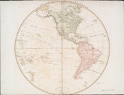
Western Hemisphere
An accurate map of North Amer…
note:
Prime meridian:
London
.
m
A map of the British and Fren…
America.
North America from the French…
abstract:
… and
London
. Relief shown
A general map of the middle B…
note:
Prime meridians:
London
and Philadelphia.
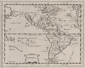
A General map of America divi…
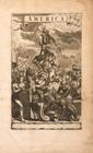
America
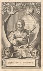
Christofel Colonus
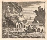
Scene viewed by Columbus.
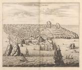
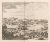
Angra op Tercera
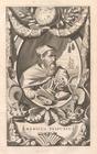
Americus Vesputius
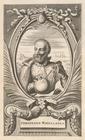
Ferdinand Magellanus
Vetus Mexico
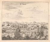
St. Iago
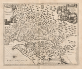
Nova Virginiae Tabula