Click to visit the main New York Public Library Homepage
The New York Public Library
Digital Collections
About Digital Collections
Browse
Search only public domain materials
Items
Collections
Divisions
Home
Search
Browse
About
Search only public domain materials
Items
Collections
Divisions
Digital Collections
Using Images
Using Data
Search
Filtered keyword search
Show filters
Hide filters
Show Only Public Domain
topic
Real property
110
Naval yards & naval stations
45
Landowners
2
Ferries
1
Forts & fortifications
1
More
Less
name
E.B. Hyde & Co
106
Ullitz, Hugo
106
Bargemusic (New York, NY)
3
Nooney, Dinanda H
3
Bierstadt Brothers
2
More
Less
collection
Robert N. Dennis collection of stereoscopic views
174
Atlases of New York City
107
Maps of New York City and State
6
Dinanda Nooney Brooklyn photograph collection
3
Scrapbooks of New York City views
1
More
Less
place
x
Brooklyn (New York, N.Y.)
New York (State)
288
New York (N.Y.)
177
New York
158
Prospect Park (New York, N.Y.)
129
More
Less
genre
Photographs
178
Stereographs
174
Maps
113
Cadastral maps
2
Aerial views
1
More
Less
publisher
E.B. Hyde & Co
106
E. & H.T. Anthony (Firm)
19
J. W. & J. S. Moulton
4
B. W. Kilburn
2
Webster & Albee
2
More
Less
division
Wallach Division: Photography Collection
177
Map Division
113
Milstein Division
2
Wallach Division: Picture Collection
1
type
still image
180
cartographic
113
Date Range
to
293 results found for:
x
Land
Filtering on:
x
Place
: Brooklyn (New York, N.Y.)
Sort by:
Relevance
Title
Date created
Date digitized
Sequence
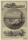
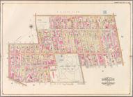
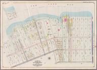
Prospect Park, Brooklyn
note:
… or the
land
we live in (New
… Beach Hotel and
Land
Co
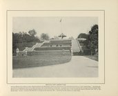
Terrace, Fort Greene Park
topic:
Terraces (
Land
use)…
m
Sea Gate, New York Harbor
m
… of
land
together with 57
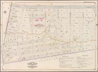
Jamaica Bay and Rockaway Beac…
collection:
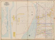
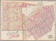
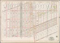
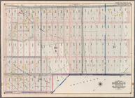
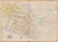
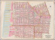
Part of Wards 31 & 32,
Land
Map Sections
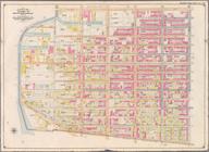
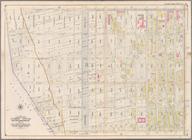
Bounded by Second Ave., Twent…
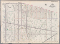
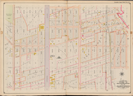
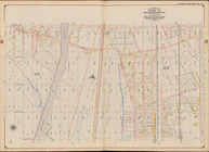
collection:
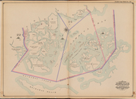
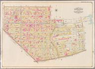
Part of Ward 8.
Land
Map Section, No. 3
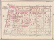
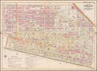
Bounded by Thirty Seventh St.…
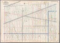
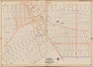
collection:
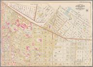
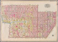
Part of Ward 8.
Land
Map Section, No. 3
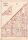
Bounded by Forty Ninth St., S…
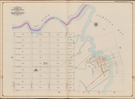
collection:
Part of Ward 8.
Land
Map Section, No. 3
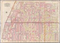
Bounded by Sixth Ave., Thirty…
collection:
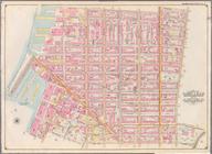
Part of Wards 8 & 30.
Land
Map Section
Bounded by Third Street, Seve…
collection:
Part of Ward 22.
Land
Map Section, No. 4
Bounded by (Gowanus Canal) Th…
collection:
Part of Wards 9, 22 .
Land
Map Section, No. 4
Bounded by Eastern Parkway, A…
collection:
Part of Wards 24 & 29.
Land
Map Section
Bounded by Atlantic Avenue, A…
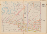
collection:
Part of Ward 24.
Land
Map Section, No. 5
Bounded by Albany Avenue, Atl…
collection:
Part of Wards 24 & 29.
Land
Map Section
Bounded by Hancock Street, Br…
collection:
Part of Wards 23 & 25.
Land
Map Section
Bounded by Broadway, Hancock …
collection:
Part of Wards 21 & 25.
Land
Map Section
Bounded by Grand Avenue, Will…
collection:
Part of Wards 7, 21 & 23.
Land
Map Section
Bounded by Flushing Avenue, W…
collection:
Part of Wards 11 & 20.
Land
Map Section
Bounded by Washington Avenue,…
collection:
Part of Wards 7 & 19.
Land
Map Sections
Bounded by Ten Eyck Street, B…
collection:
Part of Wards 16 & 18.
Land
Map Section
Bounded by Flushing Avenue, M…
collection:
Part of Wards 18 & 27.
Land
Map Sections
Bounded by Dekalb Avenue, Cyp…
collection:
Part of Wards 27 & 28.
Land
Map Section
Bounded by Cornelia Street, I…
collection:
Part of Wards 28.
Land
Map Section, No
Bounded by Livonia Avenue, Ho…
collection:
Part of Wards 26 & 32.
Land
Map Section
Bounded by Pitkin Avenue, Ber…
collection:
Part of Ward 26.
Land
Map Sections, Nos
Bounded by Fountain Avenue, V…
collection:
Part of Ward 26.
Land
Map Section, No
Bounded by Barbey Street, Van…
collection:
Part of Ward 26.
Land
Map Section, No
Bounded by Church Avenue, Lin…
collection:
Part of Wards 29 & 32,
Land
Map Section
Bounded by Avenue D, Nostrand…
collection:
Part of Wards 29, 30, 31 & 32,
Land
Map
Bounded by Albemarle Road (Av…
collection:
Part of Ward 29.
Land
Map Section, No
Bounded by Twelfth Avenue, 45…
collection:
Part of Ward 30,
Land
Map Section, No
Bounded by Seventh Avenue, 60…
collection:
Part of Ward 30,
Land
Map Sections, Nos
Bounded by (Proposed Bay Ridg…
collection:
Part of Ward 30,
Land
Map Section, No
Bounded by Fifth Avenue, Stew…
collection:
Part of Ward 30,
Land
Map Sections, Nos
Bounded by Eighteenth Avenue,…
collection:
Part of Wards 30 & 31,
Land
Map Sections
Bounded by Richardson Street,…
collection:
Part of Wards 16 & 18,
Land
Map Section
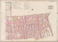
Bounded by Avenue L, E. 19th …
collection:
Part of Ward 31,
Land
Map Section, No
Bounded by Stillwell Ave., Av…
collection:
Part of Ward 31,
Land
Map Section, No
Bounded by W. 12th St., Avenu…
collection:
Part of Ward 31,
Land
Map Section, No
Bounded by Avenue V, Ocean Av…
collection:
Part of Ward 31,
Land
Map Sections, Nos
Bounded by Avenue K, E. 53rd …
collection:
Part of Ward 32,
Land
Map Section, No
Bounded by (Fresh Creek) E. 1…
collection:
Part of Ward 32,
Land
Map Section, No
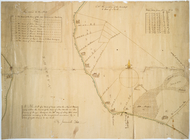
Map of a tract of
land
called the Nyack
Bounded by Clark St., Fulton …
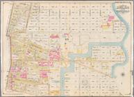
collection:
Part of Wards 1,3,4,6 &10.
Land
Map
Bounded by Smith St., Bergen …
collection:
Part of Wards 3 & 10.
Land
Map Sections
Bounded by Baltic St., Court …
collection:
Part of Wards 6,10 & 12.
Land
Map Section
Bounded by Ostego St., Dwight…
collection:
Part of Ward 12.
Land
Map Section, No. 2
Bounded by (Buttermilk Channe…
collection:
Part of Ward 12.
Land
Map Section, No. 2
Bounded by Prospect Avenue, E…
collection:
Part of Wards 8, 22,29 & 30.
Land
Map
1
2
Previous
Next
1
2
Previous
Next