Click to visit the main New York Public Library Homepage
The New York Public Library
Digital Collections
About Digital Collections
Browse
Search only public domain materials
Items
Collections
Divisions
Home
Search
Browse
About
Search only public domain materials
Items
Collections
Divisions
Digital Collections
Using Images
Using Data
Search
Filtered keyword search
Show filters
Hide filters
Show Only Public Domain
topic
Real property
812
Apartment houses
406
Educational facilities
365
Public schools
306
Streets
303
More
Less
name
Sperr, Percy Loomis, 1890-1964
1960
Nooney, Dinanda H
569
E.B. Hyde & Co
543
Ullitz, Hugo
539
E. Belcher Hyde Map Company
421
More
Less
collection
Photographic views of New York City, 1870's-1970's, from the collections of the New York Public Library
5289
Atlases of New York City
947
Dinanda Nooney Brooklyn photograph collection
569
Collection of photographs of New York City, New York State and more by Max Hubacher
417
Robert N. Dennis collection of stereoscopic views
351
More
Less
place
x
Brooklyn (New York, N.Y.)
New York (N.Y.)
6506
New York (State)
3150
New York
2856
Maps
316
More
Less
genre
Photographs
7599
Maps
1151
Stereographs
351
Clippings
155
Prints
52
More
Less
publisher
E. Belcher Hyde
424
E.B. Hyde & Co
118
G.M. Hopkins & Co
108
G.W. Bromley & Co
87
E. Robinson Co
77
More
Less
division
Milstein Division
6357
Wallach Division: Photography Collection
1332
Map Division
1212
Wallach Division: Picture Collection
84
Wallach Division: Print Collection
32
More
Less
type
still image
7844
cartographic
1166
text
100
notated music
3
Date Range
to
Looking for one of these collections?
Dinanda Nooney Brooklyn photograph collection
576 items
Collection of photographs of New York City, New York State and more by Max Hubacher
785 items
9,072 results found for:
x
N
Filtering on:
x
Place
: Brooklyn (New York, N.Y.)
Sort by:
Relevance
Title
Date created
Date digitized
Sequence
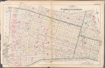
… by Bushwick Inlet,
N
.14th St., Fifth St.,
N
.6th St
note:
Cover title: City atlas of Brooklyn,
N
.Y.
… St.,
N
.6th St., Fifth
note:
Cover title: City atlas of Brooklyn,
N
.Y.
Map bound by
N
.6th
note:
Cover title: City atlas of Brooklyn,
N
.Y.
… by
N
. Second Street, Kent Avenue,
N
. Third
….,
N
. Eleventh St., Driggs Ave.,
N
. Ninth St
… Street,
N
. Eleventh Street,Driggs Street,
N
collection:
… Street,
N
. Eleventh Street,Driggs Street,
N
. Ninth
… by Metropolitan Ave., Kent Ave.,
N
. Third St., Wythe Ave.,
N
… by
N
. 14th Street
m
Gerard Basquiat &
N
. Fitzpatrick. 553 Pacific St
note:
… was misspelled as
N
. Latypatuck. …
… Street,
N
. Third Street, Kent Avenue,
N
. Eighth
m
Shell street guide of Brookly…
note:
… 73°41ʹ33ʺ/
N
40°48ʹ45ʺ--
N
m
…,
N
. Y.
note:
…., Brooklyn,
N
. Y.--K. 1135
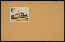
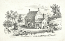
Old mansion house, Gowanus Ro…
collection:
I.
N
. Phelps Stokes Collection of American
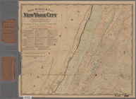
Map of the city of Brooklyn
note:
… 74°01ʹ--W 73°53ʹ/
N
40°44ʹ--
N
40°39ʹ).
Map of the county of Kings, s…
note:
… 74°02ʹ34ʺ--W 73°50ʹ00ʺ/
N
40°44ʹ22ʺ--
N
40°34ʹ10ʺ).
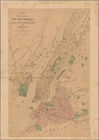
Map of New York, Brooklyn, an…
note:
… 74°14ʹ51ʺ--W 73°43ʹ15ʺ/
N
40°56ʹ32ʺ--
N
40°33ʹ19ʺ).
Brooklyn
note:
… 73°50ʹ42ʺ/
N
40°44ʹ32ʺ--
N
Bird's eye view of the city o…
collection:
I.
N
. Phelps Stokes Collection of American
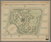
Design for laying out the gro…
note:
… Broadway
N
.Y., Dec. 9 1867."…
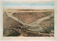
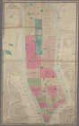
Map of the cities of New York…
abstract:
… 73°53ʹ26ʺ/
N
40°53ʹ05ʺ--
N
… Street,
N
. 1st Street, Third Street,
N
. 2nd
m
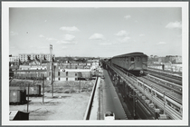
View from the
N
Street station
abstract:
… the
N
Street station
Battle of Long Island: from S…
note:
… 73°55ʹ00ʺ/
N
40°42ʹ53ʺ--
N
New map of Brooklyn and vicin…
note:
… 73°54ʹ16ʺ/
N
40°44ʹ37ʺ--
N
Plan of Bay Ridge Parkway
note:
… 74°01ʹ46ʺ/
N
40°38ʹ03ʺ--
N
Map of the enlarged city of B…
note:
… 73°50ʹ00ʺ/
N
40°44ʹ21ʺ--
N
m
Hagstrom's map of Brooklyn (N…
note:
… 74°03ʹ21ʺ--W 73°50ʹ00ʺ/
N
40°44ʹ21ʺ--
N
40°32ʹ59ʺ).
m
Map of the borough of Brookly…
note:
… 73°51ʹ17ʺ/
N
40°45ʹ04ʺ--
N
m
New guide map of New York Cit…
note:
… 73°54ʹ25ʺ/
N
40°52ʹ55ʺ--
N
Map of the borough of Brookly…
note:
… 74°02ʹ18ʺ--W 73°52ʹ13ʺ/
N
40°44ʹ24ʺ--
N
40°33ʹ59ʺ).
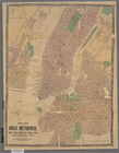
New map of the great metropol…
note:
… 73°55ʹ29ʺ/
N
40°47ʹ23ʺ--
N
Brooklyn, from Rand McNally m…
note:
…, and
N
.J.
m
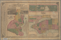
Map of the consolidated City …
note:
…] (W 74°01ʹ--W 73°53ʹ/
N
40°44ʹ--
N
40°39ʹ).
New-York : Map of the consoli…
note:
… 74°02ʹ58ʺ--W 73°55ʹ41ʺ/
N
40°45ʹ53ʺ--
N
40°42ʹ00ʺ)…
Map of New York and vicinity …
note:
…ʹ00ʺ/
N
40°49ʹ11ʺ--
N
Johnson's New York and Brookl…
note:
…ʹ40ʺ/
N
40°48ʹ12ʺ--
N
New map of the great metropol…
note:
… 73°55ʹ29ʺ/
N
40°47ʹ23ʺ--
N
New York and its surroundings…
note:
…ʹ37ʺ/
N
40°48ʹ14ʺ--
N
m
Map of the city of Brooklyn
note:
… 73°55ʹ04ʺ/
N
40°44ʹ32ʺ--
N
m
Rand, McNally & Co.'s map of …
note:
…ʹ12ʺ/
N
40°52ʹ47ʺ--
N
m
Rand, McNally & Co.'s map of …
note:
…] (W 74.08°--W 73.87°/
N
40.88°--
N
40.64°)…
Plan of the U. S. Navy Yard,
N
. Y
New York and Brooklyn
note:
… 74°02ʹ31ʺ--W 73°55ʹ26ʺ/
N
40°48ʹ29ʺ--
N
40°39ʹ56ʺ)…
m
Watson's new map of New York,…
note:
… 74°03ʹ13ʺ--W 73°57ʹ36ʺ/
N
40°48ʹ07ʺ--
N
40°38ʹ54ʺ)…
… Street, Union Avenue,
N
Elevated railway map of New Y…
note:
… 74°02ʹ55ʺ--W 73°56ʹ24ʺ/
N
40°47ʹ13ʺ--
N
40°41ʹ50ʺ)…
m
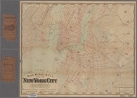
Map of the borough of Brooklyn,
N
.Y
note:
… 74°02ʹ51ʺ--W 73°50ʹ10ʺ/
N
40°48ʹ00ʺ--
N
40°34ʹ01ʺ).
m
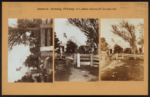
Brooklyn: Rockaway Parkway - Avenue
N
m
Brooklyn: Village Rd.
N
. - Van Sicklen
m
Brooklyn: 53rd Street (East) - Avenue
N
1
2
3
4
5
6
7
8
9
10
…
36
37
Previous
Next
1
2
3
4
5
6
7
8
9
10
…
36
37
Previous
Next