Click to visit the main New York Public Library Homepage
The New York Public Library
Digital Collections
About Digital Collections
Browse
Search only public domain materials
Items
Collections
Divisions
Home
Search
Browse
About
Search only public domain materials
Items
Collections
Divisions
Digital Collections
Using Images
Using Data
Search
Filtered keyword search
Show filters
Hide filters
Show Only Public Domain
topic
Administrative and political divisions
2
Harbors
2
Canals
1
Cities and towns
1
Economic conditions
1
More
Less
name
Williams, W. (Wellington)
2
Anderson, H
1
Barnard, W. S
1
Bormay & Co
1
Carl Flemming (Firm)
1
More
Less
collection
Maps of North America
13
Lawrence H. Slaughter Collection of English maps, charts, globes, books and atlases
1
Maps of North and South America
1
place
x
Cuba
United States
5
Florida
3
Mexico
3
South Carolina
3
More
Less
genre
Maps
15
Military maps
1
Nautical charts
1
Road maps
1
Topographic maps
1
publisher
Carl Flemming, Verlag, Buch- und Kunstdruckerei
1
Dépôt general de la Marine
1
Johann Wechel
1
John L. Narstin
1
Johnson and Browning
1
More
Less
division
Map Division
15
type
x
cartographic
Date Range
to
15 results found for:
x
Cuba
Filtering on:
x
Place
: Cuba
x
Type
: cartographic
Sort by:
Relevance
Title
Date created
Date digitized
Sequence
m
Town site of La Gloria: looki…
collection:
…, Puerto Principe,
Cuba
m
Military map of
Cuba
note:
… island of
Cuba
at scale
Cuba
.
Map of
Cuba
its provinces, railroads, cities
note:
… of
Cuba
from the latest
Mapa de la provincia de Pinar…
collection:
Cuba
…
Cuba
A new map of the United State…
note:
… of the island of
Cuba
-- City
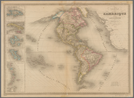
Carte de l'Amerique
note:
…; Ile de
Cuba
; Ile de la
A map of Mexico, Louisiana, a…
Floridae Americae provinciae …
abstract:
… Caroline,
Cuba
, rivers
Carte réduite des côtes et de…
abstract:
… of
Cuba
and the Bahamas
m
Mitchell's new national map e…
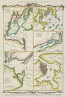
Various plans and draughts of…
Various plans and draughts of…
m
Johnson's new illustrated & e…
End of results
|
Top