Click to visit the main New York Public Library Homepage
The New York Public Library
Digital Collections
About Digital Collections
Browse
Search only public domain materials
Items
Collections
Divisions
Home
Search
Browse
About
Search only public domain materials
Items
Collections
Divisions
Digital Collections
Using Images
Using Data
Search
Filtered keyword search
Show filters
Hide filters
Show Only Public Domain
topic
Administrative and political divisions
1
Altitudes
1
Canals
1
Railroads
1
Reservoirs
1
More
Less
name
Pease, Richard H., 1813-1869
2
Weed, Parsons & Co
2
Greene, D. M. (David Maxson), 1832-1905
1
Richmond, D., (Denison) 1839-1888
1
Sweet, C. A., (Charles Adelbert), 1838-
1
More
Less
collection
x
Maps of New York City and State
place
x
Finger Lakes Region (N.Y.)
New York (State)
3
Genesee Region (N.Y.)
2
Erie Canal (N.Y.)
1
Ontario County (N.Y.)
1
genre
Maps
3
Facsimiles
2
publisher
Weed, Parsons, & Co
2
Lith. of R.H. Pease
1
R.H. Pease, eng. & print
1
division
Map Division
3
type
cartographic
3
Date Range
to
3 results found for:
x
Fingers
Filtering on:
x
Place
: Finger Lakes Region (N.Y.)
x
Collection
: a1a9d830-c5a6-012f-00ec-58d385a7bc34
Sort by:
Relevance
Title
Date created
Date digitized
Sequence
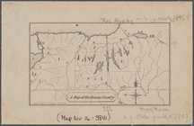
A map of the Genesee country:…
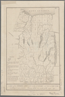
A map of the Genesee lands in…
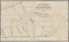
Map of the reservoirs, feeder…