Click to visit the main New York Public Library Homepage
The New York Public Library
Digital Collections
About Digital Collections
Browse
Search only public domain materials
Items
Collections
Divisions
Home
Search
Browse
About
Search only public domain materials
Items
Collections
Divisions
Digital Collections
Using Images
Using Data
Search
Filtered search
Show filters
Hide filters
Show Only Public Domain
topic
Streets
26485
Street photography
25508
Parks
2339
Real property
1973
Apartment houses
1644
More
Less
name
Stone, Dylan, 1967-
25428
Sperr, Percy Loomis, 1890-1964
8684
Abbott, Berenice, 1898-1991
2027
Federal Art Project (New York, N.Y.)
2018
G.W. Bromley & Co
1672
More
Less
collection
Drugstore Photographs, Or, A Trip Along the Yangtze River, 1999, by Dylan Stone
25428
Photographic views of New York City, 1870's-1970's, from the collections of the New York Public Library
17405
Robert N. Dennis collection of stereoscopic views
2354
Atlases of New York City
1954
Changing New York
1866
More
Less
place
x
Manhattan (New York, N.Y.)
New York (N.Y.)
49508
New York (State)
38909
New York
37976
Central Park (New York, N.Y.)
1331
More
Less
genre
Photographs
48930
Stereographs
2354
Maps
2327
Portraits
220
Cadastral maps
84
More
Less
publisher
G.W. Bromley & Co
1624
Perris & Browne
124
William Perris
105
G.W. Bromley
49
E. & H.T. Anthony (Firm)
33
More
Less
division
Wallach Division: Photography Collection
29981
Milstein Division
18583
Map Division
2239
Manuscripts and Archives Division
431
Wallach Division: Print Collection
23
More
Less
type
still image
48981
cartographic
2373
text
330
Date Range
to
51,414 results found
Filtering on:
x
Place
: Manhattan (New York, N.Y.)
Sort by:
Title
Date created
Date digitized
Sequence
m
Interview transcript: John Ka…
m
Interview transcript: Konstan…
m
Photocopy of photograph: Groc…
m
Interview transcript: Vasilio…
m
Interview transcript: Anastas…
m
Interview transcript: Tommy R…
m
Interview transcript: Costas …
m
Photocopy of photograph: Cost…
Photocopy of photograph: Grou…
m
Interview transcript: Milton …
m
Photocopy of photograph: Evan…
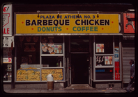
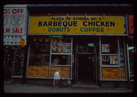
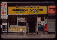
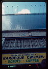
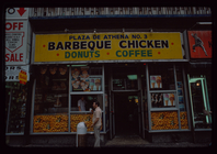
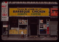
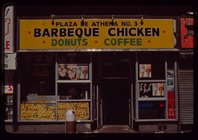
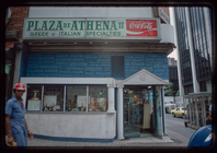
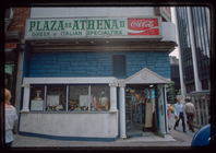
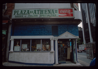
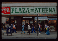
Storefront, Plaza de Athena I…
Storefront, Plaza de Athena I…
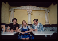
Evangelos Tzalis, restaurant …
Evangelos Tzalis, restaurant …
Evangelos Tzalis, restaurant …
Evangelos Tzalis, restaurant …
Evangelos Tzalis, restaurant …
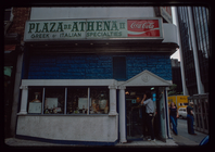
Storefront, Plaza de Athena I…
Storefront, Plaza de Athena I…
Storefront, Plaza de Athena I…
Storefront, Plaza de Athena I…
Storefront, Plaza de Athena I…
Storefront, Plaza de Athena I…
Evangelos Tzalis, restaurant …
Evangelos Tzalis, restaurant …
Evangelos Tzalis, restaurant …
Evangelos Tzalis, restaurant …
Evangelos Tzalis, restaurant …
Evangelos Tzalis, restaurant …
Evangelos Tzalis, restaurant …
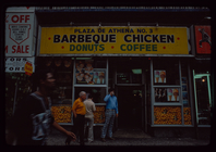
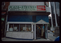
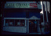
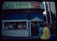
Storefront, Plaza de Athena II
Storefront, Plaza de Athena II
Storefront, Plaza de Athena II
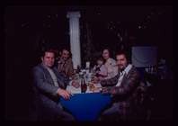
Group portrait with man in bl…
Storefront, Plaza de Athena II
Storefront, Plaza de Athena II
Storefront, Plaza de Athena II
Group portrait with Milton Ka…
Group portrait with Milton Ka…
Storefront, Plaza de Athena II
Milton Karas?, Owner, Plaza d…
Group portrait with man in bl…
Group portrait with man in bl…
Group portrait with man in bl…
Group portrait with man in bl…
Milton Karas?, Owner, Plaza d…
Group portrait with man in bl…
m
Maps of property in the city …
Storefront, Plaza de Athena I
1
2
3
4
5
6
7
8
9
10
…
205
206
Previous
Next
1
2
3
4
5
6
7
8
9
10
…
205
206
Previous
Next