Click to visit the main New York Public Library Homepage
The New York Public Library
Digital Collections
About Digital Collections
Browse
Search only public domain materials
Items
Collections
Divisions
Home
Search
Browse
About
Search only public domain materials
Items
Collections
Divisions
Digital Collections
Using Images
Using Data
Search
Filtered keyword search
Show filters
Hide filters
Show Only Public Domain
topic
Real property
1969
Fire insurance
106
Local transit
94
Landowners
91
Administrative and political divisions
88
More
Less
name
G.W. Bromley & Co
1672
Bromley, George Washington
405
Bromley, Walter Scott
404
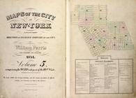
Perris, William
258
Perris & Browne
130
More
Less
collection
Atlases of New York City
1954
Maps of New York City and State
341
Collection of broadside real estate maps announcing auctions of lots in early 19th century New York City
67
Lawrence H. Slaughter Collection of English maps, charts, globes, books and atlases
6
I. N. Phelps Stokes Collection of American Historical Prints
5
More
Less
place
x
Manhattan (New York, N.Y.)
New York (State)
2285
New York
1950
New York (N.Y.)
697
United States
70
More
Less
genre
Maps
2327
Cadastral maps
84
Index maps
49
Indexes
35
Manuscript maps
32
More
Less
publisher
G.W. Bromley & Co
1624
Perris & Browne
124
William Perris
105
G.W. Bromley
49
E. Robinson Co
24
More
Less
division
Map Division
2239
Wallach Division: Print Collection
8
Manuscripts and Archives Division
3
General Research Division
2
Milstein Division
2
More
Less
type
cartographic
2371
text
78
still image
8
Date Range
to
Looking for this collection?
Maps of New York City and State
2,059 items
2,385 results found for:
x
maps
Filtering on:
x
Place
: Manhattan (New York, N.Y.)
Sort by:
Relevance
Title
Date created
Date digitized
Sequence
Maps
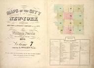
of the city of New York …
Maps
of the city of New-York
…
Maps
of the city of New-York
Maps
of the city of New-York
…
Maps
of the city of New-York
…
Maps
of the city of New-York
Maps
of the city of New -York
Maps
of the city of New York
…
Maps
of the city of New York …
m
Maps
of property in the city of New York
note:
… index,
map
of 277 Pearl Street),
map
leaves 1
…
Maps
of the city of New York …
…
Maps
of the city of New York
Maps
of the city of New York
Maps
of the city of New York …
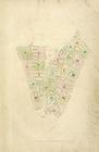
Index
Map
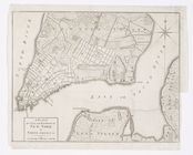
A Plan of the city and enviro…
collection:
Charts and
maps
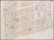
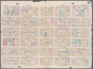
Map
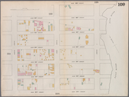
bounded by Murray Street, Broadway
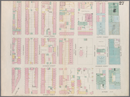
Map
bounded by Canal Street, Elm Street
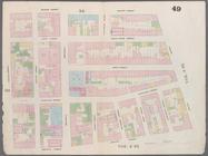
Map
bounded by Hamersley Street, Varick
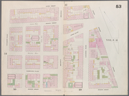
Map
bounded by Spring Street, Broadway
Map
bounded by Broome Street, Bowery
Map
bounded by Houston Street, Bowery
Map
bounded by Rivington Street, Ludlow
Map
bounded by Division Street, Montgomery
Map
bounded by 5th Street, First Avenue
Map
bounded by 4th Street, Bowery, Houston
m
Map
bounded by 9th Street, Fourth Avenue
collection:
Map
bounded by 9th Street, Fourth Avenue, 4
Map
bounded by 9th Street, University Place
Map
bounded by 14th Street, Fourth Avenue
collection:
Map
bounded by 14th Street, Fourth Avenue, 9
Map
bounded by 14th Street, University Place
Distance
map
of the state of New York
note:
… of the
map
.
Maps
of the city of New York …
Map
bounded by West 42nd Street, Tenth
Map
bounded by West 47th Street, Sixth
Map
bounded by West 47th Street, Eighth
Map
bounded by West 47th Street, Tenth
Map
bounded by West 52nd Street, Sixth
Map
bounded by West 52nd Street, Eighth
Map
bounded by West 52nd Street, Tenth
Map
bounded by West 57th Street, Tenth
Map
bounded by West 57th Street, Eighth
Map
bounded by West 57th Street, Sixth
Map
bounded by East 57th Street, Second
Map
bounded by East 57th Street, East River
collection:
Map
bounded by East 57th Street, East
Map
bounded by East 62nd Street, First
Map
bounded by East 62nd Street, Second
Map
bounded by East 62nd Street, Fourth
Map
bounded by West 59th Street, Sixth
Map
bounded by West 62nd Street, Eighth
Map
bounded by West 64th Street, Tenth
1
2
3
4
5
6
7
8
9
10
Previous
Next
1
2
3
4
5
6
7
8
9
10
Previous
Next