Click to visit the main New York Public Library Homepage
The New York Public Library
Digital Collections
About Digital Collections
Browse
Search only public domain materials
Items
Collections
Divisions
Home
Search
Browse
About
Search only public domain materials
Items
Collections
Divisions
Digital Collections
Using Images
Using Data
Search
Filtered keyword search
Show filters
Hide filters
Show Only Public Domain
topic
Road maps
54
Guidebooks
15
Guidebooks, 1802
15
Roads
15
Railroads
12
More
Less
name
Colles, Christopher, 1738-1816
53
Tiebout, Cornelius, 1777-1832
53
Carey, Mathew, 1760-1839
15
Jones, T. W
15
Moore, S. S
15
More
Less
collection
Lawrence H. Slaughter Collection of English maps, charts, globes, books and atlases
90
Maps of North America
44
I. N. Phelps Stokes Collection of American Historical Prints
5
Maps of New York City and State
5
John H. Levine Collection
3
More
Less
place
x
Middle Atlantic States
United States
73
New England
30
Virginia
21
Maryland
17
More
Less
genre
Maps
149
Prints
3
Diagrams
1
Early works to 1800
1
Guidebooks
1
More
Less
publisher
M. Carey
15
publisher not identified
6
M. Carey,
4
s.n.,
4
Chez Brocas
2
More
Less
division
Map Division
143
Wallach Division: Print Collection
5
Rare Book Division
1
type
cartographic
149
still image
1
text
1
Date Range
to
149 results found for:
x
map
Filtering on:
x
Place
: Middle Atlantic States
Sort by:
Relevance
Title
Date created
Date digitized
Sequence
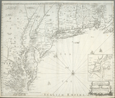
Map
of the Philadelphia, Wilmington
note:
NYPL
Map
Div. copy includes manuscripts
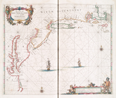
An exact
map
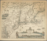
of New England, New York
note:
Map
Div. 01-5195: Bancroft Collection.
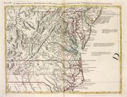
An exact
map
of New Jersey, Pensylvania, New
note:
… to Early
Maps
of the Middle
A
map
of that part of America where a degree
note:
Copy in
Map
Div. 00-413: includes text
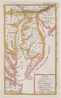
Colton's
map
showing part of Virginia
note:
Extracted from sheet with two
maps
Map
of the middle states of America
note:
… to Early
Maps
of the Middle
Map
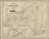
of the canals and rail roads connecting
note:
NYPL
Map
Div. copy mounted on paper and cloth
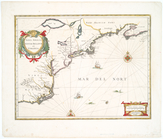
Nova Anglia, Novum Belgium, e…
note:
… in early
maps
, 39
An exact
map
of New Jersey, Pensylvania [sic
note:
Mapping
the Nation (NEH grant, 2015-2018)…
m
Rand, McNally & Co.'s
map
showing one
note:
NYPL
Map
Div. copy
Portions of the military depa…
note:
Mapping
the Nation (NEH grant, 2015-2018)…
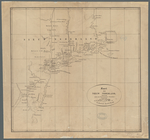
A
Map
of the country round Philadelphia
note:
… to Early
Maps
of the Middle
A new
map
of the most considerable
note:
Appears in Edward Wells' New sett of
maps
m
The Wyoming Coal Field and it…
note:
NYPL
Map
Div. copy
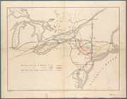
Observed path of meteor of Ch…
note:
Mapping
the Nation (NEH grant, 2015-2018)…
A new
map
of New Jarsey and Pensilvania.
m
Map
of part of Virginia, Maryland
note:
NYPL
Map
Div. copy is divided into 2 sheets 49 x
Map
of Virginia, Maryland, Delaware
note:
Title from NYPL's Dictionary catalog of the
Map
Map
of the Clinton County Coal Company
note:
Mapping
the Nation (NEH grant, 2015-2018)…
Pas caerte van Nieu Nederland…
note:
… to Early
Maps
of the Middle
An accurate
map
of the English colonies in North
note:
… to Early
Maps
of the Middle
Map
of part of Virginia, Maryland
note:
Map
of the coast of Virginia, Maryland
Novi Belgii Novaeque Angliae …
note:
… to Early
Maps
of the Middle
Nova Anglia, Novum Belgium, e…
collection:
Maps
of North America
Belgii novi, angliae novae, e…
note:
… of
map
by Jan Jansson.
Routes between New-York & Was…
note:
… to Early
Maps
of the Middle
Colton's
map
of Virginia, Maryland
note:
Mapping
the Nation (NEH grant, 2015-2018)…
… ... ; [and] Colton's
map
note:
City
map
shows block numbers, wards
m
A
map
of the most inhabited part of Virginia
note:
Described in: Fry & Jefferson
map
of Virginia
Map
showing route of the New York, Ontario
note:
Map
also shows lakes, rivers.
Pas caarte van Nieu Nederlandt
note:
Variant ed. of Burden, P.D.
Mapping
A
map
of the country between Albemarle
note:
Mapping
the Nation (NEH grant, 2015-2018)…
Map
of the state of Virginia …
note:
Mapping
the Nation (NEH grant, 2015-2018)…
An accurate
map
of Canada, with the adjacent
note:
… to Early
Maps
of the Middle
Map
of the routes through the middle
note:
… to Early
Maps
of the Middle
A new
map
of New England, New York, New
Pas caerte van Nieu Nederland…
collection:
… of English
maps
, charts
A
map
of that part of America where a degree
note:
Copy in
Map
Div. 97-6265: Lawrence H
Map
of the routes through the middle
note:
… to Early
Maps
of the Middle
Map
showing the Southern Maryland Railroad
note:
Mapping
the Nation (NEH grant, 2015-2018)…
Kaart van Nieuw Nederland: be…
note:
Mapping
the Nation (NEH grant, 2015-2018)…
Map
shewing the location of the N.Y
note:
Map
of New York State and vicinity
m
Post route
map
of the states of Virginia
note:
Includes inset
map
: District of Columbia
A
map
of the most inhabited part of Virginia
note:
Described in: Fry & Jefferson
map
of Virginia
Nouvelle Angleterre, Nlle. Yo…
note:
… to Early
Maps
of the Middle
Il Maryland, il Jersey Meridi…
note:
… to Early
Maps
of the Middle
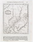
Road from Philadela. to New Y…
note:
Copy in
Map
Div. 97-6238: Lawrence H
Road from Philadela. to New Y…
note:
Copy in
Map
Div. 97-6238: Lawrence H
Road from Philadelphia to New…
note:
Copy in
Map
Div. 97-6238: Lawrence H
Road from Philadelphia to New…
note:
Copy in
Map
Div. 97-6238: Lawrence H