Click to visit the main New York Public Library Homepage
The New York Public Library
Digital Collections
About Digital Collections
Browse
Search only public domain materials
Items
Collections
Divisions
Home
Search
Browse
About
Search only public domain materials
Items
Collections
Divisions
Digital Collections
Using Images
Using Data
Search
Filtered keyword search
Show filters
Hide filters
Show Only Public Domain
topic
Real property
13
Railroad tracks
12
Nautical charts
9
Long Island, Battle of, New York, N.Y., 1776
7
Administrative and political divisions
5
More
Less
name
Long Island Rail Road
20
Sperr, Percy Loomis, 1890-1964
19
G.W. Bromley & Co
8
Hubacher, Max Henry, 1900-1989
4
Phelps, Humphrey (19th cent.)
4
More
Less
collection
Maps of New York City and State
24
Photographic views of New York City, 1870's-1970's, from the collections of the New York Public Library
22
Lawrence H. Slaughter Collection of English maps, charts, globes, books and atlases
9
Atlases of New York City
8
I. N. Phelps Stokes Collection of American Historical Prints
5
More
Less
place
x
New York (N.Y.)
Brooklyn (New York, N.Y.)
24
New York (State)
21
Queens (New York, N.Y.)
16
New York
12
More
Less
genre
Maps
50
Photographs
28
Cadastral maps
8
Prints
4
Atlases
3
More
Less
publisher
G. W. Bromley & Co
8
s.n
7
Published by Ensign & Thayer, 50 Ann St.,
2
Published by J.H. Colton & Co
2
Published for the use of the Royal Navy of Great Britain by Joseph F. W. Des Barres
2
More
Less
division
Map Division
46
Milstein Division
26
Wallach Division: Print Collection
5
Wallach Division: Photography Collection
2
type
cartographic
46
still image
34
Date Range
to
79 results found for:
x
Islands of the Atlantic
Filtering on:
x
Place
: New York (N.Y.)
Sort by:
Relevance
Title
Date created
Date digitized
Sequence
m
Islands
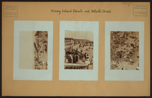
- Coney
Island
beach
m
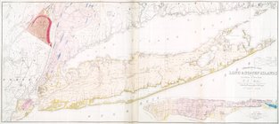
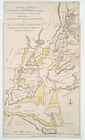
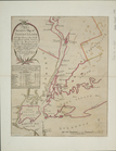
Geological map of Long & Staten
islands
note:
Includes inset "Map of New-York
Island
."…
Chart and plan of the harbour…
note:
…
Atlantic
Seaboard.
… York
Island
& North
note:
… of Long
Island
from Eaton
…
Island
& North River
note:
…
Atlantic
Seaboard.
m
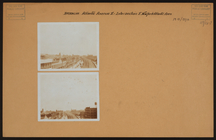
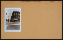
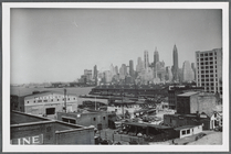
View from the foot of
Atlantic
Avenue
abstract:
… the foot of
Atlantic
Avenue
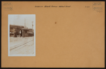
m
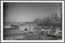
View from the foot of
Atlantic
Avenue in Brooklyn
abstract:
… of
Atlantic
Avenue in Brooklyn
…
Island
, & Long
Island
.
note:
…
Atlantic
Seaboard.
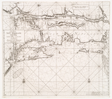
Chart of Long
Island
Sound, 1822
note:
…
Atlantic
Seaboard.
m
Brooklyn:
Atlantic
Avenue - New York Avenue
m
Brooklyn:
Atlantic
Avenue - Snediker Avenue
m
Brooklyn:
Atlantic
Avenue - Milford Street
m
Brooklyn:
Atlantic
Avenue - Fountain Avenue
m
Brooklyn:
Atlantic
Avenue - Autumn Avenue
m
Queens: 111th Street -
Atlantic
Avenue
m
Queens:
Atlantic
Avenue - 114th Street
m
Queens:
Atlantic
Avenue - 118th Street
m
Brooklyn: Sackman Street -
Atlantic
Avenue
m
Brooklyn:
Atlantic
Avenue - Wyona Street
m
Brooklyn:
Atlantic
Avenue - Hemlock Street
m
Brooklyn:
Atlantic
Avenue - Autumn Avenue
m
Brooklyn: Crescent Street -
Atlantic
Avenue
m
Queens:
Atlantic
Avenue - 109th Street
m
Queens:
Atlantic
Avenue - 116th Street
m
Queens:
Atlantic
Avenue - 120th Street
m
Brooklyn: New York Avenue (East) -
Atlantic
m
Queens:
Atlantic
Avenue - Lefferts
m
Queens:
Atlantic
Avenue - Rockaway
m
Brooklyn:
Atlantic
Avenue - Montauk Avenue
m
Brooklyn:
Atlantic
Avenue - Buffalo Avenue
…
Island
.
note:
…
Atlantic
Seaboard.
m
… at the foot of
Atlantic
Avenue
m
… of
Atlantic
Avenue, Brooklyn
… by
Atlantic
Avenue, Cummings
Plate 33: Bounded by
Atlantic
Avenue, Vanwyck
… Avenue, (
Atlantic
Ocean
…, and (
Atlantic
Ocean) Boulevard, …
…, Eastern Avenue, (
Atlantic
…,
Atlantic
Avenue, Drew
… of Staten
Island
note:
…
Atlantic
Seaboard.
… of Staten
Island
note:
…
Atlantic
Seaboard.
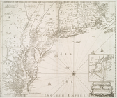
A new map of New England, New…
note:
… Jersey, Staten
Island
and part of Long
Island
]
… and Long
Island
from Cape
note:
…
Atlantic
Seaboard.
…
Island
note:
…
Atlantic
Seaboard.
Pas-kaart vande zee kusten va…
… Wyck Avenue,
Atlantic
…, (Inlet,
Atlantic
Ocean
…
Island
: 50 miles from
note:
Inset: Map of Long
Island
, 1850.
…
Island
, Aug. 27th 1776
note:
…
Atlantic
Seaboard.
…
Island
.
note:
…
Atlantic
Seaboard.