Click to visit the main New York Public Library Homepage
The New York Public Library
Digital Collections
About Digital Collections
Browse
Search only public domain materials
Items
Collections
Divisions
Home
Search
Browse
About
Search only public domain materials
Items
Collections
Divisions
Digital Collections
Using Images
Using Data
Search
Filtered keyword search
Show filters
Hide filters
Show Only Public Domain
topic
Real property
299
Business enterprises
190
Railroads
10
Landowners
9
Streets
9
More
Less
name
Beers, S. N
117
Beers, D. G. (Daniel G.)
112
Stone & Stewart
102
Asher & Adams
61
Wm. Stewart, Publisher
47
More
Less
collection
Atlases of the United States
346
Maps of New York City and State
69
Maps of North America
5
A military and topographical atlas of the United States; including the British possessions & Florida
1
Atlases of New York City
1
More
Less
place
x
New York (State)
Chautauqua County
47
Chautauqua County (N.Y.)
47
Saint Lawrence County
47
Saint Lawrence County (N.Y.)
47
More
Less
genre
Maps
374
Atlases
346
Topographic maps
25
Prints
17
Cadastral maps
10
More
Less
publisher
Stone & Stewart
70
C. K. Stone
46
C.K. Stone
42
Topographical Bureau
7
M. Dripps
4
More
Less
division
Map Division
423
Rare Book Division
1
Wallach Division: Picture Collection
1
type
cartographic
390
text
37
still image
2
Date Range
to
425 results found for:
x
Topographic maps
Filtering on:
x
Place
: New York (State)
Sort by:
Relevance
Title
Date created
Date digitized
Sequence
m
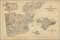
New York City and vicinity
collection:
Maps
of New York City and State
Map
accompanying
Lake Pleasant, - C.H. formerl…
note:
Mapping
the Nation (NEH grant, 2015-2018)…
m
New York und Umgegend
collection:
Maps
of New York City and State
Map
showing
topographical
survey of land
note:
Mapping
the Nation (NEH grant, 2015-2018)…
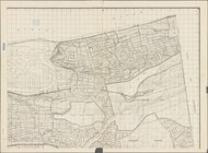
Topographical
map
showing street system
note:
… of Queens,
Topographical
New York City and environs : …
collection:
Maps
of New York City and State
m
Asher & Adams' new
topographical
map
of the state
note:
Mapping
the Nation (NEH grant, 2015-2018)…
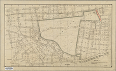
m
Map
or plan of streets, roads, avenues
note:
…"New York December, 1895,
Topographical
Map
or plan of section 10 [Crotona Park]
abstract:
… lines. Source:
Maps
Topographical
map
of Seneca County, N.Y.
note:
Mapping
the Nation (NEH grant, 2015-2018)…
Albany and vicinity
note:
…, chief
topographer
; H.M
m
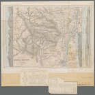
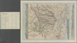
Topographical
map
of New York and vicinity …
note:
Insets: Navesink Park --
Map
of Long
Map
or plan showing the street system in the 12th
note:
…
Topographical
Engineer
Aqueduct Commissioners
topographical
map
note:
Mapping
the Nation (NEH grant, 2015-2018)…
Topographical
map
made from surveys
note:
… and
topographical
engineer.
Aqueduct Commissioners
topographical
map
note:
Mapping
the Nation (NEH grant, 2015-2018)…
A
topographical
map
of Lewis Co., New York
note:
Cadastral
map
showing property owners
A
topographical
map
of a part of northern New
note:
Mapping
the Nation (NEH grant, 2015-2018)…
m
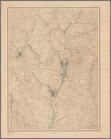
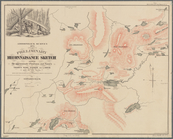
Map
of the Catskill Mountains
note:
Mapping
the Nation (NEH grant, 2015-2018)…
Map
of the Catskill Mountains
note:
Mapping
the Nation (NEH grant, 2015-2018)…
Land classification
map
, New York, Mt
note:
… Gannett Chief
Topographer
m
Map
of the Catskill Mountains
note:
Mapping
the Nation (NEH grant, 2015-2018)…
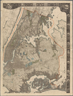
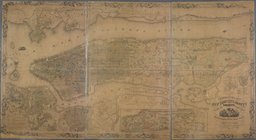
m
General
map
of the city of New York
note:
Note mounted on
map
: The original of this
map
m
Topographical
map
of the state of New Jersey
note:
…: Meteorological
map
of the state
Blackwell's, Ward's and Randa…
collection:
Maps
of New York City and State
Map
of the Marine Hospital ground, Staten
note:
… to Early
Maps
of the Middle
m
Geological
map
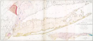
of Long & Staten islands
note:
Includes inset "
Map
of New-York Island."…
A
map
of the county between Crown Point
note:
Military
topographic
map
. Shows forts
m
Map
of New York exhibiting the post offices
note:
LC Railroad
maps
, 259
Rye Park: [New York]
note:
B.S. Olmstead,
topographical
engineer, Rye, N.Y
A
map
of the provinces of New-York
note:
LC
Maps
of North America, 1750-1789, 1048
m
Castle Ridge, Tarrytown, West…
note:
Egbert L. Viele, civil and
topographical
m
Property identification
map
of Inwood Hill
note:
Blueprint of
map
, indicating property owners
A
map
of the provinces of New-York
note:
LC
Maps
of North America, 1750-1789, 1048
m
Survey for a ship canal to co…
note:
…"
Map
no. 3."…
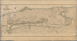
m
Topographical
map
of New York City, County
note:
Cadastral
map
. Covers the area south
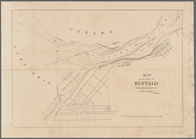
Map
of the vicinity of Buffalo
note:
Mapping
the Nation (NEH grant, 2015-2018)…
m
Map
of the Cedar Knolls, at Bronxville
note:
Topographical
map
of Cedar Knolls. Shows
Plan of High Bridge Park : pr…
collection:
Maps
of New York City and State
Flushing
note:
… catalog of the
Map
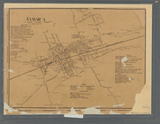
Jamaica
note:
NYPL
Map
Div. copy has accession no
… and new to the
maps
note:
From: Report on a
topographical
survey
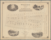
Shonnard Park at Yonkers, est…
note:
Designed from a
topographical
survey by Egbert L
Hempstead
note:
…, H. F.
Topographical
map
of the counties
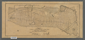
Map
of the borough of Brooklyn, City of New York
m
Plan and profile showing the …
note:
…"New York, May 31 1892
Topographical
m
General
map
m
Map
or plan showing the street system
abstract:
…,
Topographical
Bureau." Oriented
Map
showing the location of the speedway
abstract:
Map
is bound by Riverdale Ave., Van
1
2
Previous
Next
1
2
Previous
Next