Click to visit the main New York Public Library Homepage
The New York Public Library
Digital Collections
About Digital Collections
Browse
Search only public domain materials
Items
Collections
Divisions
Home
Search
Browse
About
Search only public domain materials
Items
Collections
Divisions
Digital Collections
Using Images
Using Data
Search
Filtered keyword search
Show filters
Hide filters
Show Only Public Domain
topic
Real property
8944
Fire insurance
5221
Cities & towns
5007
City planning
993
Social conditions
943
More
Less
name
Sanborn Map Company
5095
G.W. Bromley & Co
2106
M.I.T. Press
942
New York (N.Y.). City Planning Commission
942
Ullitz, Hugo
735
More
Less
collection
Atlases of New York City
9795
Maps of New York City and State
1306
Atlases of the United States
314
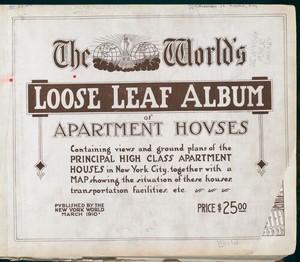
The World's loose leaf album of apartment houses: containing views and ground plans of the principal high class apartment houses in New York City, together with a map showing the situation of these houses, transportation facilities, etc
304
Collection of broadside real estate maps announcing auctions of lots in early 19th century New York City
67
More
Less
place
x
New York (State)
New York
5364
Manhattan (New York, N.Y.)
2283
New York (N.Y.)
2108
Brooklyn (New York, N.Y.)
996
More
Less
genre
Maps
11350
Atlases
314
Photographs
309
Floor plans
304
Cadastral maps
247
More
Less
publisher
Sanborn Map Company
5009
G.W. Bromley & Co
1977
MIT Press
942
E. Belcher Hyde
557
N.Y. World
304
More
Less
division
Map Division
11367
Milstein Division
305
Wallach Division: Print Collection
29
Wallach Division: Picture Collection
21
Rare Book Division
10
More
Less
type
cartographic
10416
still image
1325
text
598
Date Range
to
Looking for one of these collections?
Atlases of New York City
11,722 items
Maps of New York City and State
2,059 items
The World's loose leaf album of apartment houses: containing views and ground plans of the principal high class apartment houses in New York City, together with a map showing the situation of these houses, transportation facilities, etc.
304 items
11,880 results found for:
x
new york city map
Filtering on:
x
Place
: New York (State)
Sort by:
Relevance
Title
Date created
Date digitized
Sequence
…
New
York
City
use:
… partner (e.g.,
New
York
m
Cyclists' road
map
of
New
York
use:
… partner (e.g.,
New
York
… Estate in
New
York
City
use:
… partner (e.g.,
New
York
m
New
York
City
map
and directory.
use:
… partner (e.g.,
New
York
Map
showing the 19th Assembly District
use:
… partner (e.g.,
New
York
m
Map
of
New
York
City
use:
… partner (e.g.,
New
York
City
of
New
York
note:
City
of
New
York
, Board of Estimate
Use District
Map
Section No. 1
note:
City
of
New
York
, Board of Estimate
Use District
Map
Section No. 2
note:
City
of
New
York
, Board of Estimate
Use District
Map
Section No. 3
note:
City
of
New
York
, Board of Estimate
Use District
Map
Section No. 4
note:
City
of
New
York
, Board of Estimate
Use District
Map
Section No. 5
note:
City
of
New
York
, Board of Estimate
Use District
Map
Section No. 6
note:
City
of
New
York
, Board of Estimate
Use District
Map
Section No. 7
note:
City
of
New
York
, Board of Estimate
Use District
Map
Section No. 8
note:
City
of
New
York
, Board of Estimate
Use District
Map
Section No. 9
note:
City
of
New
York
, Board of Estimate
Use District
Map
Section No. 10
note:
City
of
New
York
, Board of Estimate
Use District
Map
Section No. 11
note:
City
of
New
York
, Board of Estimate
Use District
Map
Section No. 12
note:
City
of
New
York
, Board of Estimate
Use District
Map
Section No. 13
note:
City
of
New
York
, Board of Estimate
Use District
Map
Section No. 14
note:
City
of
New
York
, Board of Estimate
Use District
Map
Section No. 15
note:
City
of
New
York
, Board of Estimate
Use District
Map
Section No. 16
note:
City
of
New
York
, Board of Estimate
Use District
Map
Section No. 17
note:
City
of
New
York
, Board of Estimate
Use District
Map
Section No. 18
note:
City
of
New
York
, Board of Estimate
Use District
Map
Section No. 19
note:
City
of
New
York
, Board of Estimate
Use District
Map
Section No. 20
note:
City
of
New
York
, Board of Estimate
Use District
Map
Section No. 21
note:
City
of
New
York
, Board of Estimate
Use District
Map
Section No. 22
note:
City
of
New
York
, Board of Estimate
Use District
Map
Section No. 23
note:
City
of
New
York
, Board of Estimate
Use District
Map
Section No. 24
note:
City
of
New
York
, Board of Estimate
Use District
Map
Section No. 25
note:
City
of
New
York
, Board of Estimate
Use District
Map
Section No. 26
note:
City
of
New
York
, Board of Estimate
Use District
Map
Section No. 27
note:
City
of
New
York
, Board of Estimate
Use District
Map
Section No. 28
note:
City
of
New
York
, Board of Estimate
Use District
Map
Section No. 29
note:
City
of
New
York
, Board of Estimate
Use District
Map
Section No. 30
note:
City
of
New
York
, Board of Estimate
Use District
Map
Section No. 31
note:
City
of
New
York
, Board of Estimate
Use District
Map
Section No. 32
note:
City
of
New
York
, Board of Estimate
Use District
Map
Section No. 33
note:
City
of
New
York
, Board of Estimate
Use District
Map
Section No. 34
note:
City
of
New
York
, Board of Estimate
Use District
Map
Section No. 35
note:
City
of
New
York
, Board of Estimate
Height District
Map
Section No. 1
note:
City
of
New
York
, Board of Estimate
Height District
Map
Section No. 2
note:
City
of
New
York
, Board of Estimate
Height District
Map
Section No. 3
note:
City
of
New
York
, Board of Estimate
Height District
Map
Section No. 4
note:
City
of
New
York
, Board of Estimate
Height District
Map
Section No. 5
note:
City
of
New
York
, Board of Estimate
Height District
Map
Section No. 6
note:
City
of
New
York
, Board of Estimate
Height District
Map
Section No. 7
note:
City
of
New
York
, Board of Estimate
Height District
Map
Section No. 8
note:
City
of
New
York
, Board of Estimate
1
2
3
4
5
6
7
8
9
10
…
47
48
Previous
Next
1
2
3
4
5
6
7
8
9
10
…
47
48
Previous
Next