Click to visit the main New York Public Library Homepage
The New York Public Library
Digital Collections
About Digital Collections
Browse
Search only public domain materials
Items
Collections
Divisions
Home
Search
Browse
About
Search only public domain materials
Items
Collections
Divisions
Digital Collections
Using Images
Using Data
Search
Filtered keyword search
Show filters
Hide filters
Show Only Public Domain
topic
Administrative and political divisions
2
Cables, Submarine
1
Colonies
1
Nautical charts
1
Spanish-American War, 1898
1
More
Less
name
Barnard, W. S
1
Duthie, James (American architect, active late 20th century)
1
Ettling, Theodor, 1823-
1
Goldthwait, J. H
1
Habenicht, Hermann, 1844-1917
1
More
Less
collection
Maps of North America
4
I. N. Phelps Stokes Collection of American Historical Prints
1
Lawrence H. Slaughter Collection of English maps, charts, globes, books and atlases
1
place
x
North America
United States
4
Cuba
2
Mexico
2
Africa, North
1
More
Less
genre
Maps
6
Prints
1
publisher
Chez Mondhare
1
Illustrated London News & Sketch Ltd.?
1
Johnson and Browning
1
Justus Perthes
1
Paniconographie de Gillot
1
More
Less
division
Map Division
5
Wallach Division: Print Collection
1
type
x
cartographic
still image
1
Date Range
to
6 results found for:
x
Cuba
Filtering on:
x
Place
: North America
x
Type
: cartographic
Sort by:
Relevance
Title
Date created
Date digitized
Sequence
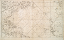
… tot't eyland
Cuba
m
Mitchell's new national map e…
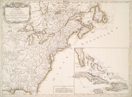
Carte des possessions anglois…
note:
Includes inset of Isles Lucayes,
Cuba
, la
…. Mexico,
Cuba
, Jamaica, St
Amerikanisch-Spanischer krieg…
note:
… insel
Cuba
.
m
Johnson's new illustrated & e…