Click to visit the main New York Public Library Homepage
The New York Public Library
Digital Collections
About Digital Collections
Browse
Search only public domain materials
Items
Collections
Divisions
Home
Search
Browse
About
Search only public domain materials
Items
Collections
Divisions
Digital Collections
Using Images
Using Data
Search
Filtered keyword search
Show filters
Hide filters
Show Only Public Domain
topic
History
21
Nautical charts
20
Harbors
16
Administrative and political divisions
14
Coasts
10
More
Less
name
United States Coast Survey
20
Bache, A. D. (Alexander Dallas), 1806-1867
19
Maffitt, John Newland, 1819-1886
13
Boutelle, C. O. (Charles Otis)
12
American Revolution (1775-1783)
5
More
Less
collection
Maps of North America
97
Lawrence H. Slaughter Collection of English maps, charts, globes, books and atlases
8
Wallach Division Picture Collection
8
Robert N. Dennis collection of stereoscopic views
7
Emmet Collection of Manuscripts Etc. Relating to American History
2
More
Less
place
x
South Carolina
North Carolina
40
Charleston (S.C.)
31
Georgia
28
Charleston
26
More
Less
genre
Maps
106
Bathymetric maps
19
Nautical charts
19
Photographs
9
Prints
8
More
Less
publisher
U.S. Coast Survey
11
publisher not identified
9
U.S. Coast Survey Office
7
Post Office Department
4
J. and C. Blaeu
3
More
Less
division
Map Division
106
Wallach Division: Photography Collection
9
Wallach Division: Picture Collection
8
Wallach Division: Print Collection
3
Milstein Division
2
More
Less
type
cartographic
106
still image
24
text
8
Date Range
to
131 results found for:
x
North Carolina
Filtering on:
x
Place
: South Carolina
Sort by:
Relevance
Title
Date created
Date digitized
Sequence
m
… of the states of
North
Carolina
and South
Carolina
…
abstract:
…: Western part of
North
Carolina
.
… map of
North
Carolina
and part of South
Carolina
…
m
… of the states of
North
Carolina
and South
Carolina
…
abstract:
…: Western part of
North
Carolina
.
Johnson's
North
Carolina
and South
Carolina
North
Carolina
& South
Carolina
…
Map of
North
Carolina
and South
Carolina
… of Virginia,
North
Carolina
, South
Carolina
…'s topographical map of
North
and South
Carolina
…
abstract:
… of the states of
North
Carolina
, South
Carolina
and most
North
and South
Carolina
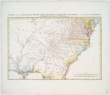
Map of the states of
North
& South
Carolina
… & the
Carolinas
topic:
Sherman's March through the
Carolinas
Sixth l. h. district
note:
…,
North
Carolina
, to
… parts of Virginia,
North
Carolina
, South
Carolina
m
… of
North
Carolina
, South
Carolina
and Georgia
… part of Virginia,
North
Carolina
, and the northern
… parts of Virginia,
North
Carolina
, South
Carolina
… and West Va.,
North
& part of South
Carolina
, Maryland
Carolina
newly discribed
note:
Covers as far
north
as southern Virginia
… of Virginia,
North
Carolina
, South
Carolina
note:
Kendall, H.P. Early maps of
Carolina
83.
m
An accurate map of
North
and South
Carolina
An accurate map of
North
and South
Carolina
m
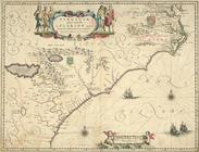
A New description of
Carolina
…
abstract:
…. Oriented with
north
A map of Virginia,
North
and South
Carolina
Carolina
…
note:
Area covers modern
North
and South
Carolina
m
A new description of
Carolina
…
abstract:
…. Oriented with
north
Battle of King's Mountain.
collection:
North
Carolina
.
Carte general de la Caroline …
collection:
South
Carolina
A new map of
Carolina
…
Sketch E showing the progress…
abstract:
… with
North
Carolina
. "No. 27
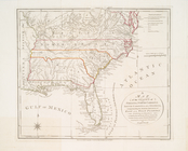
Post route map of the States of South
Carolina
m
…. Chesnee, South
Carolina
collection:
… in the
North
Carolina
mountains
m
…. Chesnee, South
Carolina
collection:
… in the
North
Carolina
mountains
m
Post route map of the states of South
Carolina
Carolina
newly discribed
abstract:
Covers as far
north
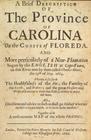
A brief description of the province of
Carolina
…, Maryland,
Carolina
, New
note:
Covers
North
America from the Gulf
To accompany Willard's histor…
collection:
Maps of
North
America
Virginiae partis australis, e…
note:
Burden, P.D. Mapping of
North
America
Carte de la Louisiane, Maryla…
note:
LC Maps of
North
America, 1750-1789, 1386
Carte de la Louisiane, Maryla…
note:
LC Maps of
North
America, 1750-1789, 1386
Virginiae partis australis, e…
m
The Negro Motorist Green Book…
Virginiae partis australis, e…
collection:
Maps of
North
America
…, Maryland &
Carolina
, from C
m
… continent of
North
America
note:
… part of
North
America
United States of Nth. America…
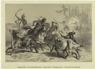
Indians plundering South
Carolina
topic:
Indians of
North
America -- 1800-1899
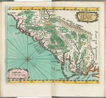
Map of the Sea-Coast of South
Carolina
…
abstract:
… with
north
toward upper left
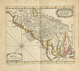
…
Carolina
with the marks
abstract:
…. Oriented with
north
Military map of South
Carolina
abstract:
… with
north
toward upper right