Click to visit the main New York Public Library Homepage
The New York Public Library
Digital Collections
About Digital Collections
Browse
Search only public domain materials
Items
Collections
Divisions
Home
Search
Browse
About
Search only public domain materials
Items
Collections
Divisions
Digital Collections
Using Images
Using Data
Search
Filtered keyword search
Show filters
Hide filters
Show Only Public Domain
topic
x
History
Boundaries
7
Nautical charts
2
Territorial questions
2
American
1
More
Less
name
Barclay, Anthony, 1792-1877
7
Porter, Peter B. (Peter Buell), 1773-1844
7
United States. Light-House Board
7
Bird, William A., 1796-1878
5
Thompson, David, 1770-1857
5
More
Less
collection
Lawrence H. Slaughter Collection of English maps, charts, globes, books and atlases
8
Maps of North America
8
Maps of New York City and State
2
Wallach Division Picture Collection
1
place
x
United States
Canada
7
North America
3
Niagara River (N.Y. and Ont.)
2
United States -- Maps -- Early works to 1800
2
More
Less
genre
Maps
18
Nautical charts
2
Charts
1
Naval prints
1
Portolan charts
1
publisher
U.S. Light-House Board
7
Buisson,
3
Chez Basset ..
1
Comparative Synoptical Chart Co
1
L. B. F. Gegel, Buchdrucker,
1
More
Less
division
Map Division
18
Wallach Division: Picture Collection
1
type
cartographic
18
still image
1
Date Range
to
19 results found for:
x
Charts
Filtering on:
x
Place
: United States
x
Topic
: History
Sort by:
Relevance
Title
Date created
Date digitized
Sequence
Plan of Amelia Island in East…
note:
… & Georgia. A
chart
m
Niagara 1819
note:
…"Photolithographed from original
charts
The second section of the sur…
note:
…"Photolithographed from original
charts
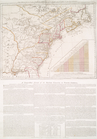
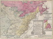
The Theatre of war in North A…
collection:
Charts
and maps
m
History of the United States:…
topic:
Charts
, diagrams, etc
m
A
chart
of the harbour of Rhode Island
note:
In: Des Barres, Joseph F.W.
Charts
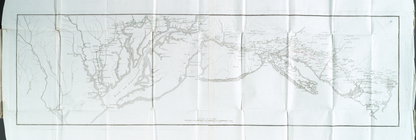
The country twenty five miles…
collection:
Charts
and maps
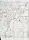
Carte du theatre de la guerre…
collection:
Charts
and maps
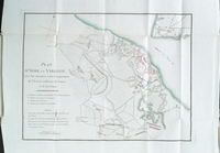
Plan d'York en Virginie, avec…
collection:
… of English maps,
charts
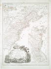
Carte d'une partie de l'Améri…
collection:
… of English maps,
charts
Lake St. Clair
note:
…"Photolithographed from original
charts
Detroit 1820
note:
…"Photolithographed from original
charts
…
Charte
, auf welcher alle
note:
…"Mit einer illuminirten accuraten
Charte
North America from the French…
collection:
… of English maps,
charts
Côte de York-town à Boston : …
collection:
… of English maps,
charts
m
Map of the St. Clair River : …
note:
…"Photolithographed from original
charts
No. 3, map of Isle Royale in …
note:
…"Photolithographed from original
charts
m
Map of the river Sainte Mary …
abstract:
…
charts
by permission
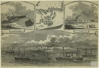
Ship Island and the approache…
note:
… channel."
Chart
showing
End of results
|
Top