Click to visit the main New York Public Library Homepage
The New York Public Library
Digital Collections
About Digital Collections
Browse
Search only public domain materials
Items
Collections
Divisions
Home
Search
Browse
About
Search only public domain materials
Items
Collections
Divisions
Digital Collections
Using Images
Using Data
Search
Filtered keyword search
Show filters
Hide filters
Show Only Public Domain
topic
Geological surveys
71
Canyons
52
Rock formations
10
Railroads
6
Indian reservations
3
More
Less
name
Bell, William, 1830-1910
71
Geographical Surveys West of the 100th Meridian (U.S.)
45
Wheeler, George M. (George Montague), 1842-1905
45
United States. War Department
31
Gedney, J. F
3
More
Less
collection
Photographs of geological formations and Western landscapes
30
Report upon United States Geographical surveys west of the one hundredth meridian, in charge of First Lieut. Geo. M. Wheeler...U.S. Army. Atlas
26
Photographs showing landscapes, geological and other features of portions of the western territory of the United States, obtained in connection with geographical and geological explorations and surveys west of the 100th meridian, seasons of 1871, 1872 and 1873
15
Maps of North America
9
place
x
West (U.S.)
United States
75
Arizona
48
Kanab Creek (Utah and Ariz.)
29
Grand Canyon (Ariz.)
28
More
Less
genre
Photographs
71
Maps
9
Geological cross-sections
1
publisher
War Dept
30
Govt. Print. Off
26
s.n
15
W.J. Keeler
2
publisher not identified
2
More
Less
division
Wallach Division: Photography Collection
71
Map Division
9
type
still image
71
cartographic
9
Date Range
to
80 results found for:
x
Washington, William
Filtering on:
x
Place
: West (U.S.)
Sort by:
Relevance
Title
Date created
Date digitized
Sequence
m
National map of the territory…
note:
… at
Washington
, D.C. by W.J
m
Colton's map of the states an…
note:
Prime meridians: Greenwich and
Washington
.
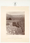
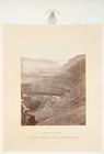
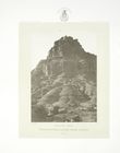
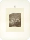
Plateau, north of the Grand C…
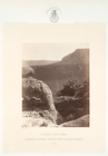
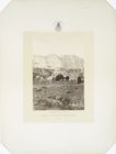
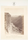
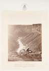
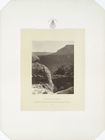
Looking south, across the Gra…
Looking south, across the Gra…
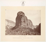
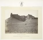
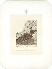
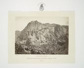
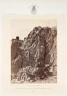
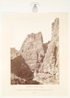
Massive sandstone, Taylor's C…
Massive sandstone, Taylor's C…
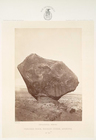
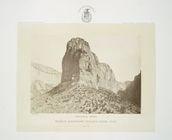
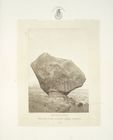
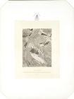
Perched rock, Rocker Creek, A…
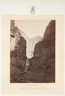
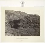
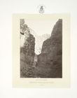
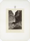
A cañon within a cañon, Kanab…
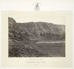
Limestone walls, Kanab Wash. …
Headlands, north of the Color…
Headlands, north of the Color…
Headlands, Paria Cañon. Colo…
Headlands, Paria Cañon. Colo…
m
National map of the territory…
note:
… at
Washington
, D.C. by W.J
m
National map of the territory…
note:
Prime meridians:
Washington
and Greenwich.
Massive sandstone, Taylor's C…
Perched rock, Rocker Creek, A…
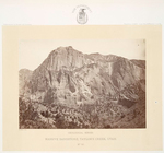
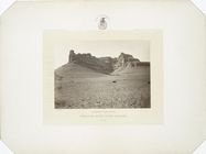
Chocolate Mesa, Rocker Creek,…
Limestone Walls, Kanab Wash. …
Hieroglyphic Pass, opposite P…
Hieroglyphic Pass, opposite P…
Alum Cove, Parowan Cañon.
Hieroglyphic Pass, opposite P…
Headlands, north of the Color…
Headlands, north of the Color…
Plateau, north of the Grand C…
Massive sandstone, Taylor's C…
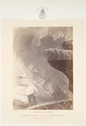
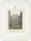
Grand Cañon, near the Paria, …
Grand Cañon, near the Paria, …
Looking south into the Grand …
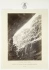
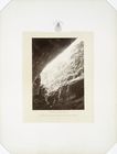
Rain sculpture, Salt Creek Ca…
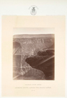
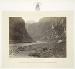
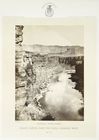
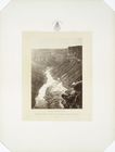
Grand Cañon of the Colorado, …
Grand Cañon of the Colorado, …
Grand Cañon of the Colorado, …
Colorado, mouth of Kanab Wash…
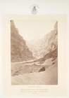
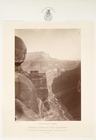
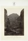
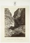
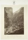
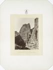
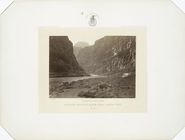
Cañon of Kanab Wash, looking …
Cañon of Kanab Wash, looking …
Cañon of Kanab Wash, looking …
Cañon of Kanab Wash, looking …
Cañon of Kanab Wash, looking …
Grand Cañon, near the Paria, …
Cañon of Kanab Wash, looking …
Cañon of Kanab Wash, looking …
Cañon of Kanab Wash, looking …
Cañon of Kanab Wash, looking …
Colorado, mouth of Kanab Wash…
Grand Cañon, near the Paria, …
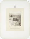
Looking south, across the Gra…
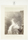
Walls of the Grand Cañon, loo…