Click to visit the main New York Public Library Homepage
The New York Public Library
Digital Collections
About Digital Collections
Browse
Search only public domain materials
Items
Collections
Divisions
Home
Search
Browse
About
Search only public domain materials
Items
Collections
Divisions
Digital Collections
Using Images
Using Data
Search
Filtered search
Show filters
Hide filters
Show Only Public Domain
topic
Real property
37
Landowners
28
History
16
Administrative and political divisions
12
Railroads
11
More
Less
name
Brodhead, John Romeyn, 1814-1873
4
Hayward, George, approximately 1800-
3
Miller & Co
3
W.E. & A.A. Baker
3
Walling, Henry Francis, 1825-1888
3
More
Less
collection
Maps of New York City and State
72
Maps of North America
30
Robert N. Dennis collection of stereoscopic views
1
place
New York (State)
63
Connecticut
10
New York
8
Yonkers (N.Y.)
5
Adirondack Mountains (N.Y.)
4
More
Less
genre
Maps
102
Cadastral maps
31
Facsimiles
9
Manuscript maps
7
Early maps
5
More
Less
publisher
publisher not identified
57
Harper & Brothers
3
W.E. & A.A. Baker
3
Miler's Lith
2
Photo-lith. by Robert A. Welcke
2
More
Less
division
Map Division
102
Wallach Division: Photography Collection
1
type
cartographic
102
still image
2
Date Range
to
103 results found
Filtering on:
x
Place term
: New York, N.Y.?
Sort by:
Title
Date created
Date digitized
Sequence
Property in the towns of Cast…
Flushing
Eagle Harbor Copper Co, and E…
The Cornplanters Reserve, Ven…
Route of the Peninsula Railro…
m
Map of Albany County, New Yor…
Chart of the N.W. coast of Am…
Sketch showing route of gener…
A topographical map of easter…
Plat of the private claims at…
Whitesboro, Brown Co., W.T.
Map of parts of Escambia and …
Plan of the town Ebenezer and…
City of Chicago
Map of the Sea-Coast of South…
m
Lands in the State of North C…
Brattleboro and vicinity : co…
The Delaware River from the F…
A map of part of the land in …
Map of Long Island: showing t…
m
Lands in the State of North C…
Map showing the only all rail…
Plan of West Point
Map of the upper part of the …
New York to New Rochelle: fro…
The Meadows: to be offered at…
Map of property at Van Buren …
Map of the village of Waterto…
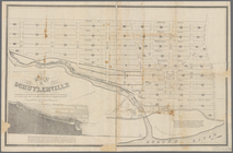
Map of Schuylerville: exhibit…
Atherton, St. Lawrence County…
m
Stony Point and Verplanck's P…
Ticonderoga and its dependenc…
Map of Richland, Oswego Co. N…
m
Panoramic views
Plan of Springfield: [Massach…
Plan of the battle of Monmouth
Map of Maine & the disputed …
Map of Orange County: [New Yo…
Map of Dobbs Ferry and Hastin…
A map of the country between …
Historical sketch map of King…
Map of part of Orange County,…
Map of Knollwood, Elmsford, W…
Map of New York, New England,…
Nieu Nederlandt
Map & profile of the Lake Ont…
Parts of 1st ward of the city…
A map of the countrey of the …
Map of New Netherland which w…
m
Niev Nederlandt