Click to visit the main New York Public Library Homepage
The New York Public Library
Digital Collections
About Digital Collections
Browse
Search only public domain materials
Items
Collections
Divisions
Home
Search
Browse
About
Search only public domain materials
Items
Collections
Divisions
Digital Collections
Using Images
Using Data
Search
Filtered search
Show filters
Hide filters
Show Only Public Domain
topic
x
Nautical charts
Harbors
6
Rivers
2
Bays
1
Coasts
1
More
Less
name
Bache, A. D. (Alexander Dallas), 1806-1867
9
United States Coast Survey
9
Harrison, A. M. (Alexander Medina), 1829-1881
3
Hilgard, J. E. (Julius Erasmus), 1825-1891
3
Mathiot, G
3
More
Less
collection
Maps of North America
10
Maps of New York City and State
3
place
Florida
6
New York (State)
3
Boston
2
Boston Harbor (Mass.)
2
Key West (Fla.)
2
More
Less
genre
Maps
13
Nautical charts
13
Bathymetric maps
7
publisher
U.S. Coast Survey
7
Coast Survey Office
2
Government Printing Office
2
U.S. Army?
1
United States Army Corps of Engineers?
1
division
Map Division
13
type
cartographic
13
Date Range
to
13 results found
Filtering on:
x
Place term
: Washington, D.C.?
x
Topic
: Nautical charts
Sort by:
Title
Date created
Date digitized
Sequence
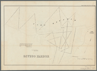
Oswego Harbor, 33d Congress, …
Sketch of West Pier, Oswego H…
Boston Harbor, Massachusetts
Boston Harbor, Massachusetts:…
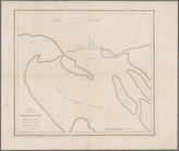
Map of the mouth of Great Sod…
Preliminary chart of Key-West…
Preliminary chart of St. John…
Preliminary chart of St. John…
Preliminary survey of Turtle …
Preliminary chart of Waccasas…
Survey of the mouth of Galien…
Reconnaissance of Pass Fourch…
Key West Harbor and its appro…
End of results
|
Top