Click to visit the main New York Public Library Homepage
The New York Public Library
Digital Collections
About Digital Collections
Browse
Search only public domain materials
Items
Collections
Divisions
Home
Search
Browse
About
Search only public domain materials
Items
Collections
Divisions
Digital Collections
Using Images
Using Data
Search
Filtered keyword search
Show filters
Hide filters
Show Only Public Domain
topic
Fire insurance
5009
Real property
5009
Cities & towns
5007
Cities and towns
2
name
Sanborn Map Company
5009
collection
Atlases of New York City
5007
Atlases of the United States
2
place
New York (State)
5009
Tarrytown (N.Y.)
2
genre
Maps
4998
Indexes
7
Keys (Legends)
4
Title pages
4
Atlases
2
More
Less
publisher
x
Sanborn Map Company
division
Map Division
5009
type
cartographic
4998
text
11
Date Range
to
5,009 results found for:
x
The sea-atlas
Filtering on:
x
Publisher
: Sanborn Map Company
x
Rights
: Public Domain
Sort by:
Relevance
Title
Date created
Date digitized
Sequence
…,
Sea
Breeze Ave.]
… by
Sea
Girt Ave
…., Coney Island Ave.,
Sea
…,
Sea
Breeze Ave., Coney
… bounded by E.90th St.,
Sea
… by
Sea
View Ave., Crest
… by Mott Ave.,
Sea
View Ave
…; Mott Creek,
Sea
Girt
… by Beach 26th St.,
Sea
Girt
… bounded by
Sea
View Ave
….,
Sea
Ave., Lower New
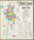
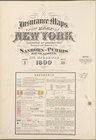
Insurance maps of Tarrytown, …
collection:
Tarrytown-Tonawanda,
Atlas
264
Insurance maps of Tarrytown, …
collection:
Tarrytown-Tonawanda,
Atlas
264
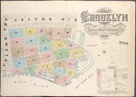
Insurance maps of the borough…
collection:
Atlas
70. Vol. 3, 1904.
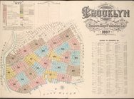
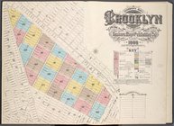
Insurance Maps of the Brookly…
collection:
Atlas
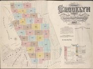
74. Vol. 4, 1887.
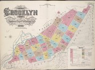
Insurance Maps of the Brookly…
collection:
Atlas
80. Vol. 6, 1888.
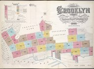
Insurance Maps of the Brookly…
collection:
Atlas
86. Vol. 8, 1887.
Insurance Maps of the Brookly…
collection:
Atlas
83. Vol. 7, 1888.
Insurance Maps of the Brookly…
collection:
Atlas
92. Vol. 10, 1905.
Insurance Maps of the Brookly…
collection:
Atlas
101. Vol. 15, 1907.
Insurance Maps of the Brookly…
collection:
Atlas
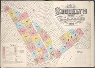
78. Vol. 5, 1908.
Insurance maps of the borough…
collection:
Atlas
63. Vol. 1, 1886.
Insurance maps of the borough…
collection:
Atlas
71. Vol. 3, 1918.
Insurance Maps of the Brookly…
collection:
Atlas
75. Vol. 4, 1905.
Insurance Maps of the Brookly…
collection:
Atlas
77. Vol. 5, 1888.
Insurance Maps of the Brookly…
collection:
Atlas
89. Vol. 9, 1888.
Insurance Maps of the Brookly…
collection:
Atlas
95. Vol. 11, 1905.
Insurance Maps of the Brookly…
collection:
Atlas
90. Vol. 9, 1907.
Insurance Maps of the Brookly…
collection:
Atlas
97. Vol. 12, 1906.
Insurance Maps of the Borough…
collection:
Atlas
134. Vol. 2, 1915.
Insurance Maps of the Borough…
collection:
Atlas
137. Vol. 3, 1902.
Insurance Maps of the Borough…
collection:
Atlas
137a. Vol. 3, 1914.
Insurance Maps of the Borough…
collection:
Atlas
145a. Vol. 8, 1912.
Insurance Maps of the Borough…
collection:
Atlas
142a, Vol. 6, 1911.
Insurance Maps of the Borough…
collection:
Atlas
148, Vol. 10, 1914.
Insurance Maps of the Borough…
collection:
Atlas
141. Vol. 5, 1903.
Insurance Maps of the Borough…
collection:
Atlas
160, 1898.
Insurance maps of the City of…
collection:
Atlas
121. Vol. 7, pt. 1, 1912.
Insurance maps of the City of…
collection:
Atlas
121. Vol. 7, pt. 2, 1912.
Insurance maps of the City of…
collection:
Atlas
114. Vol. 4, 1910.
Insurance maps of the City of…
collection:
Atlas
49. Vol. 10, pt. 1, 1909.
Insurance maps of the City of…
collection:
Atlas
49. Vol. 10, pt. 2, 1909.
Insurance maps of the City of…
collection:
Atlas
109. Vol. 1, 1905.
Insurance maps of the City of…
collection:
Atlas
129. Vol. 12, 1913.
Insurance maps of the City of…
collection:
Atlas
116.01. Vol. 5, 1898.
Insurance maps of the City of…
collection:
Atlas
55. Vol. 18, 1918.
Insurance maps of the City of…
collection:
Atlas
53.1. Vol. 15, 1915.
Insurance maps of the City of…
collection:
Atlas
52.1. Vol. 14, 1914.
Insurance Maps of the Borough…
collection:
Atlas
139. Vol. 4, 1901.
Queens V. 4, Plate No. 99 [Ma…
collection:
Atlas
139. Vol. 4, 1901.
1
2
3
4
5
6
7
8
9
10
…
20
21
Previous
Next
1
2
3
4
5
6
7
8
9
10
…
20
21
Previous
Next