Click to visit the main New York Public Library Homepage
The New York Public Library
Digital Collections
About Digital Collections
Browse
Search only public domain materials
Items
Collections
Divisions
Home
Search
Browse
About
Search only public domain materials
Items
Collections
Divisions
Digital Collections
Using Images
Using Data
Search
Filtered keyword search
Show filters
Hide filters
Show Only Public Domain
topic
Real property
36
Landowners
24
Railroads
18
Administrative and political divisions
14
History
13
More
Less
name
Gavit, John E., 1817-1874
6
Brodhead, John Romeyn, 1814-1873
4
Green-Wood Cemetery (New York, N.Y.)
4
Hayward, George, approximately 1800-
4
Pease, Richard H., 1813-1869
4
More
Less
collection
x
Maps of New York City and State
place
New York (State)
96
New York
30
Brooklyn (New York, N.Y.)
24
New York (N.Y.)
16
Manhattan (New York, N.Y.)
9
More
Less
genre
Maps
118
Cadastral maps
33
Facsimiles
8
Early maps
6
Manuscript maps
5
More
Less
publisher
x
publisher not identified
Engraved & Printed by J. E.Gavit
1
Heffron & Phelps litho
1
Lith of R.H. Pease
1
Lith. by Berggoetz & Co
1
More
Less
division
Map Division
118
type
cartographic
118
text
1
Date Range
to
Looking for this collection?
Maps of New York City and State
2,059 items
118 results found for:
x
map
Filtering on:
x
Publisher
: publisher not identified
x
Rights
: Public Domain
x
Collection
: Maps of New York City and State
For more collection details, visit the
Maps of New York City and State collection page
.
Sort by:
Relevance
Title
Date created
Date digitized
Sequence
m
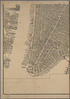
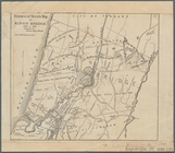
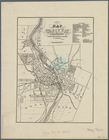
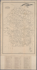
Bird's eye view of New York C…
collection:
Maps
of New York City and State
m
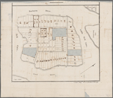
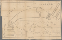
Brooklyn City Hall
abstract:
Cadastral
map
showing area surrounding
Map
of Great Barn Island, New York, showing
note:
Title, for
map
of place now known as Wards
Map
of part of Town of Fishkill
note:
Mapping
the Nation (NEH grant, 2015-2018)…
Map
of the City of New York
abstract:
… flat with
map
.
Map
of New York, New England
note:
Photocopy of a manuscript
map
, hand colored.
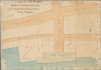
Map
of property of New Brighton, Staten
abstract:
Cadastral
map
bound
Map
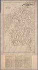
of Orange County
note:
Geological
map
showing location
m
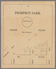
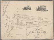
Prospect Park, plaza lots
note:
… catalog of the
Map
m
Map
showing steam, cable, and horse roads
m
Map
of Clasons Point
note:
Mapping
the Nation (NEH grant, 2015-2018)…
Map
of the tertiary of Essex Co. …
note:
… catalog of the
Map
m
Data for population from cens…
note:
Scale 1:36,000. 300 foot scale
map
(W 74°01
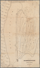
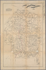
Map
of the village of Watertown in Jefferson
note:
Map
shows townships, block and lot numbers
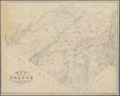
Map
of pr[op]erty of Union Avenue, Saratoga
note:
Includes inset or ancilary
map
of: "A portion
Map
of the homestead of the late
note:
… catalog of the
Map
Map
& profile of the Lake Ontario & Hudson
note:
… insets: "
Map
of French
Green-Wood Cemetery
abstract:
Cemetery
map
showing plot names
Map
of Highbridgeville in the town
note:
Mapping
the Nation (NEH grant, 2015-2018)…
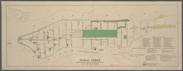
Public parks boroughs of Manh…
note:
Inset
map
of Staten Island and vicinity.
Plan of the former township o…
note:
NYPL
Map
Div. copy has accession no
m
The New York wilderness: Hami…
note:
Map
shows lot numbers, lakes, railroads
Property nos. 43, 45, and 47 …
collection:
Maps
of New York City and State
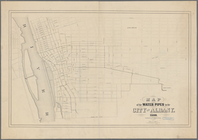
Map
of the water pipes in the city
note:
Mapping
the Nation (NEH grant, 2015-2018)…
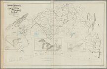
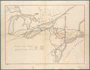
Map
showing the only all rail route
note:
Mapping
the Nation (NEH grant, 2015-2018)…
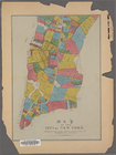
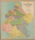
Map
of the county of Kings, showing
Map
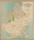
of the county of Kings, showing the ward
Map
of the county of Kings, showing
Map
of property owned by Francis Pidgeon
m
The Green-Wood cemetery 1897
abstract:
Cemetery
map
showing plot names
Historical sketch
map
of Kings Bridge
note:
Mapping
the Nation (NEH grant, 2015-2018)…
Map
of the upper part of the village
note:
Mapping
the Nation (NEH grant, 2015-2018)…
m
Map
of Brooklyn Ferry, in 1766-7
note:
… catalog of the
Map
Map
of property belonging to est. of S.J
note:
… catalog of the
Map
m
Hudson River vehicular tunnel…
collection:
Maps
of New York City and State
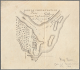
Fort la Présentation anno 174…
note:
Mapping
the Nation (NEH grant, 2015-2018)…
Green-Wood Cemetery, 1887
note:
Cemetery
map
showing detail
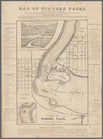
Map
of Niagara Falls, and guide table
note:
Mapping
the Nation (NEH grant, 2015-2018)…
m
Map
showing the injury to the property
note:
… catalog of the
Map
Survey of the Battery
note:
Mapping
the Nation (NEH grant, 2015-2018)…
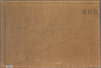
m
Bureau of roads
collection:
Maps
of New York City and State
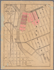
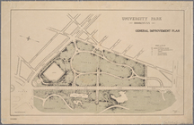
University Park, Brooklyn, N.…
note:
NYPL
Map
Div. copy has accession no
Nyack
note:
Mapping
the Nation (NEH grant, 2015-2018)…
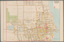
Map
of the city of Rochester
note:
Mapping
the Nation (NEH grant, 2015-2018)…
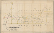
Map
of Tonawanda Swamp in the counties
note:
Mapping
the Nation (NEH grant, 2015-2018)…
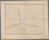
Map
of the mouth of big Sandy Creek
note:
Mapping
the Nation (NEH grant, 2015-2018)…
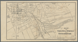
Map
of Saratoga Springs and Excelsior Park
note:
Mapping
the Nation (NEH grant, 2015-2018)…
Green-Wood Cemetery, 1886
note:
… catalog of the
Map
Guide
map
to the Brooklyn and Queens parks
Map
showing route of the New York, Ontario
note:
Map
also shows lakes, rivers.