Click to visit the main New York Public Library Homepage
The New York Public Library
Digital Collections
About Digital Collections
Browse
Search only public domain materials
Items
Collections
Divisions
Home
Search
Browse
About
Search only public domain materials
Items
Collections
Divisions
Digital Collections
Using Images
Using Data
Search
Filtered keyword search
Show filters
Hide filters
Show Only Public Domain
topic
Real property
115
Landowners
74
Railroads
58
Administrative and political divisions
51
History
48
More
Less
name
Heliotype Printing Co
7
Gavit, John E., 1817-1874
6
Hayward, George, approximately 1800-
6
Pease, Richard H., 1813-1869
6
Ackerman Lithr
5
More
Less
collection
Maps of North America
332
Maps of New York City and State
118
Maps of Europe
1
Maps of North and South America
1
place
New York (State)
98
Massachusetts
64
New York
30
United States
28
Boston
25
More
Less
genre
Maps
452
Cadastral maps
98
Geological maps
16
Facsimiles
10
Early maps
9
More
Less
publisher
x
publisher not identified
Lith of R.H. Pease
2
AM. Photo-Lith. Co. N.Y. (Osborne's Pro.)
1
D. McLellan, lithographer
1
Engraved & Printed by J. E.Gavit
1
More
Less
division
Map Division
452
type
cartographic
452
text
8
still image
7
Date Range
to
Looking for one of these collections?
Maps of North America
3,345 items
Maps of New York City and State
2,059 items
452 results found for:
x
map
Filtering on:
x
Publisher
: publisher not identified
x
Rights
: Public Domain
Sort by:
Relevance
Title
Date created
Date digitized
Sequence
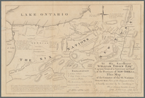
Yosemite Valley : [Calif.]
note:
… catalog of the
Map
Yorktown, armament of batteri…
note:
Mapping
the Nation (NEH grant, 2015-2018)…
Yorktown, armament of batteri…
note:
Mapping
the Nation (NEH grant, 2015-2018)…
Whitesboro, Brown Co., W.T.
note:
… catalog of the
Map
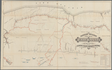
Western Division of the Erie Canal :
map
note:
Mapping
the Nation (NEH grant, 2015-2018)…
Webster Park, Franklin, N.H.
note:
Mapping
the Nation (NEH grant, 2015-2018)…
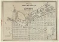
Village of Port Ontario, in t…
note:
Cadastral
map
showing blocks, lot
m
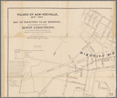
Village of New-Rochelle, New-…
note:
Mapping
the Nation (NEH grant, 2015-2018)…
m
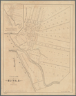
Village of Buffalo
note:
Inset:
Map
of the village of New Amsterdam
m
Vicinity of the Rapidan and R…
note:
Mapping
the Nation (NEH grant, 2015-2018)…
Vernon Co., Mo. : plat of tow…
note:
NYPL
Map
Div. copy includes manuscript
m
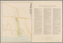
Upper Nyack
note:
Mapping
the Nation (NEH grant, 2015-2018)…
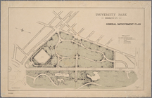
University Park, Brooklyn, N.…
note:
NYPL
Map
Div. copy has accession no
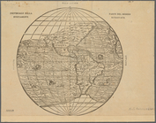
Universale della parte del mo…
note:
Mapping
the Nation (NEH grant, 2015-2018)…
United States: comparative ti…
note:
Mapping
the Nation (NEH grant, 2015-2018)…
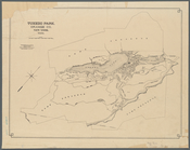
Tuxedo Park, Orange Co., New …
note:
Map
shows blocks and lots numbers, game
Town of Bethel, Fairfield Co.…
note:
Map
no. 45 from Atlas of New York
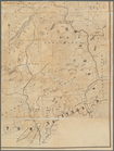
Topographical sketch of the g…
note:
… catalog of the
Map
m
Topographical
map
of the Wyoming coal field …
note:
NYPL
Map
Div. copy
To the citizens of Philadelph…
note:
… catalog of the
Map
m
To his excellency William Try…
note:
…"Copied from the original manuscript
map
To His Excellency Genl. Washi…
note:
Mapping
the Nation (NEH grant, 2015-2018)…
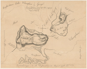
Ticonderoga and its dependenc…
note:
Mapping
the Nation (NEH grant, 2015-2018)…
m
The Wyoming Coal Field and it…
note:
NYPL
Map
Div. copy
The principal parts of Norwal…
note:
Cadastral
map
showing landowners
m
The New York wilderness: Hami…
note:
Map
shows lot numbers, lakes, railroads
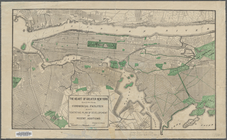
The heart of greater New York…
note:
Planning
map
. Covers all of modern
m
The Green-Wood cemetery 1897
abstract:
Cemetery
map
showing plot names
The Delaware River from the F…
note:
Mapping
the Nation (NEH grant, 2015-2018)…
The city of Boca Grande, Lee …
note:
Mapping
the Nation (NEH grant, 2015-2018)…
The boundary lines between th…
note:
Mapping
the Nation (NEH grant, 2015-2018)…
Territory covered by the prin…
note:
Mapping
the Nation (NEH grant, 2015-2018)…
Taunton River: drainage area …
note:
Mapping
the Nation (NEH grant, 2015-2018)…
Survey of the mouth of Clinto…
note:
… of the printed
maps
of Michigan
Survey of the Battery
note:
Mapping
the Nation (NEH grant, 2015-2018)…
m
Survey of the Allegheny River…
note:
… in creation of the
map
Survey for a ship canal aroun…
note:
Mapping
the Nation (NEH grant, 2015-2018)…
Superior, Douglass County, Wi…
note:
Map
copied from the record of Douglass County
m
Superior, Douglas County, Wis…
note:
… that this
map
of Douglas County
Springfield, Ill. 1892
note:
Mapping
the Nation (NEH grant, 2015-2018)…
Springfield, Greene County, M…
note:
NYPL
Map
Div. copy stamped: "Incoorporated
Southern New England and New …
note:
Mapping
the Nation (NEH grant, 2015-2018)…
Southern New England
note:
Mapping
the Nation (NEH grant, 2015-2018)…
South-Carolina and parts adja…
note:
… Ramsay 1785.
Map
also
South Nyack
note:
Mapping
the Nation (NEH grant, 2015-2018)…
Sketch showing route of gener…
note:
Mapping
the Nation (NEH grant, 2015-2018)…
Sketch of the public surveys …
note:
… catalog of the
Map
Sketch of the claims to land …
note:
… of the printed
maps
of Michigan
Sketch
map
of the City of Newyork
Sketch
map
of Pascataway, Maine & New
note:
Mapping
the Nation (NEH grant, 2015-2018)…
1
2
Previous
Next
1
2
Previous
Next