Click to visit the main New York Public Library Homepage
The New York Public Library
Digital Collections
About Digital Collections
Browse
Search only public domain materials
Items
Collections
Divisions
Home
Search
Browse
About
Search only public domain materials
Items
Collections
Divisions
Digital Collections
Using Images
Using Data
Search
Filtered keyword search
Show filters
Hide filters
Show Only Public Domain
topic
World maps
2
Colonies
1
name
Bowles, Thomas, 1694-1773
8
Moll, Herman, -1732
8
Bowles, John, 1701-1779
1
King, John
1
collection
Lawrence H. Slaughter Collection of English maps, charts, globes, books and atlases
8
place
France
2
America
1
Asia
1
Europe
1
Italy
1
More
Less
genre
Maps
8
publisher
x
... Sold ... by Tho. Bowles, print and map-seller in St. Paul's-Churchyard
division
Map Division
8
type
cartographic
8
Date Range
to
8 results found for:
x
France map
Filtering on:
x
Publisher
: ... Sold ... by Tho. Bowles, print and map-seller in St. Paul's-Churchyard
Sort by:
Relevance
Title
Date created
Date digitized
Sequence
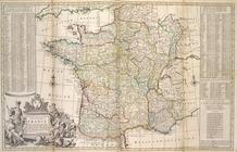
A new and exact
map
of
France
divided into all
note:
… to Early
Maps
of the Middle
m
A new
map
note:
… to Early
Maps
of the Middle
Map
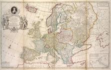
of Europe according to the newest
note:
… to Early
Maps
of the Middle
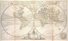
A new and correct
map
of the world, laid
note:
… to Early
Maps
of the Middle
A new and correct
map
of the whole world
note:
… to Early
Maps
of the Middle
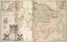
A new & exact
map
of the electorat of Brunswick
note:
… to Early
Maps
of the Middle
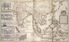
A
map
of the East
note:
… to Early
Maps
of the Middle
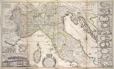
A new
map
of the upper part of Italy
note:
… to Early
Maps
of the Middle