Click to visit the main New York Public Library Homepage
The New York Public Library
Digital Collections
About Digital Collections
Browse
Search only public domain materials
Items
Collections
Divisions
Home
Search
Browse
About
Search only public domain materials
Items
Collections
Divisions
Digital Collections
Using Images
Using Data
Search
Filtered keyword search
Show filters
Hide filters
Show Only Public Domain
topic
Real property
42
Schools
1
name
Beers, D. G. (Daniel G.)
42
collection
Atlases of the United States
42
place
Jefferson County (N.Y.)
42
New York (State)
42
Adams (N.Y.)
1
genre
Atlases
42
Maps
42
publisher
x
C.K. Stone
division
Map Division
42
type
cartographic
42
Date Range
to
42 results found for:
x
JEFFERSON
Filtering on:
x
Publisher
: C.K. Stone
Sort by:
Relevance
Title
Date created
Date digitized
Sequence
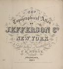
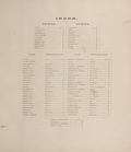
New topographical atlas of
Jefferson
Co
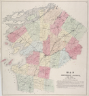
Map of
Jefferson
County, New York.
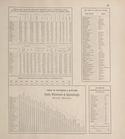
… of
Jefferson
County.; Post Offices in
Jefferson
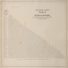
Jefferson
County. Table of Distances
Index.
collection:
New topographical atlas of
Jefferson
Co
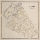
Clayton [Township]
collection:
New topographical atlas of
Jefferson
Co
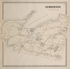
Henderson [Township]
collection:
New topographical atlas of
Jefferson
Co
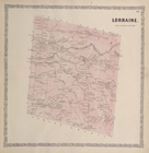
Lorraine. [Township]
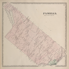
collection:
New topographical atlas of
Jefferson
Co
Pamela [Township]
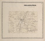
collection:
New topographical atlas of
Jefferson
Co
Philadelphia. [Township]
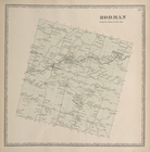
collection:
New topographical atlas of
Jefferson
Co
Rodman [Township]
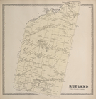
collection:
New topographical atlas of
Jefferson
Co
Rutland [Township]
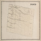
collection:
New topographical atlas of
Jefferson
Co
Worth. [Township]
collection:
New topographical atlas of
Jefferson
Co
Alexandria [Township]
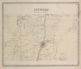
collection:
New topographical atlas of
Jefferson
Co
Antwerp. [Township]
collection:
New topographical atlas of
Jefferson
Co
Pillar Point P.O. [Village]; …
collection:
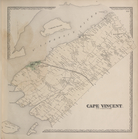
New topographical atlas of
Jefferson
Co
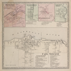
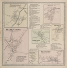
Cape Vincent [Township]
collection:
New topographical atlas of
Jefferson
Co
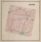
Adams. [Township]
collection:
New topographical atlas of
Jefferson
Co
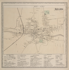
Adams [Village]; Adams Busine…
collection:
New topographical atlas of
Jefferson
Co
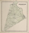
Champion. [Township]
collection:
New topographical atlas of
Jefferson
Co
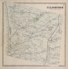
Ellisburgh [Township]
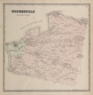
collection:
New topographical atlas of
Jefferson
Co
Houndsfield [Township]
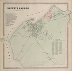
collection:
New topographical atlas of
Jefferson
Co
Sackets Harbor [Village]; Sac…
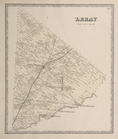
collection:
New topographical atlas of
Jefferson
Co
Leray [Township]
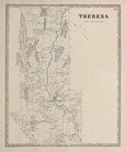
collection:
New topographical atlas of
Jefferson
Co
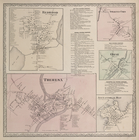
Theresa [Township]
collection:
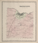
New topographical atlas of
Jefferson
Co
Watertown. [Township]
collection:
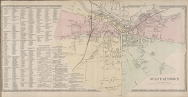
New topographical atlas of
Jefferson
Co
Watertown [Village]; Watertow…
collection:
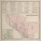
New topographical atlas of
Jefferson
Co
Watertown Business Directory.…
collection:
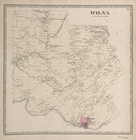
New topographical atlas of
Jefferson
Co
Wilna [Township]
collection:
New topographical atlas of
Jefferson
Co
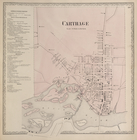
Carthage Business Directory. …
collection:
New topographical atlas of
Jefferson
Co
Three Mile Bay [Village]; Thr…
collection:
New topographical atlas of
Jefferson
Co
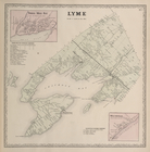
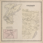
Orleans [Village]; Orleans [T…
collection:
New topographical atlas of
Jefferson
Co
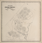
Plan of Brookside Cemetery, W…
collection:
New topographical atlas of
Jefferson
Co
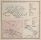
Dexter. [Village]; Dexter Bus…
collection:
New topographical atlas of
Jefferson
Co
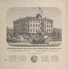
Hungerford Collegiate Institu…
collection:
New topographical atlas of
Jefferson
Co
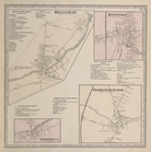
Belleville Business Directory…
collection:
New topographical atlas of
Jefferson
Co
Redwood [Village]; Redwood Bu…
collection:
New topographical atlas of
Jefferson
Co
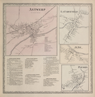
Antwerp [Village]; La Fargevi…
collection:
New topographical atlas of
Jefferson
Co
Depauville [Village]; Leraysv…
collection:
New topographical atlas of
Jefferson
Co
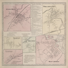
Evans Mills [Village]; Philad…
collection:
New topographical atlas of
Jefferson
Co
Ellisburgh P.O. ( Ellisvillag…
collection:
New topographical atlas of
Jefferson
Co
Sterlingville [Village]; Blac…
collection:
New topographical atlas of
Jefferson
Co
End of results
|
Top