Click to visit the main New York Public Library Homepage
The New York Public Library
Digital Collections
About Digital Collections
Browse
Search only public domain materials
Items
Collections
Divisions
Home
Search
Browse
About
Search only public domain materials
Items
Collections
Divisions
Digital Collections
Using Images
Using Data
Search
Filtered keyword search
Show filters
Hide filters
Show Only Public Domain
topic
Real property
6
name
Perris & Browne
6
Perris, William
6
collection
Atlases of New York City
13
place
Manhattan (New York, N.Y.)
6
New York
6
New York (State)
6
genre
Maps
13
Index maps
1
Title pages
1
publisher
x
Perris & Browne
division
Map Division
7
type
cartographic
13
text
1
Date Range
to
13 results found for:
x
Perris, William
Filtering on:
x
Publisher
: Perris & Browne
Sort by:
Relevance
Title
Date created
Date digitized
Sequence
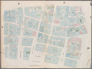
…, Old Slip,
William
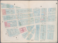
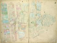
Map bounded by Murray Street,…
Map bounded by Dey Street, Br…
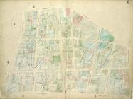
Map bounded by Frankfort Stre…
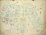
Map bounded by City Hall Squa…
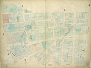
Map bounded by Battery Place,…
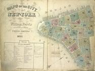
Maps of the City of New York
note:
by
William
Perris
Civil Engineer
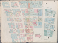
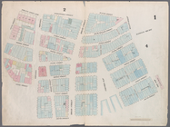
Plate 9: Map bounded by Pearl…
collection:
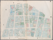
…, North
William
,
William
…,
William
Street, Old Slip
…,
William
Street, Beaver
…, Dutch Street,
William
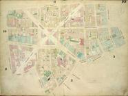
Plate 4: Map bounded by Maide…
collection:
…'s Lane,
William
Street
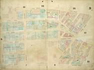
Plate 10: Map bounded by Jame…
collection:
…, Gold Street,
William
End of results
|
Top