Click to visit the main New York Public Library Homepage
The New York Public Library
Digital Collections
About Digital Collections
Browse
Search only public domain materials
Items
Collections
Divisions
Home
Search
Browse
About
Search only public domain materials
Items
Collections
Divisions
Digital Collections
Using Images
Using Data
Search
Filtered keyword search
Show filters
Hide filters
Show Only Public Domain
name
Zatta, Antonio, fl. 1757-1797
12
collection
Lawrence H. Slaughter Collection of English maps, charts, globes, books and atlases
12
place
North America
12
Middle Atlantic States
2
New Jersey
2
Delaware
1
Great Lakes Region
1
More
Less
genre
Maps
12
publisher
x
Presso Antonio Zatta
division
Map Division
12
type
cartographic
12
Date Range
to
12 results found for:
x
Cartouches
Filtering on:
x
Publisher
: Presso Antonio Zatta
Sort by:
Relevance
Title
Date created
Date digitized
Sequence
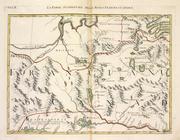
La parte Occidentale della Nu…
note:
…
cartouche
with a map
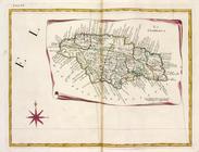
La Giammaica.
note:
…
cartouche
with a map
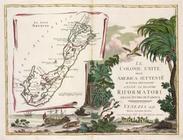
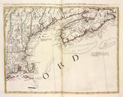
Le colonie unite dell' Americ…
note:
…
cartouche
with a map
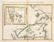
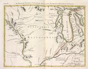
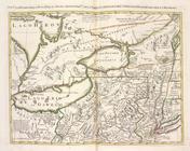
Il paese de' Selvaggi Outauac…
note:
…
cartouche
with a map
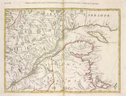
Parte Orientale del Canada, N…
note:
…
cartouche
with a map
Il paese de' Selvaggi Outagam…
note:
…
cartouche
with a map
L'Acadia, le Provincie di Sag…
note:
…
cartouche
with a map
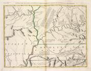
Il paese de'Cherachesi, con l…
note:
…
cartouche
with a map
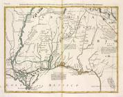
Luigiana Inglese, colla parte…
note:
…
cartouche
with a map
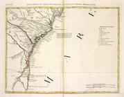
Parte Orientale della Florida…
note:
…
cartouche
with a map
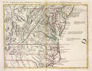
Il Maryland, il Jersey Meridi…
note:
…
cartouche
with a map
La Pensilvania, la Nuova York…
note:
…
cartouche
with a map
End of results
|
Top