Click to visit the main New York Public Library Homepage
The New York Public Library
Digital Collections
About Digital Collections
Browse
Search only public domain materials
Items
Collections
Divisions
Home
Search
Browse
About
Search only public domain materials
Items
Collections
Divisions
Digital Collections
Using Images
Using Data
Search
Filtered keyword search
Show filters
Hide filters
Show Only Public Domain
topic
Real property
115
Landowners
74
Railroads
58
Administrative and political divisions
51
History
48
More
Less
name
Heliotype Printing Co
7
Gavit, John E., 1817-1874
6
Hayward, George, approximately 1800-
6
Pease, Richard H., 1813-1869
6
Ackerman Lithr
5
More
Less
collection
Maps of North America
332
Maps of New York City and State
118
Maps of Europe
1
Maps of North and South America
1
place
New York (State)
98
Massachusetts
64
New York
30
United States
28
Boston
25
More
Less
genre
Maps
452
Cadastral maps
98
Geological maps
16
Facsimiles
10
Early maps
9
More
Less
publisher
x
publisher not identified
Lith of R.H. Pease
2
AM. Photo-Lith. Co. N.Y. (Osborne's Pro.)
1
D. McLellan, lithographer
1
Engraved & Printed by J. E.Gavit
1
More
Less
division
Map Division
452
type
cartographic
452
text
8
still image
7
Date Range
to
Looking for one of these collections?
Maps of North America
3,345 items
Maps of New York City and State
2,059 items
452 results found for:
x
map
Filtering on:
x
Publisher
: publisher not identified
x
Rights
: Public Domain
Sort by:
Relevance
Title
Date created
Date digitized
Sequence
Results 251 - 300
Bird's-eye view of the Easter…
note:
Perspective
map
, includes illustrations.
m
Map
of Ohio and Indiana …
note:
… catalog of the
Map
Map
of the mouth of St. Clair River
note:
NYPL
Map
Div. copy has accession no
A
map
of part of Alabama & Florida, …
note:
See also
Map
Div. 15-5378 [Filed
A
map
of the state of Virginia …
note:
Mapping
the Nation (NEH grant, 2015-2018)…
Map
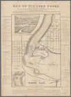
of Niagara Falls, and guide table
note:
Mapping
the Nation (NEH grant, 2015-2018)…
m
Map
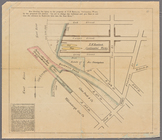
showing the injury to the property
note:
… catalog of the
Map
m
A correct
map
of the state of Vermont, from
note:
NYPL
Map
Div. copy
Map
of Venango County, Pennsylvania …
note:
NYPL
Map
Div. copy mounted on sheet 71 x 96
Hartford in 1640
note:
Mapping
the Nation (NEH grant, 2015-2018)…
Plan der Descente und der Aff…
note:
Mapping
the Nation (NEH grant, 2015-2018)…
Survey of the Battery
note:
Mapping
the Nation (NEH grant, 2015-2018)…
Plan of cottage sites at Magn…
note:
Mapping
the Nation (NEH grant, 2015-2018)…
Plan of land on West Chester …
note:
Mapping
the Nation (NEH grant, 2015-2018)…
A plan of the town of Pittsfo…
note:
Mapping
the Nation (NEH grant, 2015-2018)…
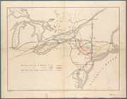
Approach of the Union Armies …
note:
Mapping
the Nation (NEH grant, 2015-2018)…
Mail and passenger route from…
note:
Mapping
the Nation (NEH grant, 2015-2018)…
m
Bureau of roads
collection:
Maps
of New York City and State
Rhode - Island, 2e feuille
note:
Mapping
the Nation (NEH grant, 2015-2018)…
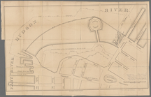
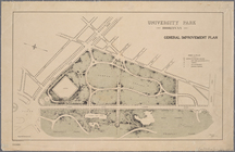
University Park, Brooklyn, N.…
note:
NYPL
Map
Div. copy has accession no
A plan of Charles Town, the c…
note:
Mapping
the Nation (NEH grant, 2015-2018)…
Louisiana, as formerly claime…
note:
Mapping
the Nation (NEH grant, 2015-2018)…
Plan of East Boston: exhibiti…
note:
Mapping
the Nation (NEH grant, 2015-2018)…
Plan of McLean Hospital lands…
note:
Mapping
the Nation (NEH grant, 2015-2018)…
Bayfield & Ashland Counties i…
note:
… catalog of the
Map
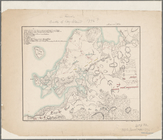
Map
of the Dead River, Kennebago, Seven
note:
… of
map
at smaller scale
Eagle Harbor Copper Co, and E…
note:
NYPL
Map
Div. copy includes manuscript
Springfield, Ill. 1892
note:
Mapping
the Nation (NEH grant, 2015-2018)…
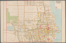
Nyack
note:
Mapping
the Nation (NEH grant, 2015-2018)…
Map
of the city of Rochester
note:
Mapping
the Nation (NEH grant, 2015-2018)…
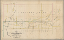
Map
of Tonawanda Swamp in the counties
note:
Mapping
the Nation (NEH grant, 2015-2018)…
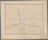
Map
of the mouth of big Sandy Creek
note:
Mapping
the Nation (NEH grant, 2015-2018)…
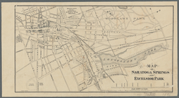
Map
of Saratoga Springs and Excelsior Park
note:
Mapping
the Nation (NEH grant, 2015-2018)…
Railroads of Minneapolis and …
note:
… catalog of the
Map
Green-Wood Cemetery, 1886
note:
… catalog of the
Map
Guide
map
to the Brooklyn and Queens parks
Map
showing route of the New York, Ontario
note:
Map
also shows lakes, rivers.
A
map
of part of the land in the Royal Grant
note:
…"Reduced one fifth from the original
map
."…
m
Map
showing Indian reservations in the United
note:
Mapping
the Nation (NEH grant, 2015-2018)…
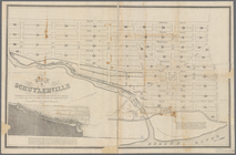
Map
of Schuylerville
note:
Map
shows blocks and lot numbers, mills
Map
of Dobbs Ferry and Hastings
note:
Map
also shows street names, roads
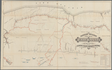
Western Division of the Erie Canal :
map
note:
Mapping
the Nation (NEH grant, 2015-2018)…
Map
of property belonging to the heirs
note:
… catalog of the
Map
Map
of Brooklyn during the Battle of Long
note:
Mapping
the Nation (NEH grant, 2015-2018)…
m
Map
of the state of Georgia
note:
NYPL
Map
Div. copy divided into 2 sheet 40 x
m
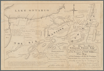
To his excellency William Try…
note:
…"Copied from the original manuscript
map
Town of Bethel, Fairfield Co.…
note:
Map
no. 45 from Atlas of New York
Plan des achats des compagnie…
note:
NYPL
Map
Div. copy has accession no
The principal parts of Norwal…
note:
Cadastral
map
showing landowners
Map
of the city of Boston and vicinity
note:
Mapping
the Nation (NEH grant, 2015-2018)…
1
2
Previous
Next
1
2
Previous
Next