Click to visit the main New York Public Library Homepage
The New York Public Library
Digital Collections
About Digital Collections
Browse
Search only public domain materials
Items
Collections
Divisions
Home
Search
Browse
About
Search only public domain materials
Items
Collections
Divisions
Digital Collections
Using Images
Using Data
Search
Filtered keyword search
Show filters
Hide filters
Show Only Public Domain
topic
Indians of North America
2
Boundaries
1
Fortification
1
Landowners
1
Real property
1
name
Abert, John James, 1788-1863
1
Bellin, Jacques Nicolas, 1703-1772
1
Compagnie des Indes
1
Emory, William H. (William Hemsley), 1811-1887
1
Gibson, J. (John), active 1750-1792
1
More
Less
collection
Maps of North America
9
Maps of New York City and State
1
place
Mexico, Gulf of
3
West (U.S.)
3
Florida
2
Mississippi River
2
Pensacola Bay (Fla.)
2
More
Less
genre
Maps
10
Cadastral maps
1
Portolan charts
1
publisher
x
publisher not identified
division
Map Division
10
type
cartographic
10
text
1
Date Range
to
10 results found for:
x
New Mexico
Filtering on:
x
Publisher
: publisher not identified
Sort by:
Relevance
Title
Date created
Date digitized
Sequence
… Ocean and part of
Mexico
use:
… partner (e.g.,
New
York
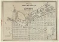
Village of Port Ontario, in t…
use:
… partner (e.g.,
New
York
… in the Gulf of
Mexico
use:
… partner (e.g.,
New
York
… of
Mexico
use:
… partner (e.g.,
New
York
Plan de la Baye de Pensacola …
use:
… partner (e.g.,
New
York
Map of the territory of Flori…
use:
… partner (e.g.,
New
York
Americae septentrionalis pars…
use:
… partner (e.g.,
New
York
A map of the
new
governments of East & West
use:
… partner (e.g.,
New
York
Lovisiana by de Rivier Missis…
use:
… partner (e.g.,
New
York
Map illustrating the plan of …
use:
… partner (e.g.,
New
York