Click to visit the main New York Public Library Homepage
The New York Public Library
Digital Collections
About Digital Collections
Browse
Search only public domain materials
Items
Collections
Divisions
Home
Search
Browse
About
Search only public domain materials
Items
Collections
Divisions
Digital Collections
Using Images
Using Data
Search
Filtered search
Show filters
Hide filters
Show Only Public Domain
topic
Railroads
14
Railroads, Elevated
12
Local transit
6
Roads
5
Trolley cars
4
More
Less
name
Rand McNally and Company
14
C.S. Hammond & Company
3
Colton, Ohman & Co
2
A.G. Hagstrom Co
1
Borough Park Company
1
More
Less
collection
x
Maps of New York City and State
place
New York (State)
23
New York
21
Brooklyn
13
Brooklyn (New York, N.Y.)
13
Kings County
12
More
Less
genre
Maps
28
Road maps
4
Mass transit
2
publisher
x
The Company
division
Map Division
28
type
cartographic
28
Date Range
to
28 results found
Filtering on:
x
Publisher
: The Company
x
Collection
: Maps of New York City and State
For more collection details, visit the
Maps of New York City and State collection page
.
Sort by:
Title
Date created
Date digitized
Sequence
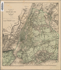
Hammond's handy reference map…
m
Freight map of the metropolit…
Rand, McNally & Co.'s new aut…
m
The John Wanamaker automobile…
m
Rand, McNally & Co.'s complet…
Map of property New York Dock…
Brooklyn, from Rand McNally m…
Rand McNally official 1921 au…
Hammond's handy reference map…
m
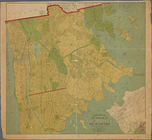
Map of the borough of Brookly…
m
The Rand McNally map of the b…
Rapid transit map of Kings, Q…
Brooklyn and vicinity
Rand McNally Map of Brooklyn
Street guide of Brooklyn : wi…
Rand, McNally & Co.'s new han…
Borough Park Company
Rand Mcnally official detaile…
Rand McNally standard map of …
Map of the City of New York :…
m
Rand McNally official motor g…
m
Map of the borough of Brookly…
Rand McNally & Co.'s new hand…
Map showing the proposed area…
Map of New York City : showin…
m
Rand McNally commercial map o…
New map of the borough of the…
Geographically correct map of…
End of results
|
Top