Click to visit the main New York Public Library Homepage
The New York Public Library
Digital Collections
About Digital Collections
Browse
Search only public domain materials
Items
Collections
Divisions
Home
Search
Browse
About
Search only public domain materials
Items
Collections
Divisions
Digital Collections
Using Images
Using Data
Search
Filtered search
Show filters
Hide filters
Show Only Public Domain
topic
Nautical charts
6
New York (State)
3
Coasts
1
Harbors
1
Navigation
1
More
Less
name
United States Coast Survey
6
Bache, A. D. (Alexander Dallas), 1806-1867
5
Geological Survey (U.S.)
4
Hassler, F. R. (Ferdinand Rudolph), 1770-1843
4
Renard, C
3
More
Less
collection
Maps of New York City and State
6
Maps of North America
5
place
New Jersey
4
Little Egg Harbor (N.J. : Township)
2
Atlantic Coast
1
Atlantic Coast (Mass.)
1
Boston Bay (Mass.)
1
More
Less
genre
Maps
11
Nautical charts
2
Bathymetric maps
1
Illustrations
1
Topographic maps
1
publisher
x
The Survey
division
Map Division
11
type
cartographic
11
still image
1
Date Range
to
11 results found
Filtering on:
x
Publisher
: The Survey
Sort by:
Title
Date created
Date digitized
Sequence
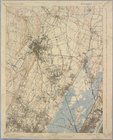
Staten Island, N.Y., ed. of F…
Paterson, N.J. - N.Y., ed. of…
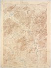
Santanoni, ed. of Mar. 1904, …
Mt. Marcy, ed. of June 1902, …
Coast Chart no. 9, Boston Bay…
Map of Utah territory: repres…
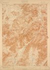
Middle part of the southern c…
Reconnaissance of the western…
Little Egg Harbor
Little Egg Harbor
m
Map of New-York Bay and Harbo…
End of results
|
Top