Click to visit the main New York Public Library Homepage
The New York Public Library
Digital Collections
About Digital Collections
Browse
Search only public domain materials
Items
Collections
Divisions
Home
Search
Browse
About
Search only public domain materials
Items
Collections
Divisions
Digital Collections
Using Images
Using Data
Search
Filtered keyword search
Show filters
Hide filters
Show Only Public Domain
topic
Nautical charts
4
Colonies
2
Discovery and exploration
2
Geography
2
Atlases, British
1
More
Less
name
Robert Sayer and John Bennett (Firm)
5
Childe, Timothy
3
Gravelot, Hubert François, 1699-1773
3
Moll, Herman, -1732
3
Pownall, Thomas, 1722-1805
3
More
Less
collection
x
Lawrence H. Slaughter Collection of English maps, charts, globes, books and atlases
place
North America
11
America
5
Lower Bay (N.Y. and N.J.)
3
New England
3
Great Britain
2
More
Less
genre
Maps
23
publisher
... Mathew Albert and George Frederick Lotter
2
Chez l'auteur, aux Galeries du Louvre
2
Printed for Timothy Childe at the White Hart at the West-end of St. Paul's Church-yard
2
Dépôt de la marine
1
J. Hinton
1
More
Less
division
Map Division
23
type
cartographic
23
Date Range
to
23 results found for:
x
Hudson Bay
Filtering on:
x
Collection
: Lawrence H. Slaughter Collection of English maps, charts, globes, books and atlases
For more collection details, visit the
Lawrence H. Slaughter Collection of English maps, charts, globes, books and atlases collection page
.
Sort by:
Relevance
Title
Date created
Date digitized
Sequence
m
A map of the British and Fren…
note:
… of
Hudson
's
Bay
and Labrador
North America
abstract:
… chart of Baffin
Bay
and
Hudson
Bay
. Prime
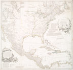
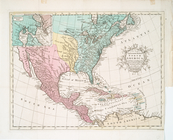
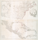
A new map of North America wi…
note:
… and
Hudson
's
Bay
A new and correct map of Nort…
note:
… and
Hudson
's
Bay
A new and correct map of Nort…
note:
… and
Hudson
's
Bay
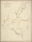
Chart of the entrance of
Hudson
's River
Carte de la
baye
et riviere de Délaware
note:
Relief shown by hachures (
Hudson
River map
… : the entrance of
Hudson
's River
m
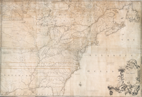
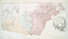
The provinces of New York, an…
note:
Insets: A chart of the mouth of
Hudson
's River
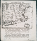
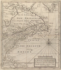
A new map of New England and …
note:
… as the
Hudson
River Valley.
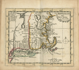
An exact mapp of New England …
note:
… the
Hudson
River Valley east
A new map of New England and …
note:
… as the
Hudson
River Valley.
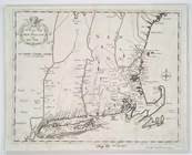
New England and New York
abstract:
…, covers the
Hudson
River
A new and accurate map of Nor…
note:
Inset:
Hudsons
Bay
[ca. 1:38,000,000].
A new and accurate map of Nor…
note:
Inset:
Hudsons
Bay
[ca. 1:38,000,000].
m
Amérique Septentrionale publi…
note:
Inset map: [
Hudson
Bay
-Labrador Region].
Amérique Septentrionale publi…
note:
Inset map: [
Hudson
Bay
-Labrador Region].
…, Canada,
Hudsons
Bay
, &c
…, Canada,
Hudsons
Bay
, &c
…, Canada,
Hudsons
Bay
, &c
m
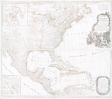
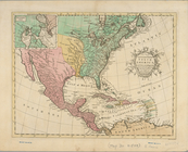
A chart of North and South Am…
note:
…'s and
Hudson
's
Bays
-- [Chart
A chart of North and South Am…
note:
… Baffin's and
Hudson
's
Bays
-- Chart
A new map of the whole contin…
note:
… &
Hudsons
bays
," tables
End of results
|
Top