Click to visit the main New York Public Library Homepage
The New York Public Library
Digital Collections
About Digital Collections
Browse
Search only public domain materials
Items
Collections
Divisions
Home
Search
Browse
About
Search only public domain materials
Items
Collections
Divisions
Digital Collections
Using Images
Using Data
Search
Filtered keyword search
Show filters
Hide filters
Show Only Public Domain
topic
Nautical charts
7
Coasts
2
name
Des Barres, Joseph F. W. (Joseph Frederick Wallet), 1729-1824
6
Des Barres, Joseph F. W. (Joseph Frederick Wallet), 1722-1824
2
Hamond, Andrew Snape, Sir, 1738-1828
1
Holland, Samuel, 1728-1801
1
Knight, John
1
collection
x
Lawrence H. Slaughter Collection of English maps, charts, globes, books and atlases
place
Early works to 1800
3
Maps
3
New York (N.Y.)
3
New York (State)
3
Atlantic Coast (North America)
2
More
Less
genre
Maps
8
publisher
Publish'd ... by I.F.W. Des Barres Esqr.,
2
Published for the use of the Royal Navy of Great Britain by Joseph F. W. Des Barres
2
... published ... by J.F.W. Des Barres esqr
1
J. Des Barres
1
J.F.W. Des Barres
1
More
Less
division
Map Division
8
type
cartographic
8
Date Range
to
8 results found for:
x
Wallet
Filtering on:
x
Collection
: Lawrence H. Slaughter Collection of English maps, charts, globes, books and atlases
For more collection details, visit the
Lawrence H. Slaughter Collection of English maps, charts, globes, books and atlases collection page
.
Sort by:
Relevance
Title
Date created
Date digitized
Sequence
A chart of Delawar Bay : with…
A chart of Delawar River from…
A chart of the coast of New Y…
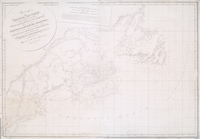
The coast of Nova Scotia, New…
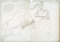
The coast of Nova Scotia, New…
[A chart of New York Island &…
A chart of New York Island & …
A plan of Fort Montgomery & F…