Click to visit the main New York Public Library Homepage
The New York Public Library
Digital Collections
About Digital Collections
Browse
Search only public domain materials
Items
Collections
Divisions
Home
Search
Browse
About
Search only public domain materials
Items
Collections
Divisions
Digital Collections
Using Images
Using Data
Search
Filtered search
Show filters
Hide filters
Show Only Public Domain
topic
x
Surveys
Canals
1
Cities and towns
1
Landowners
1
Measurement
1
More
Less
name
Andrews, Horace
1
Drayton, T. F
1
Erroll, William George Hay, Earl of, 1801-1846
1
Gardiner, James T. (James Terry), 1842-1912
1
Gavit, John E., 1817-1874
1
More
Less
collection
x
Maps of New York City and State
place
New York (State)
3
Hudson River (N.Y. and N.J.)
1
Morrisania (New York, N.Y.)
1
New York
1
Niagara Canal (N.Y. : Proposed) -- Maps
1
More
Less
genre
Maps
4
Cadastral maps
1
Topographic maps
1
publisher
Engraved & printed by John E. Gavit
1
Lith. by Weed, Parsons, & Co
1
New York State Survey
1
Publisher not identified
1
Town of Morrisania, Commissioners
1
More
Less
division
Map Division
4
type
cartographic
4
Date Range
to
4 results found
Filtering on:
x
Collection
: Maps of New York City and State
x
Topic
: Surveys
For more collection details, visit the
Maps of New York City and State collection page
.
Sort by:
Title
Date created
Date digitized
Sequence
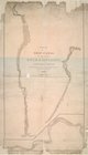
Map of the town of Morrisania
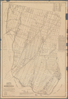
Topographical map of Seneca C…
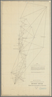
Sketch of the triangulation o…
m
Survey for a ship canal to co…