Click to visit the main New York Public Library Homepage
The New York Public Library
Digital Collections
About Digital Collections
Browse
Search only public domain materials
Items
Collections
Divisions
Home
Search
Browse
About
Search only public domain materials
Items
Collections
Divisions
Digital Collections
Using Images
Using Data
Search
Filtered keyword search
Show filters
Hide filters
Show Only Public Domain
topic
Railroads
8
Administrative and political divisions
5
Local transit
5
City planning
4
Ferries
4
More
Less
name
Dripps, M. (Matthew)
4
G.W. & C.B. Colton & Co
4
Colton, G. Woolworth (George Woolworth), 1827-1901
2
Harrison, J.F
2
Laing, Joseph, b. 1827 or 1828
2
More
Less
collection
x
Maps of New York City and State
place
New York (State)
21
New York
12
New York (N.Y.)
10
Brooklyn (New York, N.Y.)
9
Manhattan (New York, N.Y.)
9
More
Less
genre
Maps
27
Topographic maps
2
Advertisements
1
Cadastral maps
1
publisher
M. Dripps
4
G.W. & C.B. Colton
2
G.W. and C.B. Colton & Co
2
J. F. Harrison
1
A. Brown & Co
1
More
Less
division
Map Division
26
Manuscripts and Archives Division
1
type
x
cartographic
Date Range
to
27 results found for:
x
800
Filtering on:
x
Collection
: Maps of New York City and State
x
Type
: cartographic
For more collection details, visit the
Maps of New York City and State collection page
.
Sort by:
Relevance
Title
Date created
Date digitized
Sequence
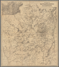
Railroad suburbs between Holl…
note:
Scale 1:9,600,
800
foot = 1 feet; (W 73°46
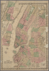
Map of the city of New York m…
note:
Scale 1:9,600.
800
feet to 1 inch. (W
Rand McNally standard map of …
note:
Scale approximately 1:316,
800
; 5 miles = 1
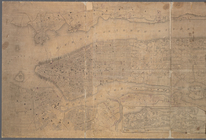
Map of the city of New York m…
note:
Scale 1:9,600.
800
feet to 1 inch. (W
Map of the city of New York m…
note:
Scale 1:9,600.
800
feet to 1 inch. (W
m
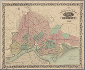
Map of the city of Brooklyn, …
note:
Scale [ca. 1:9,600].
800
feet pr. inch.
m
Map of the City of Brooklyn a…
note:
Scale [1:9,600]
800
ft. pr. in. (W 74°03
Map of the consolidated city …
m
Topographical map of the city…
note:
Scale [ca. 1:10,
800
]. 900 feet to an inch.
m
Bureau of roads
abstract:
… approximately 1:4,
800
; 400 feet
East River from the Battery t…
note:
Scale 1:10,
800
. 900 feet to one inch. (W
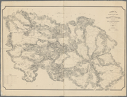
Map of Jamaica in the 4th war…
note:
Scale 1:4,
800
; 400 feet to 1 inch (W 73°49
m
Topographical map of the City…
note:
Scale 1:10,
800
. 900 feet to an inch (W
Plan of the position which th…
note:
Scale approximately 1:10,
800
(W 73°39ʹ28ʺ--W
Topographical map showing str…
note:
Scale 1:4,
800
, 400 feet = 1 inch.
m
Map of the borough of Brookly…
note:
Scale [ca. 1:24,
800
].
m
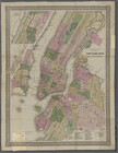
Map of New York City
note:
Scale 1:4,
800
. 400 feet to an inch. (W
Coltons map of the New York w…
note:
… 1:3,
800
,000. Statute miles 60
Hagstrom's map of ... New Yor…
note:
Scale approximately 1:16,
800
.
Map of New York City showing …
note:
Scale 1:4,
800
. 1 inch = 400 feet. (W
Colton's New York City : Broo…
note:
Scale [1:28,
800
]. 2400 ft. to 1 inch. (W
m
Topographical map of New York…
note:
Scale [ca. 1:10,
800
. 900 feet to an in.]
Colton's New York City, Brook…
note:
Scale approximately 1:28,
800
; 2400 ft. to one
G. Woolworth Colton's new map…
abstract:
… approximately 1:28,
800
; 2,400 ft
G. Woolworth Colton's new map…
abstract:
… approximately 1:28,
800
; 2,400 ft
Topographical map showing the…
note:
… of approximately 1:52,
800
.
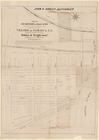
Map of 163 sections or villa …
note:
Scale approximately 1:
800
(W 73°48ʹ29ʺ--W
End of results
|
Top