Click to visit the main New York Public Library Homepage
The New York Public Library
Digital Collections
About Digital Collections
Browse
Search only public domain materials
Items
Collections
Divisions
Home
Search
Browse
About
Search only public domain materials
Items
Collections
Divisions
Digital Collections
Using Images
Using Data
Search
Filtered keyword search
Show filters
Hide filters
Show Only Public Domain
topic
Nautical charts
30
Harbors
15
Coasts
5
Navigation
3
Administrative and political divisions
2
More
Less
name
United States Coast Survey
13
Hassler, F. R. (Ferdinand Rudolph), 1770-1843
11
Bache, A. D. (Alexander Dallas), 1806-1867
10
Knight, John, approximately 1802-1872
6
Mathiot, G
6
More
Less
collection
x
Maps of New York City and State
place
New York (State)
18
New York Harbor (N.Y. and N.J.)
13
New York (N.Y.)
11
Long Island (N.Y.)
8
New York Metropolitan Area
8
More
Less
genre
Maps
37
Nautical charts
12
Bathymetric maps
1
Early works to 1800
1
publisher
U.S. Coast Survey office
4
Survey of the Coast of the United States
3
U.S. Coast and Geodetic Survey
3
W. Hooker
3
Government Printing Office
2
More
Less
division
Map Division
37
type
cartographic
37
text
3
Date Range
to
37 results found for:
x
Nautical charts
Filtering on:
x
Collection
: Maps of New York City and State
For more collection details, visit the
Maps of New York City and State collection page
.
Sort by:
Relevance
Title
Date created
Date digitized
Sequence
m
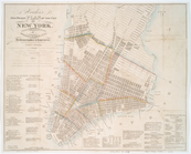
Oyster Bay and Huntington, Hu…
topic:
Nautical
charts
m
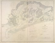
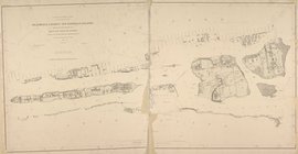
Eastern part of Long Island S…
abstract:
Includes
charts
of tides, bottom types
Coast
chart
topic:
Nautical
charts
Jamaica Bay and Rockaway Inle…
collection:
… and Geodetic Survey.
Nautical
chart
; no. 542.
Chart
of the entrance of Hudson's River
topic:
Nautical
charts
Middle part of Long Island So…
abstract:
… by soundings. Includes
charts
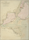
Eastern part of the southern …
topic:
Nautical
charts
A
chart
of New York
topic:
Nautical
charts
Middle part of the southern c…
note:
Includes notes,
charts
and 2 coastal
Western part of the southern …
note:
Includes notes,
charts
and 5 coastal
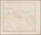
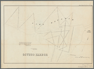
Sketch of West Pier, Oswego H…
topic:
Nautical
charts
Map of the mouth of Great Sod…
note:
… engraved with
chart
of same
Map of Buffalo Harbor, N.Y., …
topic:
Nautical
charts
Oswego Harbor, 33d Congress, …
topic:
Nautical
charts
A
chart
of New York
topic:
Nautical
charts
Long Island Sound (western sh…
abstract:
… 1:80,000. Includes
charts
Bay and harbor of New York
note:
Includes text,
charts
, and views.
m
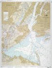
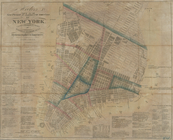
Map of New-York Bay and Harbo…
topic:
Nautical
charts
1889, Larchmont Harbor, N.Y.:…
topic:
Nautical
charts
Map of the Harbor of New York…
topic:
Nautical
charts
m
Map of New-York Bay and Harbo…
topic:
Nautical
charts
New York Harbor and entrance …
topic:
Nautical
charts
Hell Gate and its approaches
topic:
Nautical
charts
Long Island Sound from New Yo…
note:
Nautical
chart
.
A draught of New York from th…
topic:
Nautical
charts
m
United States--east coast, Ne…
note:
Chart
no.: 12327
A
chart
of the bar of Sandy Hook
note:
Appears in Faden's Collection of
charts
Map of New-York Bay and Harbo…
topic:
Nautical
charts
Plan de New-York et des envir…
topic:
Nautical
charts
Chart
and plan of the harbour of New York
topic:
Nautical
charts
Map of New-York Bay and Harbo…
topic:
Nautical
charts
Asher & Adams' map of the bay…
Hooker's new pocket plan of t…
note:
…, instrument maker &
chart
Hooker's new pocket plan of t…
note:
…, instrument maker &
chart
Hooker's new pocket plan of t…
note:
…, instrument maker &
chart
Hooker's new pocket plan of t…
note:
…, instrument maker &
chart
Blackwell's, Ward's and Randa…
note:
… and Geodetic Survey.
Nautical
chart
; no. 3040.
End of results
|
Top