Click to visit the main New York Public Library Homepage
The New York Public Library
Digital Collections
About Digital Collections
Browse
Search only public domain materials
Items
Collections
Divisions
Home
Search
Browse
About
Search only public domain materials
Items
Collections
Divisions
Digital Collections
Using Images
Using Data
Search
Filtered keyword search
Show filters
Hide filters
Show Only Public Domain
topic
Real property
240
Cities & towns
123
Fire insurance
123
Maps
17
Insurance, Fire
4
More
Less
name
Sanborn Map Company
123
Ullitz, Hugo
79
E.B. Hyde & Co
73
E. Belcher Hyde Map Company
52
G.W. Bromley & Co
29
More
Less
collection
x
Atlases of New York City
place
New York (State)
242
Brooklyn (New York, N.Y.)
130
New York
119
Maps
30
Queens (New York, N.Y.)
22
More
Less
genre
Maps
283
Cadastral maps
8
Topographic maps
1
publisher
Sanborn Map Company
123
E. Belcher Hyde
66
E.B. Hyde & Co
21
G.M. Hopkins & Co
16
G.W. Bromley & Co
15
More
Less
division
Map Division
283
type
cartographic
283
still image
1
Date Range
to
283 results found for:
x
Atlantic City (N.J.)
Filtering on:
x
Collection
: Atlases of New York City
For more collection details, visit the
Atlases of New York City collection page
.
Sort by:
Relevance
Title
Date created
Date digitized
Sequence
….; Including
Atlantic
Ave.,
Atlantic
Ave., Pacific St
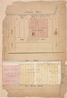
note:
Cover title:
City
atlas of Brooklyn,
N
.Y.
…,
Atlantic
Avenue, Court
…,
Atlantic
Ocean, Alexander
….,
Atlantic
Ocean, Remsen St
… Avenue, (
Atlantic
Ocean)
Atlantic
Avenue, Surf
…, Bond Street,
Atlantic
… Ave.,
Atlantic
Ave
… Ave.,
Atlantic
Ave
…, Court Street,
Atlantic
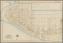
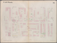
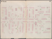
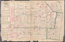
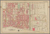
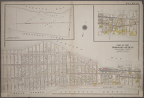
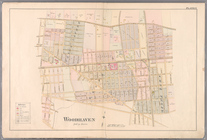
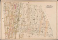
Plate 17: Map bounded by
Atlantic
Street
…,
Atlantic
Avenue, 4th Avenue
…., (
Atlantic
Ocean) Surf Ave. and
Atlantic
Ave.
…, Smith Street,
Atlantic
… Street,
Atlantic
Avenue
….; Including
Atlantic
Ocean
…
Atlantic
Ocean, W. 5th St
…
Atlantic
Ocean]; Sub Plan
… and
Atlantic
Avenue
… and
Atlantic
Ocean
…,
Atlantic
Avenue
…,
Atlantic
Ferry, Moore
… Street,
Atlantic
Street
… Avenue and
Atlantic
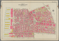
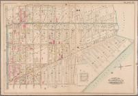
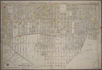
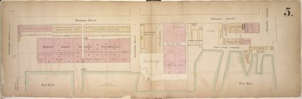
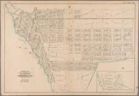
Plate 4: [Bounded by
Atlantic
Avenue, Bond
…,
Atlantic
Avenue, Brooklyn
…,
Atlantic
Avenue, Williams
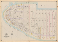
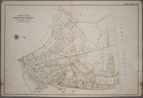
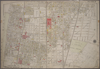
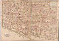
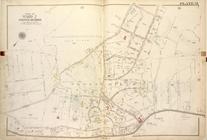
Map bounded by
Atlantic
Ocean, 45th St
note:
Fire insurance plans of
cities
… Highland Avenue to
Atlantic
… Avenue and
Atlantic
… and
Atlantic
Avenue
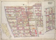
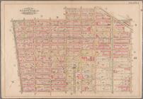
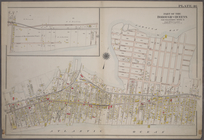
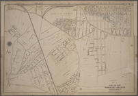
Plate 33: Bounded by
Atlantic
Avenue, Vanwyck
… Avenue, (
Atlantic
Ocean
…, and (
Atlantic
Ocean) Boulevard, …
…, Eastern Avenue, (
Atlantic
…,
Atlantic
Avenue, Drew
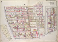
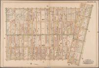
Plate 37: Bounded by
Atlantic
Avenue, Cummings
…,... (
Atlantic
Ocean, Jamaica
… Avenue,
Atlantic
Avenue
…), Furman St.,
Atlantic
St
… by
Atlantic
St., Columbia St
… by
Atlantic
Basin, Summit St
… Avenue,
Atlantic
Avenue
…,
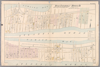
Atlantic
Avenue, Rockaway
… Avenue and
Atlantic
…. Portland Avenue,
Atlantic
…, Fifth Avenue,
Atlantic
…, Rochester Avenue,
Atlantic
…,
Atlantic
Avenue, Henry
… (
Atlantic
Ave), Corners Road
Map bound by
Atlantic
Ave., Clinton St
note:
Cover title:
City
atlas of Brooklyn,
N
.Y.
1
2
Previous
Next
1
2
Previous
Next