Click to visit the main New York Public Library Homepage
The New York Public Library
Digital Collections
About Digital Collections
Browse
Search only public domain materials
Items
Collections
Divisions
Home
Search
Browse
About
Search only public domain materials
Items
Collections
Divisions
Digital Collections
Using Images
Using Data
Search
Filtered keyword search
Show filters
Hide filters
Show Only Public Domain
topic
Real property
77
Fire insurance
66
Cities & towns
65
Docks
2
name
Sanborn Map Company
66
G.W. Bromley & Co
6
Ullitz, Hugo
4
E. Belcher Hyde Map Company
3
E.B. Hyde & Co
3
More
Less
collection
x
Atlases of New York City
place
New York (State)
79
New York
13
Manhattan (New York, N.Y.)
5
Brooklyn (New York, N.Y.)
4
Bronx (New York, N.Y.)
3
More
Less
genre
Maps
84
Topographic maps
3
Title pages
1
publisher
Sanborn Map Company
66
G.W. Bromley & Co
6
E. Belcher Hyde
2
E. Robinson Co
2
F. Heppenheimer
2
More
Less
division
Map Division
85
type
cartographic
84
text
1
Date Range
to
85 results found for:
x
sel_id:61
Filtering on:
x
Collection
: Atlases of New York City
For more collection details, visit the
Atlases of New York City collection page
.
Sort by:
Relevance
Title
Date created
Date digitized
Sequence
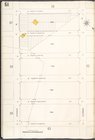
Plate
61
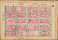
Plate
61
, Part of Section 3
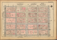
Plate
61
, Part of Section 3
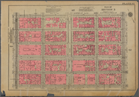
Plate
61
, Part of Section 3
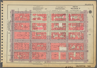
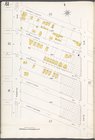
Double Page Plate No.
61
, Part of Ward
Richmond, Plate No.
61
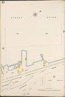
[Map bounded
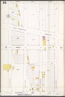
Plate
61
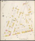
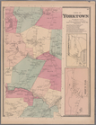
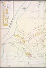
: Town of Yorktown, Westerchester Co
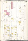
Manhattan, V. 11, Plate No.
61
[Map
Manhattan, V. 5, Plate No.
61
[Map
Queens V. 5, Plate No.
61
[Map bounded
Brooklyn Plate No.
61
[Map bounded
Queens V. 3, Plate No.
61
[Map bounded
Staten Island, V. 1, Plate No.
61
[Map
Manhattan, V. 7, Plate No.
61
[Map
Staten Island, V. 1, Plate No.
61
[Map
Brooklyn Vol. A Plate No.
61
[Map
Brooklyn V. 7, Plate No.
61
[Map
Brooklyn V. 3, Plate No.
61
[Map
Brooklyn V. 4, Plate No.
61
[Map
Brooklyn V. 8, Plate No.
61
[Map
first:
7b040661-6842-
61
e2-e040-e00a1806661d
Brooklyn V. 9, Plate No.
61
[Map
Brooklyn V. 12, Plate No. 98 …
collection:
… bounded by Bay Parkway,
61
Queens V. 2, Plate No.
61
[Map bounded
Queens V. 3, Plate No.
61
[Map bounded
Queens V. 10, Plate No.
61
[Map bounded
Manhattan, V. 1, Plate No.
61
[Map
Bronx, V. 18, Plate No.
61
[Map bounded
Bronx, V. A, Plate No.
61
[Map bounded
Brooklyn V. 2, Plate No.
61
[Map
Brooklyn V. 3, Plate No.
61
[Map
Queens V. 4, Plate No.
61
[Map bounded
Brooklyn V. 3, Double Page Plate No.
61
Bronx, V. A, Plate No.
61
[Map bounded
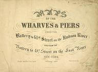
Maps of the Wharves & Piers f…
collection:
… to
61
st Street
Brooklyn V. 10, Plate No.
61
[Map
Brooklyn V. 12, Plate No. 99 …
collection:
… bounded by
61
st St., Bay
Queens V. 8, Plate No.
61
[Map bounded
Bronx, V. 9, Plate No.
61
[Map bounded
Manhattan V. 7, Plate No.
61
[Map
Bronx, V. 15, Plate No.
61
[Map bounded
Bronx, V. 14, Plate No.
61
[Map bounded
Bronx, V. 14, Plate No.
61
[Map bounded
Bronx, V. 13, Plate No.
61
[Map bounded
Brooklyn Vol. B Plate No. 199…
collection:
… St., 17th Ave.,
61
st
Brooklyn Vol. B Plate No. 200…
collection:
… Ave.,
61
st St., 17th
Brooklyn V. 15, Plate No. 48 …
collection:
….
61
st St.]
Brooklyn V. 15, Plate No.
61
[Map
Brooklyn V. 11, Plate No.
61
[Map
Brooklyn V. 11, Plate No. 89 …
collection:
… bounded by 9th Ave.,
61
st
Brooklyn V. 11, Plate No. 90 …
collection:
… St., 11th Ave.,
61
st