Click to visit the main New York Public Library Homepage
The New York Public Library
Digital Collections
About Digital Collections
Browse
Search only public domain materials
Items
Collections
Divisions
Home
Search
Browse
About
Search only public domain materials
Items
Collections
Divisions
Digital Collections
Using Images
Using Data
Search
Filtered keyword search
Show filters
Hide filters
Show Only Public Domain
topic
x
History
Boundaries
7
Nautical charts
5
Charts, diagrams, etc
3
Indian land transfers
3
More
Less
name
Montanus, Arnoldus, 1625?-1683
116
Ogilby, John, 1600-1676
116
Barclay, Anthony, 1792-1877
7
Porter, Peter B. (Peter Buell), 1773-1844
7
United States. Light-House Board
7
More
Less
collection
Lawrence H. Slaughter Collection of English maps, charts, globes, books and atlases
139
Maps of North America
13
Collection of Russian and Ukrainian posters, 1917-1921
3
Maps of New York City and State
3
The tapestry hangings of the House of lords; representing the several engagements between the English and Spanish fleets, in the ever memorable year MDLXXXVIII, with the portraits of the lord high-admiral, and the other noble commanders, taken from the life. To which are added, from a book entitled, Expeditionis hispanorum in Angliam vera descriptio, A.D. 1588, done, as is supposed, for the said tapestry to be work'd after, ten charts of the sea-coasts of England, and a general one of England, Scotland, Ireland, France, Holland, &c. shewing the places of action between the two fleets; ornamented with medals struck upon that occasion, and other suitars. ble devices. Also an historical account of each day's action, collected from the most authentic manuscripts and writers
2
More
Less
place
America
119
West Indies, British
116
United States
19
Canada
7
New Jersey
6
More
Less
genre
Maps
157
Nautical charts
3
Posters
3
Charts
2
Prints
2
More
Less
publisher
Printed by the author, and are to be had at his house
116
U.S. Light-House Board
7
Buisson,
3
Printed by James Parker, and a few Copies are to be Sold by him, and Benjamin Franklin, in Philadelphia;
3
At the Presses of S. Hall, and Thomas & Andrews, and sold by E. Larkin, and the other booksellers in Boston; by Gaine & Ten Eyck, and S. Campbell, New-York; [etc.,etc.]
2
More
Less
division
Map Division
156
Rare Book Division
4
Schomburg Manuscripts, Archives and Rare Books Division
2
Wallach Division: Picture Collection
2
Wallach Division: Print Collection
2
More
Less
type
still image
106
cartographic
59
text
7
Date Range
to
167 results found for:
x
Charts
Filtering on:
x
Topic
: History
Sort by:
Relevance
Title
Date created
Date digitized
Sequence
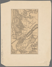
Population - 1647; Gov. Stuyv…
topic:
Charts
, diagrams, etc
aert vande Svyd Rivier in Nie…
collection:
Chart
of the South River in New Sweden
m
Map of the St. Clair River : …
note:
…"Photolithographed from original
charts
m
Map of the river Sainte Mary …
abstract:
…
charts
by permission
Lake St. Clair
note:
…"Photolithographed from original
charts
No. 3, map of Isle Royale in …
note:
…"Photolithographed from original
charts
Detroit 1820
note:
…"Photolithographed from original
charts
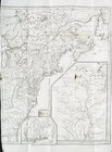
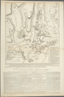
Battle of Long Island
abstract:
…: Battle maps and
charts
m
Isole famose porti: fortezze,…
topic:
Charts
, etc
Plan of Amelia Island in East…
note:
… & Georgia. A
chart
A map and
chart
of those parts of the Bay
topic:
Nautical
charts
Charts
and plans illustrating the topography
m
A
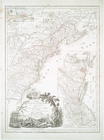
chart
of the harbour of Rhode Island
note:
In: Des Barres, Joseph F.W.
Charts
Lloyd's new military map of t…
note:
… and
charts
for the times.
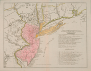
Rhode - Island, 2e feuille
topic:
Nautical
charts
m
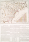
History of the United States:…
topic:
Charts
, diagrams, etc
The second section of the sur…
note:
…"Photolithographed from original
charts
m
Niagara 1819
note:
…"Photolithographed from original
charts
m
Free population in Buenos Air…
note:
Chart
listing various statistics among
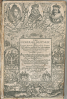
The generall historie of Virg…
collection:
… of English maps,
charts
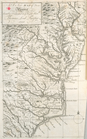
The country twenty five miles…
collection:
Charts
and maps
Carte du theatre de la guerre…
collection:
Charts
and maps
…
Charte
, auf welcher alle
note:
…"Mit einer illuminirten accuraten
Charte
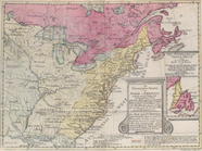
North America from the French…
collection:
… of English maps,
charts
A new and correct map of Amer…
collection:
… of English maps,
charts
A New map of Virginia.
collection:
… of English maps,
charts
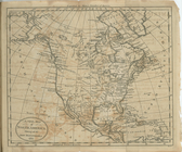
A new map of North America sh…
collection:
… of English maps,
charts
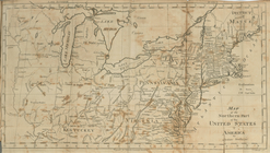
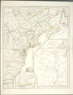
Map of the northern part of t…
collection:
… of English maps,
charts
Map no. I : [to accompany A b…
collection:
… of English maps,
charts
Map no. II : [to accompany A …
collection:
… of English maps,
charts
Map no. III : [to accompany A…
collection:
… of English maps,
charts
Plan of the position which th…
collection:
… of English maps,
charts
Carte d'une partie de l'Améri…
collection:
… of English maps,
charts
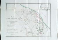
Côte de York-town à Boston : …
collection:
… of English maps,
charts
Plan d'York en Virginie, avec…
collection:
… of English maps,
charts
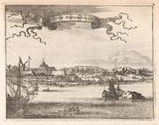
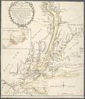
Novum Amsterodamum.
collection:
… of English maps,
charts
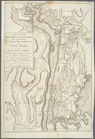
A plan of New York Island, wi…
collection:
Charts
and maps
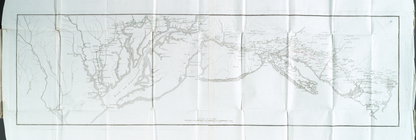
The Theatre of war in North A…
collection:
Charts
and maps
Position der Königl; Grosbrit…
collection:
Charts
and maps
Theatre de la guerre en Améri…
collection:
Charts
and maps
A plan of the operations of t…
collection:
Charts
and maps
The seat of action between th…
collection:
Charts
and maps
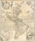
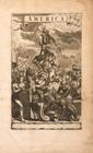
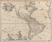
America
collection:
… of English maps,
charts
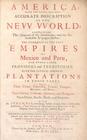
America: Being The Latest, An…
collection:
… of English maps,
charts
Novissima et Accuratissima To…
collection:
… of English maps,
charts
Gold and Silver Smiths in the…
collection:
… of English maps,
charts
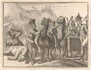
Llama, a four-footed Creature…
collection:
… of English maps,
charts
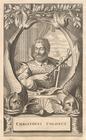
Christofel Colonus
collection:
… of English maps,
charts
Scene viewed by Columbus.
collection:
… of English maps,
charts
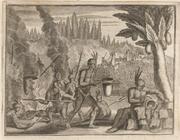
Brave reception of a King in …
collection:
… of English maps,
charts