Click to visit the main New York Public Library Homepage
The New York Public Library
Digital Collections
About Digital Collections
Browse
Search only public domain materials
Items
Collections
Divisions
Home
Search
Browse
About
Search only public domain materials
Items
Collections
Divisions
Digital Collections
Using Images
Using Data
Search
Filtered keyword search
Show filters
Hide filters
Show Only Public Domain
topic
x
Administrative and political divisions
Railroads
4
Ferries
2
Indians of North America
2
Local transit
2
More
Less
name
G.W. & C.B. Colton & Co
3
Farmer, John, 1798-1859
2
Rawdon, Clark & Co
2
Bonissel, N. 17..-18.
1
Colton, G. Woolworth (George Woolworth), 1827-1901
1
More
Less
collection
Maps of New York City and State
5
Maps of North America
3
Maps of Europe
1
place
New York (State)
5
Brooklyn (New York, N.Y.)
4
Hoboken (N.J.)
3
Jersey City (N.J.)
3
Manhattan (New York, N.Y.)
3
More
Less
genre
Maps
9
publisher
G.W. & C.B. Colton
2
A.J. Johnson
1
E. Belcher Hyde
1
Engraved, printed and published by G.W. & C.B. Colton & Co
1
G.W. and C.B. Colton & Co
1
More
Less
division
Map Division
8
Manuscripts and Archives Division
1
type
x
cartographic
Date Range
to
9 results found for:
x
800
Filtering on:
x
Topic
: Administrative and political divisions
x
Type
: cartographic
Sort by:
Relevance
Title
Date created
Date digitized
Sequence
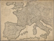
Carte de l'Empire Français Di…
note:
Scale [ca. 1:2,
800
,000] (W 12°00ʹ--E
m
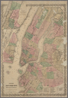
Map of the borough of Brookly…
note:
Scale [ca. 1:24,
800
].
Coltons map of the New York w…
note:
… 1:3,
800
,000. Statute miles 60
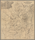
Johnson's Indiana
note:
Scale approximately 1:844,
800
(W 88°--W 84°/N 42
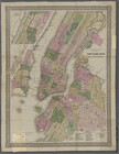
Colton's New York City : Broo…
note:
Scale [1:28,
800
]. 2400 ft. to 1 inch. (W
Improved map of the territori…
note:
Scale 1:1,900,
800
. 30 geographical miles
Map of the territories of Mic…
note:
Scale 1:1,900,
800
. 30 geographical miles
G. Woolworth Colton's new map…
abstract:
… approximately 1:28,
800
; 2,400 ft
G. Woolworth Colton's new map…
abstract:
… approximately 1:28,
800
; 2,400 ft