Click to visit the main New York Public Library Homepage
The New York Public Library
Digital Collections
About Digital Collections
Browse
Search only public domain materials
Items
Collections
Divisions
Home
Search
Browse
About
Search only public domain materials
Items
Collections
Divisions
Digital Collections
Using Images
Using Data
Search
Filtered keyword search
Show filters
Hide filters
Show Only Public Domain
topic
x
Administrative and political divisions
Railroads
26
Roads
7
Distances, etc
6
Indian reservations
6
More
Less
name
G.W. & C.B. Colton & Co
8
United States. General Land Office
8
Mitchell, S. Augustus (Samuel Augustus), 1792-1868
7
Rand McNally and Company
6
Stoddard, Seneca Ray, 1844-1917
6
More
Less
collection
Maps of North America
58
Maps of New York City and State
23
place
New York (State)
19
New Jersey
8
Pennsylvania
8
Adirondack Mountains (N.Y.)
7
Brooklyn (New York, N.Y.)
6
More
Less
genre
Maps
81
Cadastral maps
4
Road maps
3
Wall maps
2
Geological maps
1
More
Less
publisher
S. Augustus Mitchell
6
G.W. & C.B. Colton & Co
5
General Land Office
4
S.R. Stoddard
4
Department of the Interior, General Land Office
3
More
Less
division
Map Division
81
type
x
cartographic
text
3
still image
1
Date Range
to
81 results found for:
x
S. W
Filtering on:
x
Topic
: Administrative and political divisions
x
Type
: cartographic
Sort by:
Relevance
Title
Date created
Date digitized
Sequence
County & township map of the …
note:
Drawn and engraved by
W
.H. Gamble.
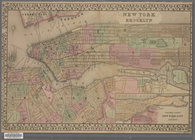
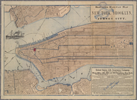
New York and Brooklyn
note:
Scale not given. (
W
74°02ʹ31ʺ--
W
73°55ʹ26ʺ/N
County map of Kentucky and Te…
note:
Drawn and engraved by
W
.H. Gamble
m
Map of Kentucky and Tennessee…
note:
Scale approximately 1:1,450,000 (
W
90°18ʹ--
W
81°48
Official railroad map of Nebr…
note:
…. L.
W
. Gilchrist, J. R. Gilkeson,
W
.
S
m
Mitchell's new national map e…
note:
engraved by
W
. Williams, map engraver
Plan of the city of Philadelp…
note:
Drawn and engraved by
W
.H. Gamble.
Map of the surveyed part of M…
note:
Scale approximately 1:510,000 (
W
87°20ʹ--
W
82°10
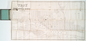
Troy, N.Y., from actual survey
note:
by
S
.A. Beers, civl. engineer.
Map of the city of Worcester:…
note:
Page 7, from F.
W
. Beer & Co.'
s
atlas
County map of the state of Te…
note:
Drawn and engraved by
W
.H. Gamble.
m
… by F.
W
. Beers, L.B
collection:
… and
S
.N. Beers assisted by F.
W
. Beers, L.B. Lake
Plan of the city of Philadelp…
note:
Scale not given (
W
75°13ʹ14ʺ--
W
75°01ʹ52ʺ/N
The cities of Pittsburgh and …
note:
Scale approximately 1:24,700 (
W
80°01ʹ20ʺ--
W
Map of the rail-roads of the …
note:
Scale not given (
W
80°12ʹ--
W
71°47ʹ/N 45°44
Hunt's map of Philadelphia : …
note:
Scale approximately 1:23,000 (
W
75°13ʹ45ʺ--
W
Chapman's sectional map of Wi…
note:
… miles to an inch (
W
92°40ʹ--
W
86°50ʹ/N 46°50
Mitchell's county and townshi…
note:
title engd. by
W
.Williams, map engraver
m
Abbott's map of the city of M…
note:
…. ; drawn by E.T. &
W.S
m
County & township map of the …
note:
Drawn and engraved by
W
.H. Gamble
Plan of the city of Philadelp…
note:
Scale approximately 1:35,000 (
W
75°13ʹ14ʺ--
W
m
Johnson's new illustrated & e…
note:
Scale approximately 1:3,072,000 (
W
127°35ʹ00ʺ--
W
Watson's new map of the city …
note:
engraved by
W.S
. Barnard.
Map of the rail roads of the …
note:
Scale approximately 1:1,000,000 (
W
80°20ʹ--
W
71°20
A map of the city of Providen…
note:
In lower left margin: Engraved at
S
&
W
Map of the city of Concord, N…
note:
…
W
. Sanborn, 1856.
State of Minnesota : 1887 : c…
note:
… miles to 1 inch (
W
97°05ʹ--
W
90°55ʹ/N 49°10ʹ--N
An improved map of the survey…
note:
… miles to an inch (
W
87°20ʹ--
W
82°20ʹ/N 43°50
m
Map of Orange and Rockland Co…
note:
by F.F. French,
W
.E. Wood and
S
.N. Beers.
m
Map of Maine: constructed fro…
note:
Made by
W
. Anson, Civil Engineer, in 1836.
McClung's map of Minnesota : …
note:
… in the year 1870 by J.
W
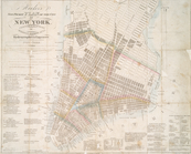
Map of the city of Brooklyn
note:
Scale not given (
W
74°01ʹ--
W
73°53ʹ/N 40°44
Map of the state of Wisconsin
note:
….
S.W
. Lamoreux
Rand McNally & Co.'
s
North Dakota
note:
Scale approximately 1:1,125,000 (
W
104°03ʹ--
W
m
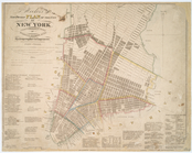
Map of the consolidated City …
note:
Scale [ca. 1:22,352] (
W
74°01ʹ--
W
73°53ʹ/N
Houston Post map of the great…
note:
Scale approximately 1:2,450,000 (
W
110°09ʹ--
W
Map of the state of Wisconsin
note:
….
S.W
. Lamoreux
Indexed map of Pittsburgh and…
note:
Scale not given (
W
80°03ʹ18ʺ--
W
79°53ʹ38ʺ/N
Map of the New York wildernes…
note:
by
W.W
. Ely, M.D.
Rand McNally & Co.'
s
new sectional map
note:
… miles to 1 inch (
W
104°35ʹ--
W
95°50ʹ/N 50°10
m
Rand, McNally & Co.'
s
Minnesota
note:
Scale approximately 1:1,000,000 (
W
97°15ʹ--
W
89°30
Rice & Reed's township map of…
note:
… (
W
97°14ʹ--
W
89°29ʹ/N
Map of the state of Missouri …
note:
… (
W
95°46ʹ--
W
89°05ʹ/N
Map of Kansas
note:
Scale approximately 1:1,520,000 (
W
102°25ʹ--
W
Elevated railway map of New Y…
note:
Scale not given. (
W
74°02ʹ55ʺ--
W
73°56ʹ24ʺ/N
Hooker's new pocket plan of t…
note:
… by
W
. Hooker
The Civic Federation map of C…
note:
Scale approximately 1:339,000 (
W
88°15ʹ--
W
87°06
m
Kentucky and Tennessee
note:
Scale approximately 1:1,130,000 (
W
90°20ʹ--
W
81°40
Hooker's new pocket plan of t…
note:
… by
W
. Hooker
Territory of Wyoming
note:
… miles to 1 inch (
W
111°--
W
104°/N 45°--N 41°).